Molėtai, Švenčionys, and Vilnius District municipalities
Molėtai and Švenčionys Districts
Lithuania's longest lake and regional-park landscape
Radvilų g. 1, Dubingiai, Molėtai District
55.05800, 25.45300
1-3 hours for the Dubingiai side, a full day with trails or boating
May-October for views, trails, and water routes
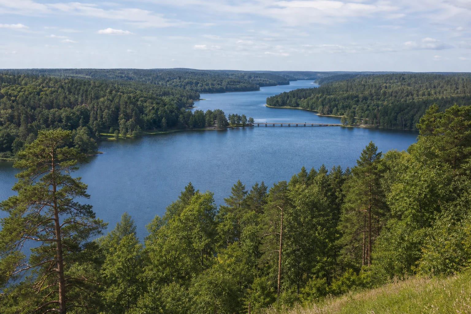
Lake Dubingiai
Lake Asveja: Lithuania's longest lake
Asveja, also called Lake Dubingiai, is one of Lithuania's most distinctive water bodies. VLE states that the lake stretches through Molėtai, Švenčionys, and Vilnius districts, with a length of 21.9 km, or 29.7 km when bays are included.
Its form creates the impression. The lake feels more like a winding river or narrow water corridor between forests than a round leisure lake.
Depth, branches, and wooded shores
VLE gives an area of 1015 ha, maximum depth 50.2 m, shoreline 72.5 km, and 6 islands totalling 4.4 ha. Asveja is not only the longest but also Lithuania's third-deepest lake. It is of glacial-runnel origin, occupying part of the Giedraičiai-Dubingiai runnel; VLE counts 34 basins on the lake floor, 16 of them deeper than 35 m.
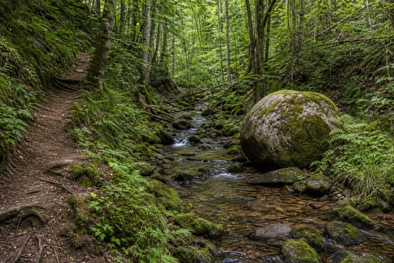
The shores are often steep, wooded, and indented with bays and slopes. The best way to visit Asveja is not to look only for a swimming spot but to build a route of several stops: bridge, castle site, slope trails, and water views.
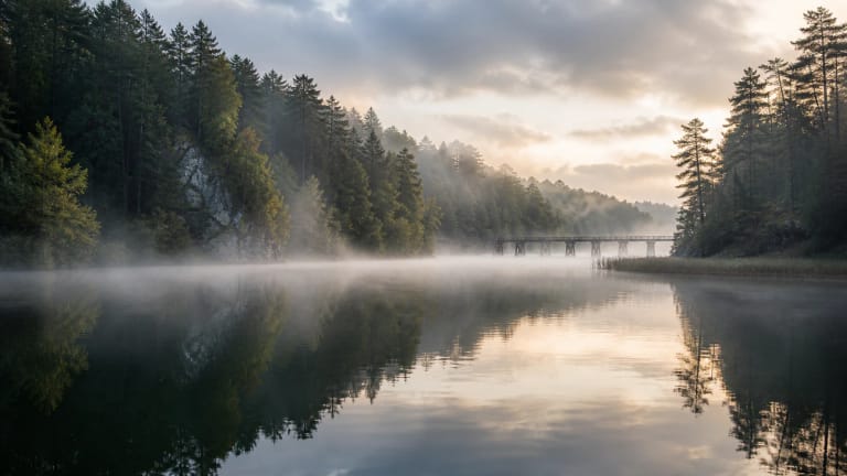
Lake Asveja and Dubingiai Bridge
Dubingiai Bridge is one of Asveja's most recognisable accents. Saugoma.lt lists it as a visitor object, and for travellers it is a useful orientation point between the town, lake, and castle site.
VLE states that the current bridge was built in 1934 through President A. Smetona's care, designed by A. Rozenbliumas, and is Lithuania's first wooden bridge across a lake; since 1995 it has been a cultural property. Underwater archaeological research in 1998-1999 and 2019 found piles, log ends, and seventeenth-eighteenth-century pottery from an older great bridge at 2.5-12 m depth. Dubingiai was therefore a long-term lake crossing, not just a modern road.
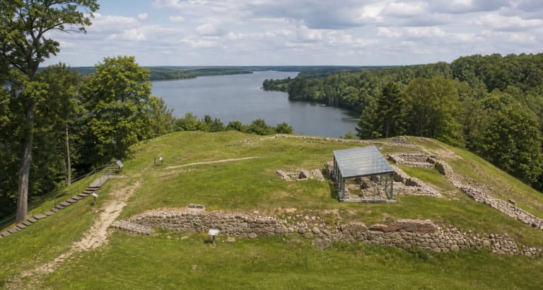
Lake Asveja and Dubingiai Castle Site
Another essential stop is Dubingiai Castle Site. Saugoma.lt presents the Dubingiai Castle Site nature trail as a route that helps explain the link between the town, Radziwiłł history, and the lake landscape.
From the castle site it is easier to see why Asveja mattered not only for nature but also for settlements and roads. Water divided the shores, but also created connections, defence, and trade directions.
Liudgardas Slope and other routes
For more nature, look into Liudgardas Slope Nature Trail. Saugoma.lt links it with steep slopes, stairs, and lake panoramas, so it is not the easiest route but shows Asveja's relief well.
Asveja Regional Park was established in 1992 and protects not only the lake but the whole lake-system landscape, the Dubingiai urban complex, and natural and cultural values.
How to plan a trip
For a first visit, start in Dubingiai: the visitor centre, bridge, castle site, and one shorter trail let you understand Asveja's character without driving around the whole lake.
If boating or kayaking, account for the lake's length and wind. Distances on the water can feel shorter than they are because bays and bends mislead the eye.