Molėtai District Municipality
Molėtai District
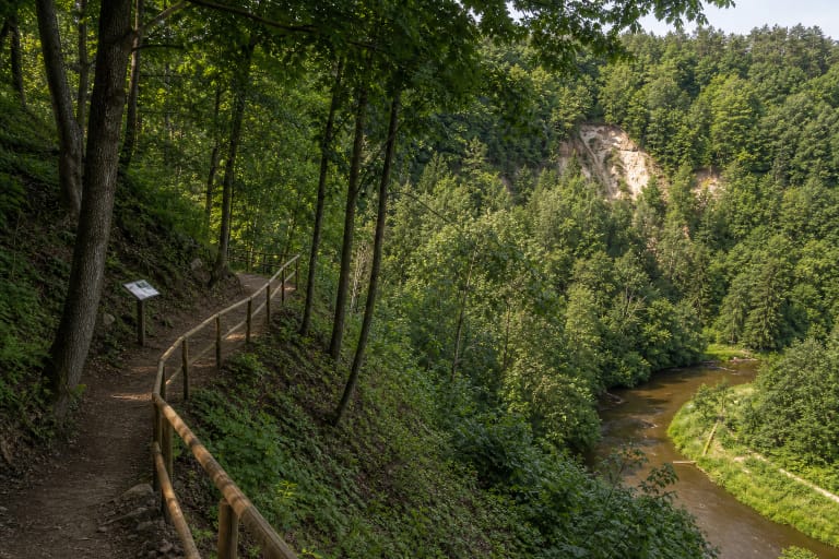
stream-valley trail in Asveja Regional Park
Jurkiškis Stream area, Asveja Regional Park
55.07400, 25.41490
about 30-90 minutes, depending on pace and conditions
April-October; after rain the trail may be slippery
Jurkiškis Stream Trail
A small trail with strong relief
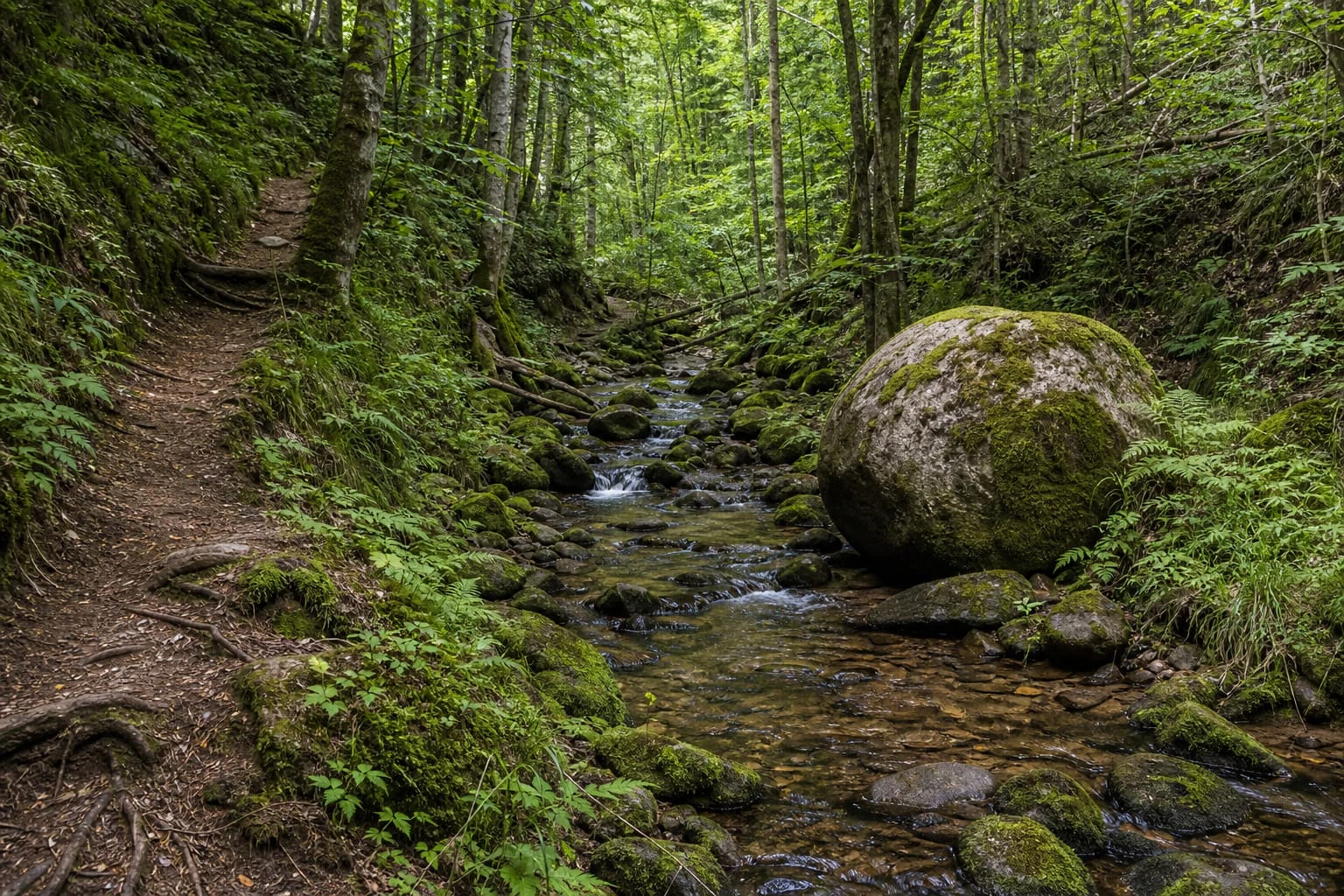
Jurkiškis Stream Nature Trail is not large in scale, but it is strong in form. Visitors meet a narrow forest valley, stony streambed, mossy boulders, slopes, and a damp ravine atmosphere.
This is a place where the route is interesting not because of a panorama but because of details: sound of water, stones, roots, slopes, and a stream that feels much faster than expected from a small Lithuanian watercourse.
Context of Asveja Regional Park
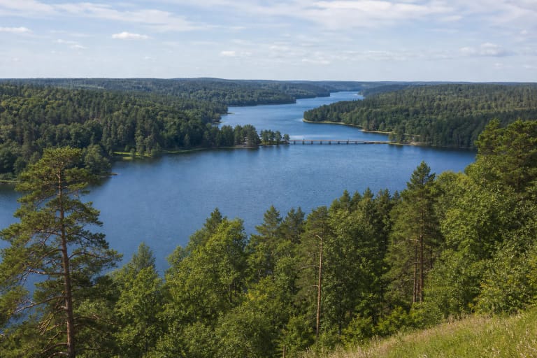
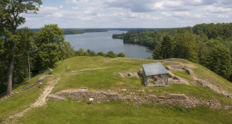
Jurkiškis Stream belongs to Asveja Regional Park, established in 1992. VLE gives the park area as 12,208 ha (2018), with forests covering about 60 percent, and its natural core as Lithuania's longest glacial-runnel Lake Asveja, also called Lake Dubingiai. The park administration is in the former Dubingiai inn, built in the first half of the nineteenth century.
In VLE's list of Asveja Regional Park nature trails, Jurkiškis Stream Trail is described as a circular route about 1.8 km long. In Lithuanian terms the stream feels steep, stony, and expressive, so it is sometimes called a 'mountain stream' - a visual description, not a geographical mountain term.
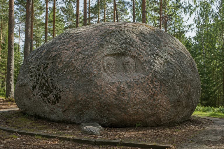
Boulders and Puntukas's child
By Jurkiškis Stream stands the largest Jurkiškis stone, also called Puntukas's child. It is a rapakivi granite boulder carried by the glacier from southern Finland. Saugoma.lt notes that Asveja Regional Park has 40 natural heritage objects, with the large Jurkiškis stone among the most important.
The trail therefore works as a short geology story too: how glaciers carried boulders, why the streambed contains many stones, and how a small valley can reveal a much older landscape history.
What to expect on the trail
The trail has a forest and ravine character. Expect uneven roots, stones, damp slopes, narrower passages, and slippery places after rain.
Choose shoes with grip. Do not judge this route by kilometres alone; move safely and allow time to stop by the stream and boulders.
Planning it with Asveja
Jurkiškis Stream Trail works best as a short but memorable stop in an Asveja Regional Park day. It combines well with Dubingiai, Lake Asveja, Dubingiai Bridge, and visitor-centre information.
Because public visitor-infrastructure information for this trail is more fragmentary than for major park routes, check current conditions with the Asveja Regional Park visitor centre before travelling.
Who will enjoy it
Jurkiškis suits visitors who like small natural places and want to see detailed relief, not only lake panoramas. Damp, soft light is best for photography because mossy stones and water gain more colour.
Children can walk it if supervised near water, slopes, and stones. It is not ideal for strollers or for a very easy walk.