- Place
- Lazdijai District Municipality
- Region
- Dzūkija
- Type
- glacial trough lake in Veisiejai Regional Park
- Address
- Lake Vilkinys, Veisiejai Eldership, Lazdijai District
- Coordinates
- 54.04754, 23.76577
- Visit duration
- 30-90 minutes at a chosen lawful access point; a longer walk depends on the shore selected
- Best time
- a dry late spring, summer, or early autumn day; calm weather is best for water and forest views
Vilkiniai, Vilkinys Lake, Lake Vilkinys
Lake Vilkinys is a Lazdijai District lake
Lake Vilkinys lies in Veisiejai Eldership, Lazdijai District, in the lake-rich southeastern part of Veisiejai Regional Park. The Encyclopaedia of Lithuania places it about 9 kilometres southeast of Veisiejai. This is a more remote landscape lake, usually recognised through geographic and natural-history data rather than one tourism address.
The name may also appear as Vilkiniai. When searching, check the place near Veisiejai and the coordinate on this page, not only the spelling. Lithuania has similarly named water bodies, so a similar name alone is not enough to establish the identity of the lake.
The VLE point on this page is a representative location for the whole lake, not a pier, beach, or guaranteed entry to the water. Choose an actual approach according to local signs, land boundaries, and the access conditions in force on the day of your visit.
A glacial trough lake with a broad basin
Lake Vilkinys is a glacial lake formed in a trough. It covers 143.8 hectares, extends about 3.9 kilometres from north to south, and reaches about 0.7 kilometres at its widest point. The water surface lies at an elevation of 113.5 metres.
The maximum depth is 15.1 metres and the average depth is 5.8 metres. The lake's catchment covers about 30.6 square kilometres. These figures show the scale of the water body, but they do not mean that every part of the shore is equally easy to reach or safe for entering the water.
Two islands lie in the northern part of the lake, with a combined area of about 2 hectares. They are a natural part of the landscape, not automatically accessible visitor sites. Do not plan to land on them without assessing weather, water, and nature-protection conditions.
The shore changes from forest to wet ground
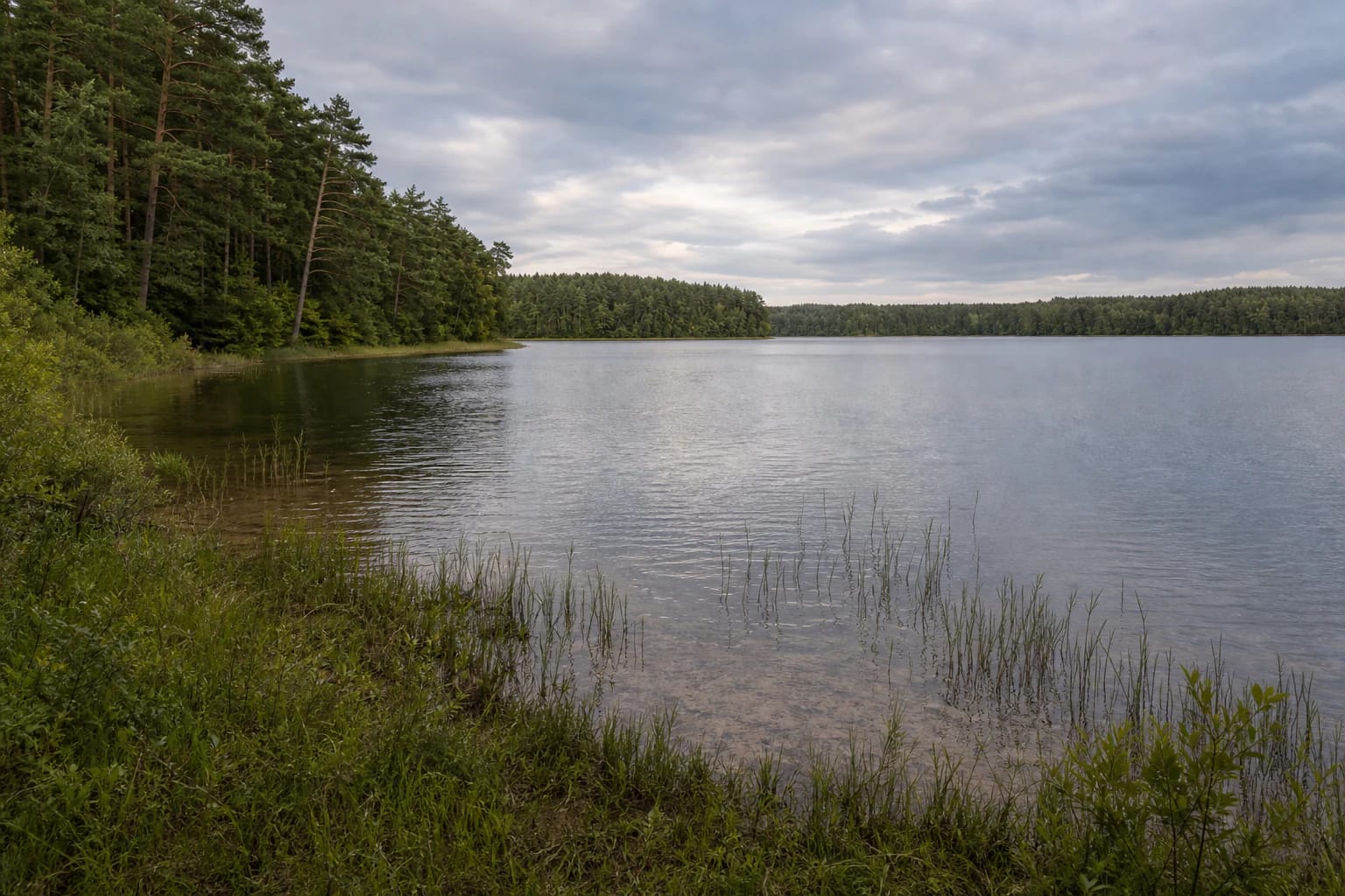
The shoreline of Lake Vilkinys is about 10.9 kilometres long. Shores are mostly low, with wetland-like sections in the southwest and in parts of the northwest. Forest covers parts of the western and southeastern edges, so the view changes noticeably from one shore to another.
The littoral is mainly sandy, while the deeper bottom is muddy and uneven. After rain, low sections can be wet, slippery, or harder to cross. A convenient map point does not mean that a car can drive to the water.
Vilkinys is better suited to quiet landscape observation than to searching for one standardised recreation zone. Move carefully at the water's edge, do not damage vegetation, avoid wetland ground, and leave the shore free of litter.
Vilkinys belongs to the Nemunas basin
Several small streams flow into Lake Vilkinys, while the Vilkė flows out towards Lake Stirtai. The lake belongs to the middle Nemunas basin, so its water connections extend beyond one shoreline.
The Environmental Protection Agency lists Vilkinys as a separate Lazdijai District water body in the Nemunas basin. This administrative record matters for water monitoring, but it does not replace a visitor's responsibility to keep fuel, rubbish, and other pollutants away from the shore.
Swim or launch a boat only where local rules and actual conditions allow it. The lake's size, uneven bottom, wet margins, and uncertain access are reasons to assess the situation carefully, not to take risks for a view.
Part of the Veisiejai Regional Park lake district
Lake Vilkinys is part of Veisiejai Regional Park. The State Service for Protected Areas describes the park as a place protecting a wooded lake landscape, ecosystems, and cultural heritage. The park has 37 lakes, and Vilkinys is listed among its largest and deepest water bodies.
The park landscape is more than a water surface. Glacial troughs, pine woods, wet margins, and nearby heritage sites form one setting. Plan a visit as an introduction to the Veisiejai lake district rather than as a drive to a single coordinate and back.
Other protected-area sites around Veisiejai can be combined into a day route, but check distances and real access before setting out. In a protected area, local rules and available infrastructure can matter more than the shortest line shown on a map.
How to visit responsibly
Allow 30 to 90 minutes if you choose one lawful shore access and take a short walk. Exploring a longer shoreline takes more time and depends on the route, weather, and whether the way crosses private or wet ground.
A dry late spring, summer, or early autumn day is usually easier for walking. Calm weather makes the forest reflections easier to see, while heavy rain can leave low ground muddy and slippery. Before swimming or boating, check local signs and current safety conditions.
Park only in a designated place, do not drive into woodland or meadow, keep fires within designated facilities, and take all rubbish with you. Keep dogs under control so they do not disturb wildlife or other visitors. The value of Vilkinys lies in its quiet, continuous landscape.