- Place
- Mėčiūnai village, Lazdijai District Municipality
- Region
- Dzūkija
- Type
- a state-protected 1.57-hectare Stone Age settlement on a pine-covered hill traditionally called a hillfort, on the western shore of Lake Ančia
- Address
- Mėčiūnai village, Kapčiamiestis eldership, Lazdijai District, Gudiškės Forest
- Coordinates
- 54.07794, 23.70069
- Visit duration
- 45-75 minutes for the hill and Lake Ančia shore; longer if part of the forest-track approach must be walked
- Best time
- a dry, clear day from late spring to autumn; travel in daylight because the approach follows forest tracks and the slopes are slippery after rain
Mėčiūnai ancient settlement, Pustelnyko Headland, Mėčiūnų senovės gyvenvietė, Pustelnyko ragas
The hillfort name and the site's official identity as an ancient settlement are not the same thing
The State Service for Protected Areas presents the place as the Mėčiūnai ancient settlement, better known as Mėčiūnai Hillfort and called Pustelnyko Headland by local people. The Cultural Heritage Register likewise uses Mėčiūnai ancient settlement as its official name. It carries unique code 5293, formerly A1638, and is a state-protected individual immovable property covering 15,700 square metres, or 1.57 hectares.
The distinction is more than terminology. Hillfort describes the landform and local naming tradition, while present protection rests on an archaeological settlement. Official descriptions identify no artificial defensive bank, ditch, wooden castle plan, or castle recorded in historical documents. You can visit a place long called Mėčiūnai Hillfort, but cannot confidently describe a particular Yotvingian fortress on its summit.
Older hillfort catalogues retain a first-millennium date, whereas the current protected-areas record emphasises the Stone Age. These are not two different hills but different interpretations of the same site. The sound minimum claim is that archaeology confirms a Stone Age settlement, while identifying a defensive hillfort would require further evidence.
A pine-covered hill rises between Lake Ančia and a deep forest hollow
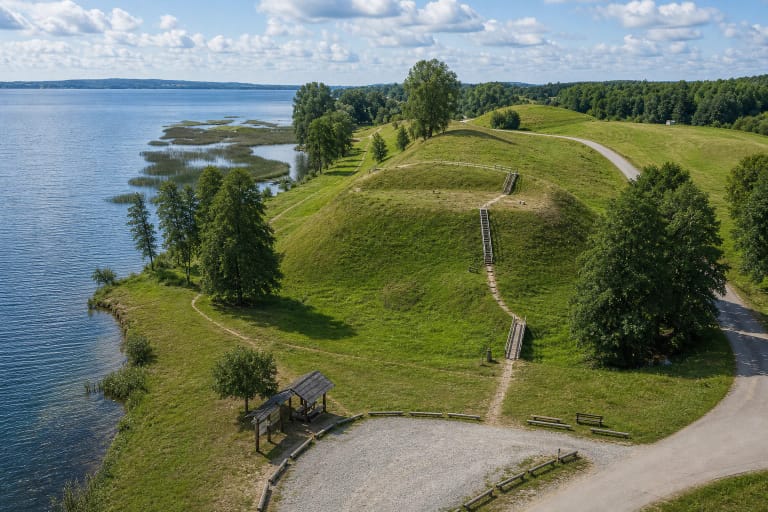
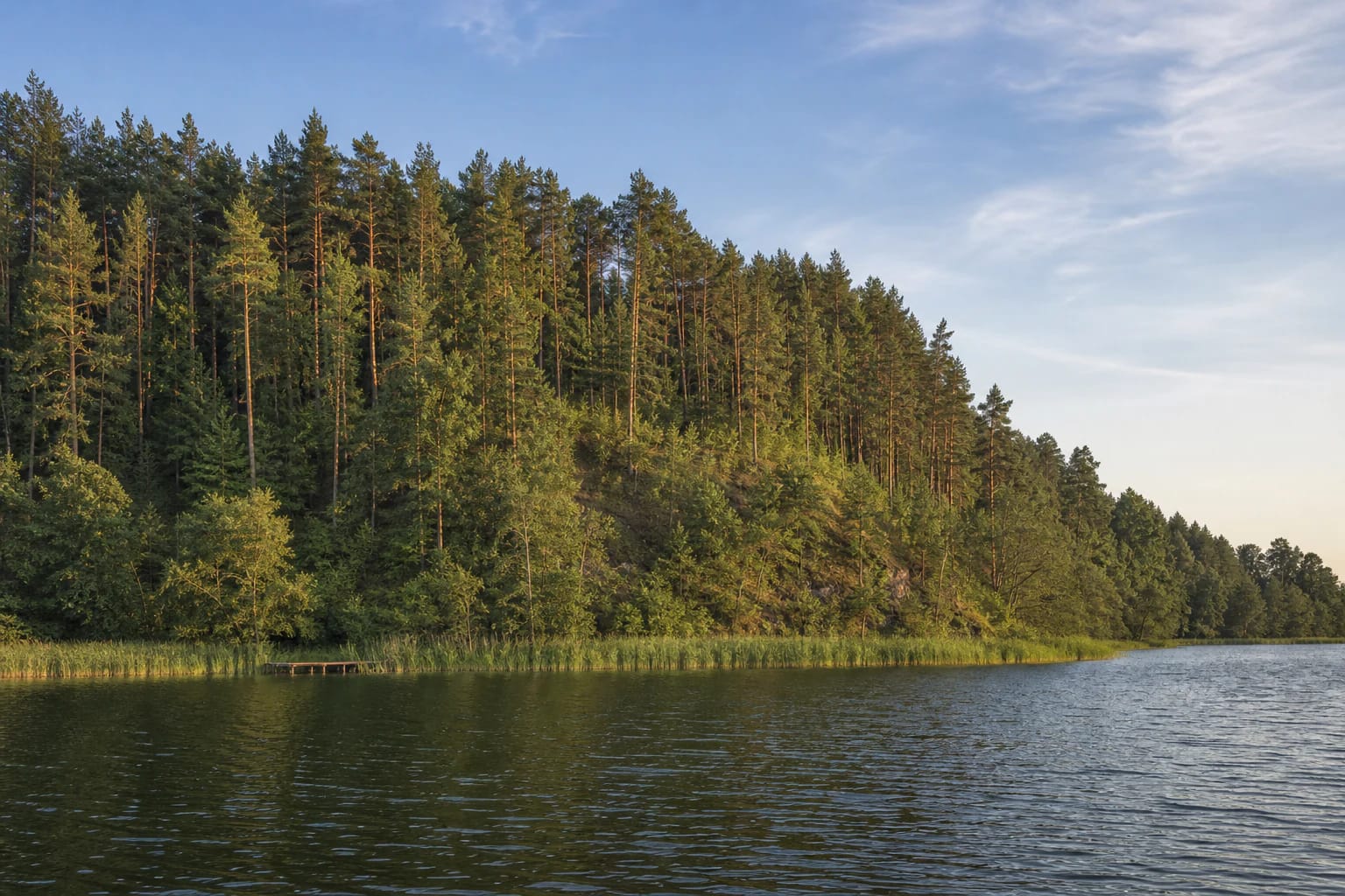
Mėčiūnai stands on the western shore of Lake Ančia at the eastern edge of Gudiškės Forest. The large wooded hill is roughly 180 metres long north to south and up to 160 metres wide. Water borders it to the north, east, and southeast, while a forested hollow up to about 15 metres deep separates it from higher ground to the west and southwest. This near-promontory form helps explain the local headland or ragas name.
At the top is a roughly rectangular enclosure measuring about 25 by 16 metres, elongated north to south, with its southern end about one metre higher. A broad natural terrace runs along the western slope 2.5-3 metres below the summit and measures around 40 metres across. The slopes are steep and vary from approximately 15 to 25 metres high.
Pines cover the hill and reeds screen parts of its shore. Official photographs taken from the lake show a densely wooded point and a small timber jetty at its foot, not a cleared viewpoint. Trees mean that the panorama from the summit is less open than from a managed observation tower. The site's appeal lies in seclusion, landform, and the relationship between forest and water.
Eight square metres revealed a hearth and Stone Age flint working
In 2001 archaeologist Eugenijus Ivanauskas excavated eight square metres on the Mėčiūnai hill. The investigation found a hearth and a cultural layer belonging to an earlier Stone Age settlement. Such a small trench cannot reveal the complete settlement plan, but it was enough to confirm preserved human activity on the hill.
The State Service for Protected Areas lists a flint blade and flakes, a core, and a fragment of an oval axe among the finds. A blade is a deliberately detached elongated piece, while a core is the prepared block from which blades and flakes were struck. These objects speak to making and using tools, not to weaponry from a medieval castle.
The heritage register protects the full 1.57-hectare site even though only a minute portion has been excavated. Most archaeological information therefore remains beneath the forest floor. Metal detecting, unauthorised digging, lighting a fire on the summit, or eroding a slope could damage both the landscape and an unexamined cultural layer.
Reaching the site requires navigation on forest tracks, and the final stretch may need to be walked
The precise site pin is 54.077944, 23.700694. An older route in the Lithuanian hillfort atlas starts near Vainežeris, follows an eastbound forest track for roughly one kilometre, turns south at a junction, turns east after about 350 metres, continues to the track's end, and then walks approximately 200 metres northeast through the forest. Track condition, barriers, and vehicle access can change, so use these directions only with a current map and never drive beyond a restriction.
No paved car park or level marked path has been confirmed beside the site. It is safer to leave a low-clearance car at a lawful wider point without blocking a forest road and walk the remaining distance. Carry an offline map, water, tick-protective clothing, and shoes with good grip. Similar-looking forest tracks are much harder to follow after dark.
Saugoma.lt explicitly says that the site is not adapted for visitors with reduced mobility. Steep 15-25-metre slopes, tree roots, forest floor, and an unimproved walking section also make a pushchair impractical. A small lakeshore jetty appears in official photographs, but its current condition, public availability, and safe approach by water are not guaranteed.
No ticket or opening hours are listed, and the site has neither an exhibition nor a reconstructed castle
The official site record lists no ticket, gate, or opening hours. It is a self-guided outdoor archaeological place, so visit in daylight and check current Veisiejai Regional Park information, forestry restrictions, and weather before travelling. Allow 45-75 minutes for the hill, summit, and shore, excluding extra walking if the forest track proves unsuitable for a car.
There is no masonry, reconstructed gateway, or display case of finds on the summit. Read the shape of the hill, western terrace, relationship between its slopes and Lake Ančia, and the pine forest floor that preserves the settlement layer. Remembering the measurements and the site's official identity before arrival reveals more than searching for castle walls that are not there.
On 15 July 2026, the exact Google Maps listing averaged 5.0 out of 5 from five reviews. This clears the requested threshold but is a highly changeable score because the sample is so small. Combine the trip with the regional park visitor centre in Veisiejai, Veisiejai Manor, or the Vainežeris area, while reserving sufficient daylight for remote Mėčiūnai.