- Place
- Telšiai, Telšiai District Municipality
- Region
- Samogitia
- Type
- a public recreation waterfront developed in stages along the northern shore of the 272.2-hectare Lake Mastis
- Address
- Northern shore of Lake Mastis, Telšiai
- Coordinates
- 55.98112, 22.24804
- Visit duration
- 1.5-3 hours for the central waterfront, Zakso Hill recreation zone, and the western Sculpture Park section
- Best time
- a dry morning from May to September for a quieter walk, or a long summer evening for town lights above the water; check the latest tests before swimming
Mastis Waterfront, Lake Mastis Promenade, Masčio ežero pakrantė
The waterfront is a route through several zones, while the map pin marks only a central reference point
The name Lake Mastis waterfront usually refers to a network of developed public spaces on the northern side of the lake, not the complete shoreline of a water body 4.2 kilometres long. It links the central promenade, an island with footbridges, piers and fountain surroundings, the hillside connection to the amphitheatre, the Zakso Hill recreation zone, and the western art and museum area. Different sections were created under different projects, so their surfaces, functions, and present condition are not identical.
Coordinates 55.981120, 22.248039 mark a representative point on the central northern waterfront. It is a useful place from which to begin a walk beside the water, but it is not the centre of the whole promenade, an official entrance, the exact beach location, or a car park. The waterfront can be approached from the directions of Ežero, Telšės, Vilniaus, Naujoji, Muziejaus, and Parko streets.
There is no shared admission charge or gated opening schedule for the public waterfront. Amphitheatre events, seasonal hire, fountain operation, pier services, and individual sports areas can keep separate schedules. On 8 July 2026 the municipality also announced path repairs from the beginning of Vilniaus Street towards the outdoor gym near Zakso Hill, so check the latest works notice before setting out.
Mastis is a shallow glacial lake whose northern shore differs markedly from its southern margins
VLE records an area of 272.2 hectares, a north-south length of 4.2 kilometres, and a maximum width of 1.1 kilometres. The surface lies at 125.2 metres, the maximum depth in the northern part reaches 5.3 metres, and the mean depth is 3.1 metres. Its basin formed around a stranded block of glacial ice, so Mastis is a natural lake even though its urban northern shore has been extensively reshaped.
The Durbinis, Berkina, and Juodupis flow into Mastis, while the Mastupis carries water out towards the Patekla and the Venta basin. Much of the shoreline is high and fragments of four terraces survive on the eastern and western sides, but the southern and south-eastern margins are low and marshy. The landscaped town waterfront therefore represents only one part of the lake's natural character.
Mastis has two islands. The northern island is connected to the shore by two footbridges and forms part of the recreation network, while the southern island lies in a much less urbanised part of the lake. VLE also records Stone Age finds, the first bathymetric measurements in 1905, and later studies by Steponas Kolupaila and other researchers. These facts belong to the lake's history but do not mean archaeological finds are displayed along the promenade.
Today's promenade emerged when derelict and contaminated urban land was regenerated in 2008-2013
Municipal project records describe several related stages rather than a single waterfront reconstruction. The first phase's first package, implemented in 2008-2013 between Naujoji Street and 4 Luokės Street, renewed or installed walking and cycling paths, lighting, rest areas, floating and boat piers, playgrounds, a fountain, shelters, and terraces. The record also states that this area was adapted for disabled visitors.
The second package of that phase covered the section from Luokės Street to the southern slope of Zakso Hill. It developed planted areas, sports, playground, and rest spaces, piers, a beach, paths, and viewpoints on Zakso Hill. A separate second phase in 2009-2013 addressed the section from Naujoji Street to the Durbinis, expanding the open-air amphitheatre and adding stairs, a bridge, a lift, and improved links from Ežero and Žemaitės streets.
The first package of the third phase in 2009-2011 added a floating pier as well as beach, summer-stage, leisure, playground, and access infrastructure. The landscape visitors see today is therefore not an untouched historic embankment. It is an early twenty-first-century urban regeneration scheme in which stone-reinforced edges, planting, bridges, paths, and performance spaces deliberately reconnect the lake with hilly central Telšiai.
The strongest walk links the central waterfront, Zakso Hill, and the western art zone
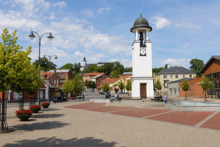
For a short walk, begin near the representative central point, cross the footbridges around the northern island, and look back at the old-town slope from water level. The fountain, terraces, and pier area show most clearly how the design brings people close to the lake. The fountain and some seasonal services may not be operating, so the route's value lies in the townscape as well as water displays.
Paths eastwards lead towards Zakso Hill and the active-recreation area, with layers of beach, play, and sports infrastructure. VLE describes Zakso Hill as a 10-12-metre-high kame on the north-eastern shore whose absolute elevation reaches 139 metres. Climbing it changes the scale: the lake is read from above, while the green slope itself is more apparent from the water's edge.
Westwards, the route passes the connections to the town and amphitheatre before reaching Akademija Sculpture Park, the VDA Telšiai Faculty, Arts Incubator, and Žemaičių Museum Alka. A continuous, uniform circuit around the entire lake cannot be confirmed. Allowing 1.5-3 hours to cover the developed northern zones, pause at artworks, and climb into the old town is realistic.
The amphitheatre, lift, and Sculpture Park belong to the same waterfront story but remain distinct places
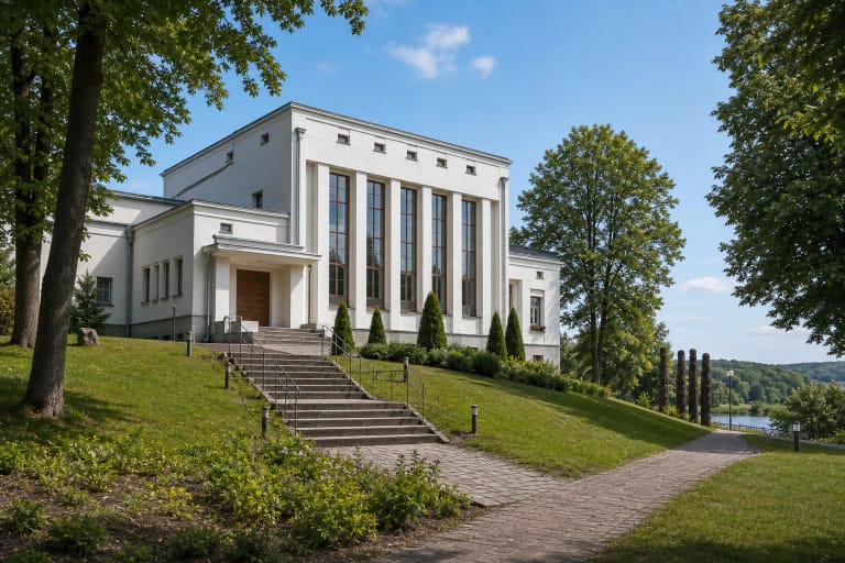
The amphitheatre is set into the town slope above the shore, so the performance venue and lakeside path are not the same attraction. Stairs and a lift bridge the change in level and allow visitors to climb from the water towards the old town. Lift operation, event restrictions, and technical availability can change, so visitors who depend on step-free access should verify current conditions before travel.
Akademija Sculpture Park was founded on the western Lake Mastis shore in 2011 as a collaboration between the VDA Telšiai Faculty and the municipality. It displays works made in different periods by students of the Telšiai art school, using granite, metal, and other materials. VDA describes it as an ongoing project, so the display can continue to grow rather than remaining a fixed list from one date.
Smaller expressions of Telšiai identity also appear along the shore, including bear figures attached to footbridges. They should not be confused with the Sculpture Park: the bears form a separate series of small public-art details, whereas Akademija traces the development of professional art education in Telšiai since 1931. A slow walk reveals both layers instead of reducing the waterfront to one panorama photograph.
Bathing, accessibility, and temporary works must be judged against conditions on the day
Municipal project records identify a beach and its infrastructure, but the presence of sand does not establish current water quality. In 2021 the Ministry of Environment reported that excessive pollution meant swimming in Mastis was not permitted at that time and discussed pollution reduction and sediment-management plans. Conditions can change, so consult the latest municipal or public-health information and on-site signs before every swim.
Central areas have hard surfaces, gentler connections, benches, and accessibility measures recorded in the original projects. The full route nevertheless combines sections built at different times with footbridges, slopes, stairs, and street crossings. No officially audited step-free circuit around all of Lake Mastis was found, and construction can temporarily close even a normally convenient section.
The repair programme begun in July 2026 includes path surfacing, drainage, benches, stands, bins, metal bridge structures, and decking. The municipality planned to complete the work within two months if weather allowed, but that is not a guaranteed completion date. Follow temporary signs, stay outside fenced works, and take particular care where walkers and cyclists share space.