- Place
- Telšiai, Telšiai District Municipality
- Region
- Samogitia
- Type
- state-protected urban heritage area of national significance covering approximately 56.1 hectares
- Address
- Turgaus Square, LT-87122 Telšiai
- Coordinates
- 55.98367, 22.25033
- Visit duration
- 1.5-3 hours for the principal walking circuit; half a day with the cathedral, yeshiva, and museum
- Best time
- a bright weekday morning for quieter streets or a long summer evening, when the townscape is easiest to read from the hills and Lake Mastis waterfront
Historic Centre of Telšiai, Telšiai Old Town, KVR code 17113, Historic Part of Telšiai
Telšiai Old Town is a protected area, while the map pin marks only a practical starting point
Telšiai Old Town extends across the northern side of Lake Mastis and has no single gate, address, or ticket office. It entered the Register of Cultural Property on 31 May 1994, carries unique code 17113, is protected by the state, and is classified at the national level of significance. Protection covers more than individual façades: street routes, blocks, squares, passages, surfaces, building patterns, views, silhouette, relief, the Mastis shoreline, and the archaeological layer all matter.
Coordinates 55.983672, 22.250330 mark a representative point in Turgaus Square from which to begin a walk. They are neither the geometric centre nor an official entrance. The special plan approved in 2022 records an area of 560,953 square metres, while the KVR map summary read on 19 July 2026 returned 561,616 square metres. The small difference most likely reflects different versions of boundary data, so approximately 56.1 hectares is the most useful description for visitors.
There is no old-town admission charge or shared opening schedule for the public streets and squares. The cathedral, Minor Church, yeshiva museum, other exhibitions, cafés, and tourist centre each keep separate hours and prices. Markets, religious services, traffic restrictions, and conservation works can alter a normal route, so check the official pages of any interiors you specifically want to enter.
Market Square grew from a historic road, which is why it looks more like a broad street
VLE describes Telšiai as an organically developed radial town with elements of an early linear settlement and of the rectangular planning introduced during the sixteenth-century Volok Reform. The current KVR record makes the pattern more precise: the central and eastern parts are radial, while a more regular network appears in the western and northern sectors. Look beyond individual buildings and notice how streets fan away from the Market Square in several directions.
Turgaus Square developed where the principal route between Luokė and Alsėdžiai widened. Its elongated quadrilateral, broad-street form evolved from the early sixteenth century to the middle of the nineteenth, while its western portion changed in the late twentieth century after part of a block was demolished. Today's fountain, white clock tower, Samogitian symbols, and renewed paving form a contemporary public layer and should not automatically be treated as authentic eighteenth- or nineteenth-century market furniture.
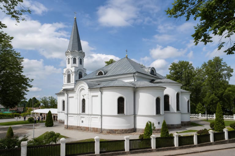
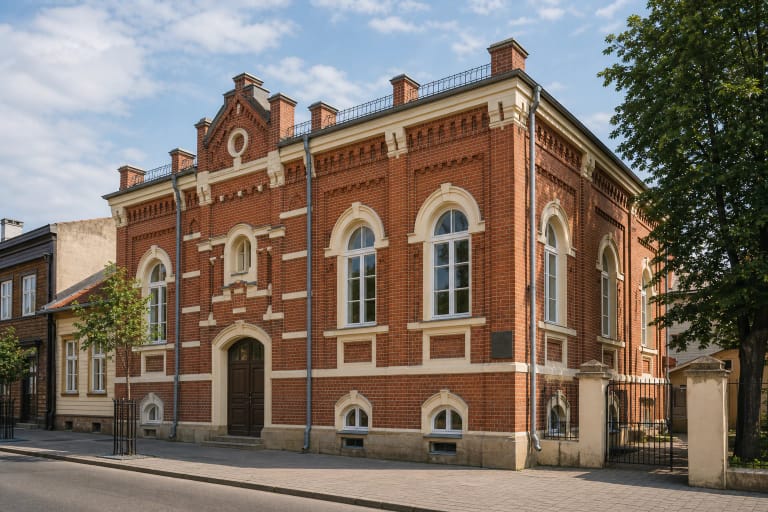
For a concise circuit, walk east from the square to Šviesos Street and the Minor Church on Vilnius Hill, return through the square, then follow Respublikos Street west and climb to Cathedral Square on Insula Hill. Add the yeshiva on Iždinės Street and the surviving wooden-building fragments on Kalno and Mažoji Kalno streets to see other scales of the town. This reveals considerably more than the decorative bear symbols around the central square.
Two hills and Lake Mastis form the architectural framework of the old town
Telšiai developed between the Insula hillfort and Vilnius Hill on the northern shore of Lake Mastis. KVR protects the contrasting terrain rising northwards in terraces, the highest central Insula Hill, Vilnius Hill in the east, and the lake shoreline marking the old town's southern edge. Early in the town's development, the lake reached closer to today's Luokės and Respublikos streets and Turgaus Square; the shore later withdrew as the margin became marshy.
The relief explains why the cathedral, seminary, and Minor Church appear and disappear between buildings as you move. Turgaus Square is the central compositional axis, closed to the west by the Cathedral of St Anthony complex and to the east by the Church of the Assumption. Descending towards Ežero or Respublikos Street reveals the high plinths beneath some houses and the historic centre's relationship with Mastis.
The same relief means this is not an entirely level walk. Central spaces include renewed surfaces and gradual connections, but steeper sections, fieldstone paving, uneven entrances, and street crossings remain. The official heritage documents do not provide a continuous audited step-free circuit through the whole old town. Wheelchair users should plan a shorter route, avoid slippery stone sections, and verify access to each interior separately.
From a town recorded in 1398 to red-brick houses built after the fire of 1908
Telšiai appears in written sources from 1398, and a state manor is documented in the second half of the fifteenth century. A Catholic parish was founded in 1536, and a Bernardine friary began operating on Insula Hill in 1624. Denser building followed the Luokė-Alsėdžiai road in the seventeenth century, creating the market space, while the street network expanded in other directions during the eighteenth.
Fires, the Great Northern War, famine, and the plague of 1710 repeatedly damaged the town. Recovery was aided by the 1721 privilege for a weekly market and four annual fairs, the arrival of land and castle courts in 1764, and Magdeburg rights in 1791. Plans prepared in 1837-1839 and 1851 proposed a more regular network, yet development remained largely organic, so the older radial structure survived.
The fire of 1908 destroyed more than 300 buildings. Red-brick masonry houses rose quickly along the principal streets in 1909-1912, and the interwar municipality paved streets and commissioned new public buildings. Telšiai became a diocesan centre in 1926; the seminary was built on Insula Hill in 1928 and the Bishops' Palace in 1929. The visible old town is therefore chiefly a late-nineteenth- and early-twentieth-century town, not an intact medieval ensemble.
The masonry centre gives way to wooden houses, high plinths, and fragments of older paving
One- and two-storey masonry buildings set along the street or square dominate the centre, with occasional three-storey accents. Building density falls away from Turgaus Square and becomes more domestic. The special plan identifies more than fifty individual or complex cultural-property objects inside the old town, but this does not mean every house is separately listed. The shared system of blocks, plots, volumes, and views is also protected.
Kalno and Mažoji Kalno streets retain a particularly important group of early-twentieth-century, low-rise, professionally designed wooden houses. Their character reflects carpentry traditions, the cultures of different urban communities, greenery, the lake, and the hilly site. Some retain their original volume, façade details, and tall basement levels, but the official plan also records sharply varying condition and a continuing risk of loss.
Fieldstone paving is protected in parts of Cathedral Square, in short sections of Respublikos, Naujoji, and Iždinės streets, and in several entrances. Excavations in 2022 between 14 Žvejų Street and 4 Luokės Street exposed eighteenth- and nineteenth-century stone paving together with still earlier timber structures and small-stone floor fragments. Read these as archaeological layers, not as a promise that the entire old town retains ancient cobbles.
A multi-faith town is visible through both surviving places and conspicuous absences
No single community made the historic centre. In 1738, Jews accounted for 21 of the town's 36 families; the 1897 census recorded 3,088 Jewish residents in a population of 6,205. Synagogues, religious schools, workshops, and shops operated in the late nineteenth and early twentieth centuries, while the yeshiva founded in the 1870s became an international centre of Talmudic learning. The Jewish community of Telšiai was destroyed in the Holocaust in 1941.
The parish church and Bernardine complex formed the Catholic axis, while Orthodox and Lutheran sanctuaries appeared in the nineteenth century. After the Second World War, the Great Synagogue, Lutheran church, Jewish bank, and other historic buildings were demolished, and standard apartment blocks and larger public buildings replaced portions of the older fabric. An authentic street route can therefore survive more fully than the buildings that once defined it.
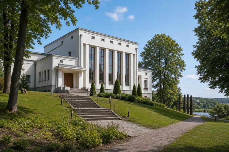
Today the restored Telšiai Yeshiva, the two hilltop churches, old red-brick and wooden houses, and contemporary public art help visitors read the layered story. The tactile town model made in 2007 and Romualdas Kvintas's Samogitian Legend installed in 2008 are valuable expressions of present-day identity, but they are not substitutes for the historic plan. The strongest visit connects both layers and acknowledges the missing places as well as the visible ones.