- Place
- Šiauliai District Municipality
- Region
- Žemaitija
- Type
- 262 m pedestrian and cycle bridge with viewing and rest platforms
- Address
- Laurynas Ivinskis Square, Kuršėnai, Šiauliai District
- Coordinates
- 56.00089, 22.93426
- Visit duration
- 30-60 minutes for the bridge and riverbanks; 1-3 hours with the square, manor park, and Venta trail
- Best time
- a bright spring-to-autumn evening for views and illumination, preferably in dry conditions
Venta River Pedestrian Bridge, Kuršėnai Smart Bridge
A bridge joining the town square and manor park
Construction began in October 2019 with AB Kauno tiltai as contractor, and the bridge opened to the public on 4 December 2020. It leads from the renewed Laurynas Ivinskis Square to Kuršėnai Manor Park on the opposite side of the Venta valley, turning an everyday connection into the clear axis of a town sightseeing route.
Ieva Puidokaitė of UAB Atamis led the architectural design. The UAB TEC Infrastructure team developed the structural project, with Domas Čėsna leading that part and Aurimas Andzelis responsible for the principal structural solutions. Builders had to work both on an island and beside sensitive manor grounds where heavy machinery was difficult to bring in.
Why sources give 233, 262, and 267.88 metres
The municipality and Central Project Management Agency consistently present the finished public bridge as a 262 m pedestrian and cycle crossing. That is the clearest visitor-facing figure and the one used in this guide.
Design sources also publish a 233 m structural length and 267.88 m on a technical project card. These probably use different boundaries: the main steel structure, the full visitor connection, or the project centreline. Without the drawings, one should not label any of them an error; for planning, it is enough to expect a crossing of roughly a quarter of a kilometre.
Corten, curves, and places to pause above the valley
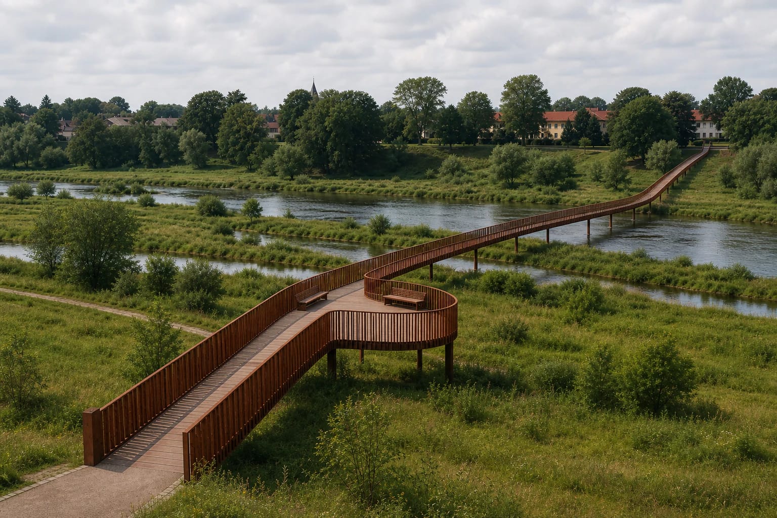
The roughly 500-tonne structure is not straight in plan. It curves over Venta channels and the green valley, pairing rust-coloured Corten steel with wood-plastic composite deck boards. Dense vertical balusters and the brown surface echo tree trunks from a distance, especially in autumn.
A widened central platform contains benches, a terrace, and a rope net above an opening in the deck. The design deliberately creates changing views towards water, old channels, park, and town. The rope lounger is for resting rather than bouncing; young children should never be left unsupervised on it.
Smart equipment and evening lighting
A 2021 project account listed Wi-Fi, phone charging, music, bicycle-tyre inflation, and an SOS button at a solar-powered station. These were part of the completed design, but their actual condition in 2026 has not been publicly confirmed. Do not rely on the bridge as your only charger or pump.
Architectural lighting picks out the curve after dark, and colours may change for events or national occasions. No permanent colour sequence or switch-on schedule was found. As public infrastructure, the scheme can change during maintenance or energy-saving periods.
Free access, shared movement, and accessibility
The bridge is an open pedestrian and cycle connection with no separate ticket or visiting hours. On 25 July 2026, its exact Google Maps listing held a 4.8 rating from 648 reviews. Town festivals, races, and other events can bring heavy crowds or temporary traffic control.
The approaches were designed for disabled visitors and families with pushchairs. Snow, ice, maintenance, or event barriers can still reduce access temporarily. Cyclists should slow down and yield to pedestrians; everyone should stay off the railings, avoid jumping into the river, and supervise children beside the net and viewing edges.