- Place
- Varėna District Municipality
- Region
- Dzūkija
- Type
- a deep thermokarst forest lake with an officially monitored bathing area
- Address
- Glūkas village, Varėna Eldership, 65486 Varėna District Municipality
- Coordinates
- 54.28526, 24.57234
- Visit duration
- 1-3 hours for the bathing area, forest-shore views, and rest; longer for lawful camping
- Best time
- May to September for lakeside recreation; during the bathing season, only after checking the latest official water test
Glūkas, Lake Glūkas
The 37-metre depth occupies a thermokarst basin
The Universal Lithuanian Encyclopedia identifies Glūkas as a thermokarst lake. Such a hollow forms when a block of glacial ice buried beneath sediment melts and the overlying surface collapses. Glūkas is therefore not simply a shallow pool in sandy country: its eastern basin reaches 37 m, and the mean depth is 12.6 m.
VLE gives an area of 69 ha, a west-to-east length of 1.4 km, and a maximum width of 0.7 km. The surface lies 109.3 m above sea level, and the catchment covers 6.1 sq km. State registers round the surface to either 69 or 69.5 ha, a small documentary difference rather than evidence of two lakes.
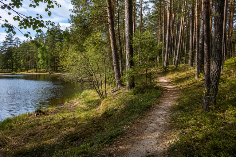
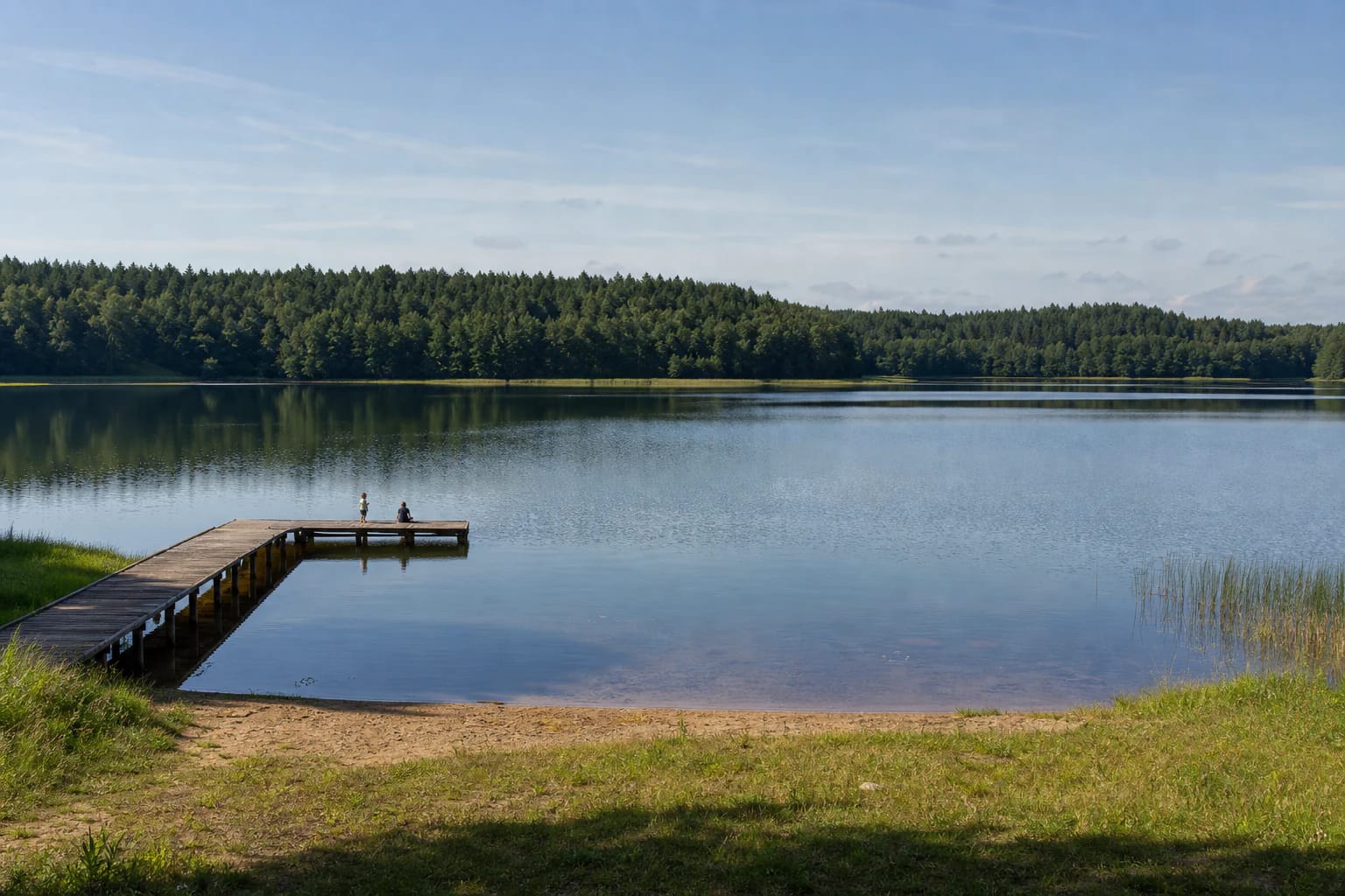
High, steep shores are most pronounced on the southern side, and forest surrounds the water. Real photographs show a broad open surface, a dense belt of pine and deciduous trees, small sandy or grassy access points, and modest piers. Glūkas derives its character from a quiet forest basin, not intensive resort development.
Glūkas belongs to the Merkys basin and is not a closed bowl
A stream enters the northeastern part of Glūkas from smaller Lake Glūkaitis. Water leaves in the northwest towards Lake Varėnis, and the whole system belongs to the Merkys basin. VLE records an 18 percent throughflow, showing that water circulates even though Glūkas appears almost enclosed in the landscape.
Woodland and high slopes limit broad open access around the lake. This preserves the impression of a natural hollow but also means that shoreline approaches are not equally practical. Visitors should use the established bathing or camping area rather than descending an unmarked, steep forest slope.
Shore vegetation, sand, and forest floor are vulnerable to repeated trampling. Do not park over roots or within the protected shoreline strip, create new fire sites, or widen informal paths. Use existing recreation infrastructure and carry all waste away.
The official bathing area is one point on the shore, not the whole lake
In the e-TAR register of monitored Lithuanian bathing waters, Glūkas carries code LT001380111030138 and coordinates 54.2839, 24.5664. This point is on the southwest side and does not coincide with the general Google lake pin in the water body's centre. For swimming, navigate to the official shore zone rather than the centroid.
The Institute of Hygiene's 2026 schedule assigns regular tests to Glūkas from late May to early September. A timetable confirms planned monitoring, not the latest result. Before entering the water, consult the current Varėna District Municipality or Institute of Hygiene update and read warnings on site.
Even a satisfactory microbiological result does not remove drowning risk. Glūkas is deep, and bottom conditions and access can change quickly outside the bathing zone. Never swim alone or while impaired, supervise children at close range, and remain within boundaries shown by buoys or signs.
The Glūkas campsite is officially listed, but its services need a current check
Varėna District's sustainable tourism strategy lists Glūkas campsite among campsites on lake shores. This confirms a recreational use but is not a current service tariff and does not guarantee a particular number of tables, fire sites, toilets, or tent pitches.
A focused visit normally takes 1-3 hours, enough to see the lake basin, rest at the official bathing area, and walk around the established access zone. If you plan to pitch a tent, light a fire, fish, or launch a craft, check current forest, campsite, fire-safety, and angling rules in advance.
The word campsite does not make the entire Glūkas shoreline a legal overnight area. Camp and light fires only where expressly permitted, do not drive beyond barriers, and follow seasonal wildfire restrictions. Services, payment arrangements, and management can change, so rely on current official information rather than old traveller reports.
Deep water rewards quiet recreation only with open-water discipline
The maximum depth of 37 m is invisible from shore, and a clear, calm surface can be deceptive. Farther from the marked bathing area, cold water, fatigue, and waves from passing craft become greater risks. Return to shore as weather worsens rather than waiting for a storm to arrive.
Glūkas is a state water body, but fishing permits, closed seasons, equipment restrictions, and minimum sizes can change. Before angling, consult Lithuania's Environmental Protection Department and ALIS, and leave no line, hooks, or bait packaging on the shore.
For a paddleboard, kayak, or other craft, choose a lawful launch that does not erode the bank. Wear a buoyancy aid, assess the wind, and keep clear of the bathing zone. The lake's depth is not a reason to jump from an unchecked pier, whose condition and underwater obstacles may be unknown.
The Google pin marks the lake centre, so the beach needs a separate waypoint
The exact Google Maps listing is titled Glūkas and has place ID ChIJE6kaFRoE3kYR-jBtoWFiUjw. Its point at 54.2852646, 24.5723386 is a general water-body centre, so this page labels the coordinates as a centroid. It locates the lake but is not a car park, beach gate, or pier coordinate.
On 15 July 2026, the exact listing showed an average of 4.7 out of 5 from 55 reviews. The official bathing area is a separate southwest-shore point at approximately 54.2839, 24.5664. Check the route before turning onto a forest road and leave vehicles only where parking is lawful.
The lake has no single ticket desk or shared opening hours. Shore access, campsite arrangements, seasonal services, forestry work, and bathing-area supervision may follow different regimes. Check official notices before travelling and obey signs and barriers on site.