- Place
- Marcinkonys, Marcinkonys eldership, Varėna District Municipality
- Region
- Dzūkija
- Type
- a 3.6 km circular nature trail through the southern edge of Marcinkonys and around the old mill pond on the Duobupis
- Address
- Trail start beside Miškininkų Street 61; Google lists Naujalių Street 3, Marcinkonys
- Coordinates
- 54.06078, 24.39872
- Visit duration
- 1-1.5 hours for the 3.6 km loop, longer for quiet birdwatching and a stop by the pond
- Best time
- a dry day in spring or autumn; pond life is more vocal in spring and fungi add interest in autumn, while the natural tread can be slippery after rain
Girinio Trail, Girinio Health Trail
The 3.6 km circuit begins at the edge of Marcinkonys, not beside the pond
The park directorate's walking-routes page gives a length of 3.6 km and links to a trail start at the southern edge of Marcinkonys. That point is 54.0610064, 24.3983958, beside the visitor centre at Miškininkų Street 61. The exact Google listing for Girinio Trail places its pin at 54.0607803, 24.3987173, only a few dozen metres away, and assigns it the address Naujalių Street 3. The pin on this page therefore marks the entrance area, not the centre of the pond or a promise that cars can drive to the water.
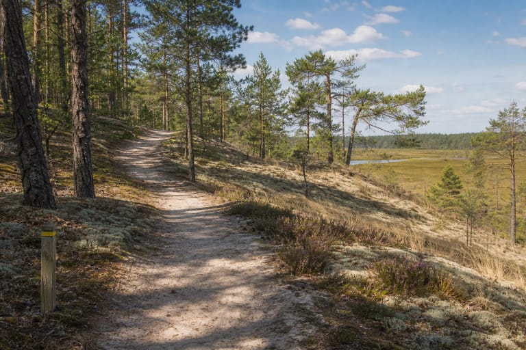
The route leaves the edge of the village, enters the pine woods, reaches the old mill pond, circles its surroundings, and returns towards Marcinkonys. Most walkers can cover 3.6 km in 1-1.5 hours, although birdwatching or a quiet rest by the water can extend the visit. Varėna District Municipality's official inventory likewise lists Girinio as an approximately 3.6 km trail featuring the old mill pond.
A car park stands by the visitor centre and provides the clearest arrival landmark. The centre and its indoor exhibition are not the same attraction as the outdoor trail. Closure of the centre does not automatically close the forest route, while walking the route does not include admission to the paid exhibition.
The old mill pond is the route's focus, but no surviving mill is presented as an attraction
Official descriptions from the national park and Saugoma.lt route the trail around an old mill pond. The park calls it the Duobupis pond and identifies its birds, aquatic fauna, and the life of shallow enclosed waters as subjects of the walk. The sources do not describe a surviving mill building, a construction date, or preserved machinery, so visitors should not expect a restored watermill here.
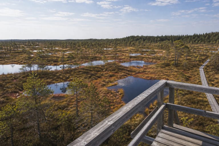
The pond changes the rhythm of the walk: a drier pine wood gives way to a waterside margin, deciduous trees, damper vegetation, and a broader sky. Move quietly, avoid standing on a fragile bank, and watch the surface from a little distance. The official account deliberately names habitat groups without promising a checklist, so any particular bird, amphibian, or fungus depends on season and luck.
The directorate mentions distinctive recreational structures, shelters, and a beach, while Saugoma.lt also confirms recreation facilities and a beach. That wording does not guarantee a lifeguard, daily supervision, water-quality testing, or unchanged furniture every season. Before entering the water, read signs on site and verify current bathing conditions.
Blue waymarks distinguish the Girinio circuit from the longer Zackagirio trail
Field route accounts describe Girinio Trail with a blue diagonal stripe inside a white square. Its first stretch coincides with the red-marked Zackagirio Nature Trail, and the routes separate beyond a small bridge. To remain on the 3.6 km circuit, those accounts direct walkers left and onwards along the blue marks. An appendix to Varėna District's tourism strategy also records red diagonal marks for Zackagirio and blue marks for the other route.
Painted marks can fade, disappear behind vegetation, or change after maintenance. The park directorate publishes an official GPX file for Girinio Trail, so download it while reception is still reliable in Marcinkonys. A Google pin locates the start but cannot represent the complete circuit or every forest junction.
Most of the route follows a trodden natural woodland path, with one section on a gravel forest road. Field accounts mention an information panel by the pond and two rest places. Treat the present condition of benches, shelters, arrows, and the small bridge as changeable infrastructure rather than a permanent guarantee.
Girinio Trail is about the meeting of pine forest and shallow water
The park directorate identifies four main themes: plants and fungi of Dzūkija's pine woods, birds and aquatic fauna of the Duobupis pond, measures used to protect forest animals, and the life of shallow enclosed waters. The trail works best as a comparison between dry pinewood and the pond margin, not as a rapid collection of named attractions.
Notice the pale sand, mats of moss and lichen, and the way vegetation changes on the descent towards the water. At the pond, listen for calls, scan the surface, and look for the forest-management measures mentioned in the official description. Do not pick unidentified fungi, disturb the forest floor, or approach nests.
The walk is short, yet season changes it more than distance does. Spring brings more sound beside the water, summer fills the bank with vegetation, autumn highlights fungi, and winter can conceal roots and sandy irregularities beneath ice or snow. Low waterside stretches and timber elements may be slippery after heavy rain.
The trail has no separate ticket-office schedule, while the visitor centre is a different service
The official Girinio Trail description gives no separate ticket, gate, or fixed opening hours. On 15 July 2026, the exact Google listing marked it open 24 hours, but daylight is the sensible choice for a first walk through the forest. On the same date, the listing averaged 4.6 out of 5 from 15 reviews. It clears the requested 4.5 threshold, although both a small sample and the average can change.
For visitors who also want the Marcinkonys visitor-centre exhibition, the Lithuanian official page updated on 14 April 2026 listed Tuesday-Friday hours of 8:00-17:00, Saturday 9:00-16:00, and a lunch break from 12:00 to 12:45. Self-guided exhibition admission was EUR 2 for adults, EUR 1 for pupils, students, disabled visitors, and pensioners, and free for children under six; a EUR 5 adult day ticket covered several directorate exhibitions. Check the official page before travelling because hours and prices become outdated, and during research the official English version displayed different Tuesday-Friday hours.
The visitor-centre building officially has a lift and an accessible toilet, but this does not establish step-free access around Girinio Trail. Natural sand, roots, a gravel-road section, and a potentially wet pond margin may obstruct a wheelchair or pushchair. If access is essential, contact the centre for the present condition of the entire 3.6 km circuit.