- Place
- Ruoščiai, Kėdainiai District Municipality
- Region
- Aukštaitija
- Type
- open-air marker of the country's geographical midpoint and contemporary field-stone ensemble
- Address
- Ruoščiai village, Kėdainiai district
- Coordinates
- 55.33001, 23.90561
- Visit duration
- 20-40 minutes for the centre marker, stone circle, and a short walk
- Best time
- dry weather from late spring to autumn, when the field approach is firmer and the Central Lithuanian horizon is open
Geographic Centre of Lithuania, Geographic Center of Lithuania, Lithuania's geographical midpoint, Lithuanian Stonehenge
What the point at Ruoščiai actually marks
The Geographical Centre of Lithuania lies in fields at Ruoščiai, roughly 9 kilometres northwest of central Kėdainiai. In 1995, specialists from the Lithuanian Land Management Institute assessed the outline of the national territory and placed the country's geographical midpoint here. Sources usually give the rounded coordinates 55°19′ north and 23°54′ east, while the visitor marker is at 55.330007, 23.905606.
A geographical centre is not a naturally visible feature of the ground. It is a calculated point whose position depends on the territorial outline and method chosen. The stones therefore do not prove that an administrative boundary or road junction passes here; they give physical form to a cartographic idea.
From one boulder to a three-region marker
A large field stone first marked the place in 1995. Two more boulders were later brought in under a design by architect Vytautas Kundrotas to symbolise Samogitia and Aukštaitija. The pairing suits this landscape, since the historical boundary between Lithuania's two great regions is associated with the Nevėžis area, although the calculated point is not itself an ethnographic boundary marker.
A granite plaque engraved with the midpoint coordinates was installed on the stones in 2009. The dates describe separate stages: 1995 is the determination of the centre, while 2009 refers to the clearer marker now read by visitors.
Why it is nicknamed Lithuanian Stonehenge
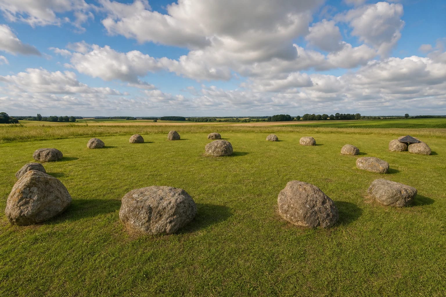
In 2021, twelve large field boulders were arranged in a ring with a thirteenth stone at the centre. The composition, about 36 metres across, acquired the tourism nickname Lithuanian Stonehenge. It is a visual comparison, not an archaeological claim: the Ruoščiai circle is a contemporary installation, not a prehistoric observatory or ancient sacred site.
The older centre marker and newer ring are now read as one field ensemble. Its scale is clearest when you walk around the outside and look between the boulders towards the level agricultural horizon.
Not the Centre of Europe and not central Kėdainiai
The Geographical Centre of Lithuania at Ruoščiai is often confused with the Geographical Centre of Europe in the Girija and Purnuškės area north of Vilnius. They are different calculations and different attractions: Ruoščiai marks the midpoint of Lithuania's territory, while the Vilnius District site represents a version of Europe's centre calculated in 1989 by France's National Geographic Institute.
Ruoščiai is not the geometric centre of Kėdainiai city either. It lies in a rural landscape beyond town, so select the exact attraction listing in navigation rather than making a broad search for the word centre.
Access, field conditions, and responsible visiting
The attraction is outdoors, with no ticket office or set opening hours, and can be seen free of charge. It is a short stop rather than a visitor centre: do not expect an exhibition hall, permanent staff, or reliably available toilets.
The final approach uses a village and field road. Its surface and the grass can soften after rain, so wear firm footwear, keep vehicles out of crops, and park without blocking residents or farm machinery. The ground is level, but wheelchair access across gravel and grass has not been officially confirmed.
The exact Google Maps listing showed an average of 4.5 out of 5 from 353 reviews on 27 July 2026. The figure changes. As the boulders and meadow form an open public space, take litter away, do not climb on the coordinate plaque, and do not move smaller stones.