Vilnius District Municipality
Vilnius Region
geographical Europe-centre marker near Vilnius
Girija village / Purnuškės area, Vilnius district
54.90670, 25.31830
20-45 minutes, longer if combined with Europos Parkas
a clear day, when the open site is pleasant for a short walk
Centre of Europe, Geographical Europe Centre
What Is Marked Here
The Geographical Centre of Europe is a place in Vilnius district, near Purnuškės village, 26 km north of Vilnius, marking the point calculated in 1989 by France's National Geographic Institute (IGN). VLE states that the calculation was made by IGN scientist Jean-George Affholder using refined European continent contours and a centre-of-mass method; the stated point is at 54°54′ north latitude and 25°19′ east longitude.
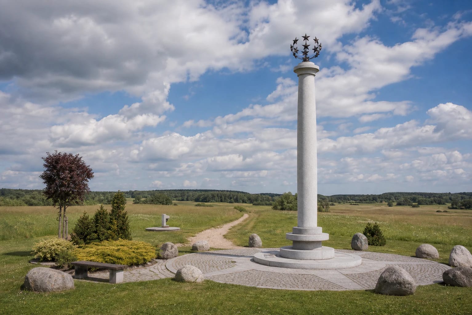
This is not a city centre or an EU administrative symbol, but a geography calculation. The point is the only Geographical Centre of Europe entered in the Guinness Book of Records. Visitors find an open area, a white granite column with a crown of stars, and a quiet field landscape; since 1992 the surroundings have been protected as Girija Reserve.
Why Several Europe Centres Are Mentioned
The Europe-centre question depends on method: how Europe's boundaries are defined, whether islands are included, and what geometry is used. VLE notes that the first known report about a centre of Europe was published as early as 1775 in Poland (Suchowola), and later centres were marked in Slovakia, Ukraine (Dilovė), Belarus (Polotsk), Estonia (Saaremaa island), and elsewhere.
The Lithuanian marker rests on the 1989 IGN calculation, making it the best-known and most officially presented version in Lithuania. VLE also notes that IGN scientists refined the coordinates in 2004, placing them slightly farther south near Pašiliai, but the monument was not moved.
The Monument
The current marker is a white granite column with a crown of stars, erected in 2004 by sculptor Gediminas Jokūbonis. The design clearly marks a coordinate while using European symbolic language.
The open setting matters. In photographs, the horizon and sky are part of the experience, giving the place the feeling of a geographic point rather than a conventional city monument.
Geographical Centre and Europos Parkas
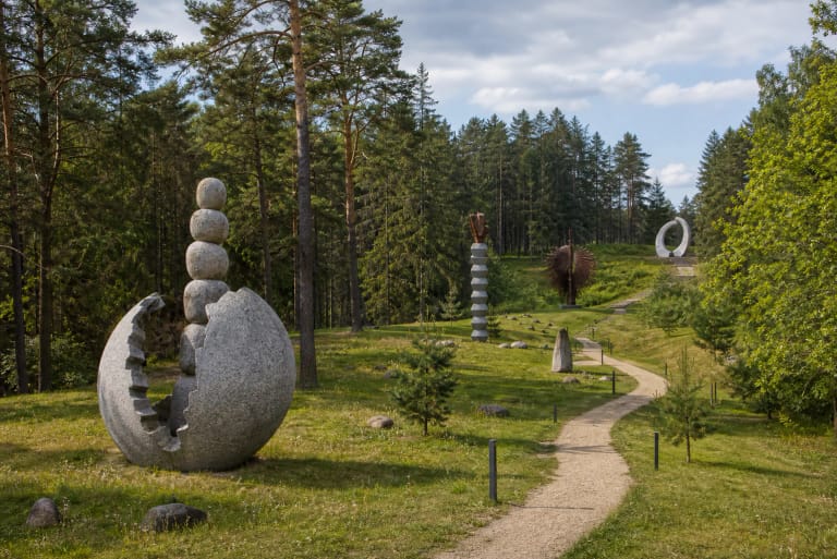
The Geographical Centre of Europe and Europos Parkas are often mentioned together, but they are not the same. The geographical centre is a coordinate-and-monument site; Europos Parkas is an open-air contemporary art museum.
If you have time, visit both. The first gives the geographic fact; the second gives a cultural interpretation.
What to Do on Site
The site is small. Visitors stop to see the monument, take photographs, read information, and walk briefly around the area. It is not a half-day object unless combined with Europos Parkas.
It works best for travellers who like symbolic points, coordinates, and map stories: the simple claim of having stood at the centre of Europe.
How to Arrive
The site lies north of Vilnius, in the Girija and Purnuškės area. It is easiest to reach by car, combined with Europos Parkas or other northern Vilnius-area sites.
Check navigation carefully, because the name is similar to Europos Parkas. Choose the Geographical Centre of Europe if you want the column.
Nearby
The closest thematic combination is Europos Parkas. You can also connect the site with Verkiai Regional Park, the Green Lakes, or northern Vilnius routes.
For a Vilnius trip, this stop adds a geography and symbolism layer to the usual old town, museum, and panorama route.