- Place
- Buivydai village, Dūkštos Eldership, Vilnius District Municipality
- Region
- Vilnius District
- Type
- state-protected hillfort with an associated settlement at its foot and a viewpoint above the Dūkšta Valley
- Address
- Buivydai village, Dūkštos Eldership, Vilnius District
- Coordinates
- 54.82277, 24.94041
- Visit duration
- about 45-75 minutes for the hillfort alone; about 2.5-3 hours for the full 5-kilometre Dūkšta Nature Trail
- Best time
- a dry day from late spring to autumn; steep slopes, steps, and paths can become slippery after rain
Buivydai Hillfort with Settlement, Buivydai Hillfort by the Dūkšta
Which Buivydai Hillfort stands on the Dūkšta Nature Trail
This public site is in Buivydai village in Neris Regional Park at 54.8227736, 24.9404065. The map pin marks the viewpoint on the northern part of the hillfort, not a car park. Follow park signs on arrival and do not leave a car on a narrow road or private property.
The Buivydai name can be misleading on maps. Bradeliškės Hillfort stands about 400 metres north, while another archaeological site to the east is known as Buivydai Hillfort II or Vėjo Kalnas. There is also a hillfort of the same name in Anykščiai District. The site intended for visitors on the Dūkšta trail is this main hillfort, Cultural Heritage Register code 5657.
The hillfort can be a separate stop or part of the Dūkšta Nature Trail. Allow 45-75 minutes for the climb, panorama, and earthworks. The official 5-kilometre route has repeated ascents and descents, so 2.5-3 hours is more realistic when allowing for stops.
A terrace, three ditches, and three ramparts reinforced the natural defences
The hillfort occupies a promontory at the northern edge of a plateau. The valleys of the Dūkšta and a smaller stream, together with a ravine fed by springs and snowmelt, protected it on several sides. Slopes rise about 40 metres above the Dūkšta side and about 25 metres above the smaller valley, so the position becomes clearest when visitors look down into the valley as well as up at the mound.
The builders formed a terrace about 7 metres wide halfway up the eastern slope and steepened its upper part. On the southern approach, where natural obstacles were weaker, they dug three ditches and raised three intervening ramparts. The highest rampart at the edge of the summit is about 5 metres high and 15 metres wide.
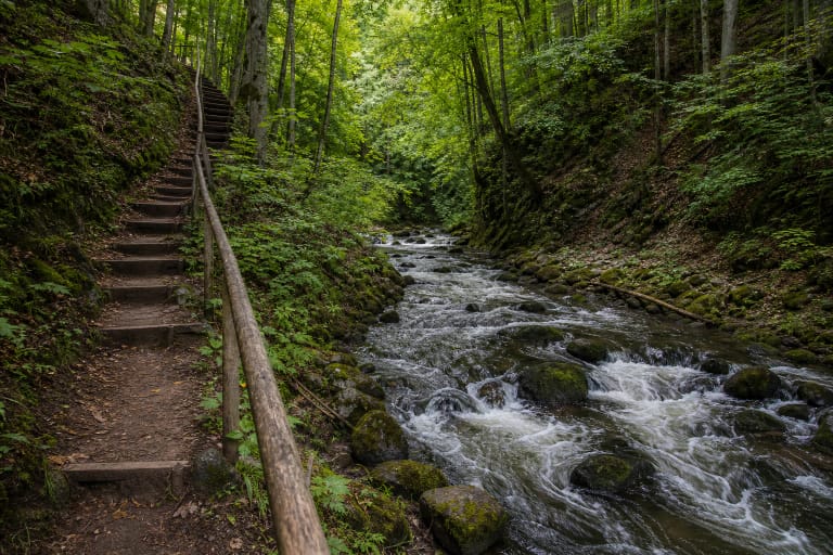
Real views show this rampart as a tall, rounded green ridge with timber steps running straight up its face. It is not a reconstructed castle wall, but a route over genuine archaeological earthworks. Stay on the path because shortcuts and descents down the steep slope erode the protected surface.
Why sources use different sets of measurements for the summit
VLE describes the top as two areas divided by a 10-metre rampart. The southern platform measures 11 by 25 metres and the northern one is an oval 38 by 20 metres. The dividing rampart rises 6.5 metres from the southern side and 4.5 metres from the northern side.
The official park description concentrates instead on the slope terrace and the outer southern defence of three ditches and three ramparts. The accounts do not replace one another: one describes divisions within the summit, while the other explains the outer defences and slopes. Their measurements should not be added together as though they described one simple rectangular platform.
Walk slowly across the top and watch the changes in height. The northern viewpoint stands above a high slope and looks along the Dūkšta Valley toward Bradeliškės and Karmazinai hillforts. The relief is easier to read after leaves fall, although wet steps and exposed edges require extra care.
Pottery from the 4th-8th centuries is firmer evidence than colourful castle legends
The hillfort was surveyed in 1970 and 1979, and a team led by Gintautas Vėlius excavated it in 2008. They found hand-built, non-wheel-thrown pottery with smooth and coarse surfaces. The sherds date to the 4th-8th centuries and demonstrate use substantially earlier than VLE's broader dating of the hillfort to the beginning of the second millennium.
An ancient settlement is registered south of the hillfort. VLE connects Buivydai and Bradeliškės with a defensive system between Kernavė and Vilnius. This is an interpretation based on archaeology and landscape, not a chronicle of a particular battle at Buivydai: the checked sources preserve neither a castle name nor a complete plan of its timber buildings or a documented battle date.
Visitors should not search for pottery themselves. The hillfort and settlement are protected archaeological sites, so digging, metal detecting, collecting finds, and lighting fires are prohibited. If a possible object is exposed, leave it in place and report it to heritage specialists.
Work in 2011-2012 improved access, but the visit remains steep
Neris Regional Park states that Buivydai and Bradeliškės hillforts were restored and adapted for visitors in 2011, followed by an access road in 2012. A viewpoint was created above the slope on the northern side, but the precise map pin does not promise that a vehicle can reach the summit.
The official pages publish no separate hillfort opening hours, ticket office, or compulsory admission. First-time visitors should come in daylight and check park notices before travelling because heavy rain, flooding, storms, or maintenance can change trail conditions.
Steps, roots, high slopes, and the elevation changes of the longer trail do not provide a barrier-free environment. Wear shoes with reliable grip after rain, keep children back from edges, and ask the park about current access if anyone in the group has limited mobility.