Vilnius District Municipality
Vilnius District
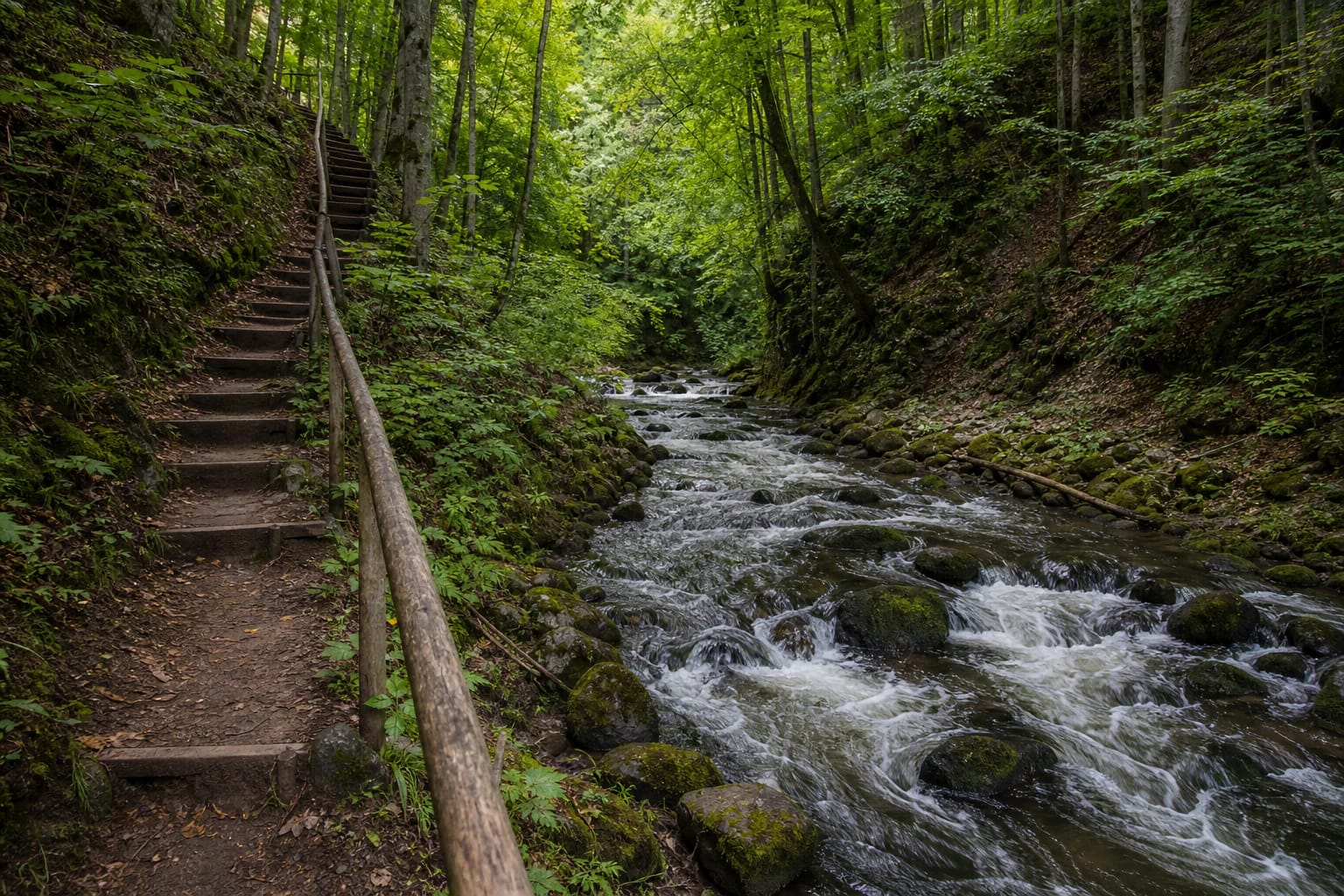
Neris Regional Park hiking trail along the Dūkšta
Dūkšta area, Vilnius district
54.82680, 24.94640
about 2.5 hours
April-October; after rain, use footwear with good grip
Dūkštai Nature Trail
One of the More Demanding Neris Regional Park Trails
Dūkšta Nature Trail is not a simple short stroll. Neris Regional Park presents it as a route of about 5 km, for which visitors should plan roughly 2.5 hours.
The trail is physically more demanding because of slopes, stairs, narrower stretches, and the fast Dūkšta stream valley. Prepare for a hike rather than an easy park loop.
The Dūkšta Stream as the Trail's Axis
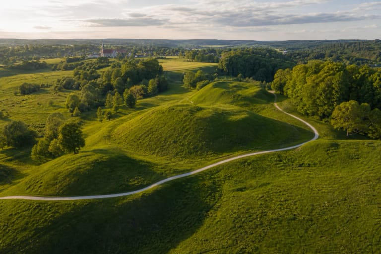
The Dūkšta stream gives the trail its character. Neris Regional Park calls it Lithuania's only 'mountain stream': fast, stony, and dropping about 20 m over its last few kilometres. During spring floods it becomes strong enough to attract water-tourism enthusiasts.
Because of the relief, the valley is sometimes described as a Lithuanian canyon. It was carved long ago by glacial meltwaters. It is not a mountain canyon, but by Lithuanian standards the narrow, steep-sided stream valley is genuinely distinctive.
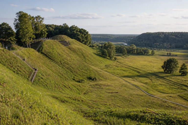
Hillforts and Sacred Sites on the Trail
The route includes Bradeliškės and Buivydai hillforts, the pyramid-like Karmazinai sacred hill, the thick Sacred Oak of Daubos, two high outcrops, and the Ąžuolų Hill viewpoint over the Neris valley.
For that reason the Dūkšta trail works best at a slower pace: read the information panels, stop at hillforts, and notice how the stream valley shaped the placement of old sites.
Landscape of the Middle Neris
Neris Regional Park was established in 1992 and covers 10,523 ha. VLE states that forests occupy 87 percent of its area and that the park protects the unique middle-Neris valley landscape of loops, terraces, and ravines.
Even though this trail follows the Dūkšta, the wider context is the Neris landscape: rivers, valleys, hillforts, old routes, and forest communities.
Difficulty and Safety
After rain, the trail can be slippery, especially on slopes, stairs, and by the stony stream. Choose hiking footwear, carry water, and keep a cautious pace.
Children can walk it, but allow extra time and consider whether they are ready for a 5 km route with elevation changes. The trail is not suitable for strollers.
What to See Nearby
The Dūkšta trail combines well with the Dūkštai area, the Neris Regional Park visitor centre, and the direction of Kernavė. Still, after this trail it is better not to overload the day: it can feel harder than its length suggests.
For a calmer rhythm, choose the Dūkšta trail and just one additional stop. That keeps the outing enjoyable instead of turning it into a rushed checklist.