- Place
- Bradeliškės, Dūkštai Eldership, Vilnius District Municipality
- Region
- Vilnius District
- Type
- state-protected hillfort with an outer bailey in the Dūkšta valley and an archaeological stop on the Dūkšta Nature Trail
- Address
- Bradeliškės, Dūkštai Eldership, Vilnius District
- Coordinates
- 54.82549, 24.94373
- Visit duration
- about 30-60 minutes for the hillfort alone; roughly 2-3 hours for the full 5 km Dūkšta Nature Trail, depending on pace and conditions
- Best time
- a dry day from late spring to autumn; slopes and trail structures can be slippery after rain
Pakilta, Brodeliškės Hillfort, Bradeliškės Hillfort with Outer Bailey, Bradeliškių piliakalnis
Visit Bradeliškės on its own or as part of the complete Dūkšta trail
The hillfort stands at Bradeliškės in Dūkštai Eldership, at 54.8254865, 24.9437265. The map point marks the archaeological site itself, not a guaranteed parking area. Follow signs on arrival and never leave a vehicle on a narrow road or private land.
Allow about 30-60 minutes to climb the hill, read the 3D panel, and study the landform. For the wider valley context, take the official Dūkšta Nature Trail. The park describes a route of about 5 km and two hours, but longer stops, children, or wet conditions can extend the outing to 2.5-3 hours.
Official pages publish no separate hillfort timetable, ticket office, or mandatory admission. It is an outdoor heritage site, but a first visit is safest in daylight. Check the official trail page before setting out because storms, flooding, or maintenance can change access conditions.
The Dūkšta encloses the hill on three sides and is also eroding it
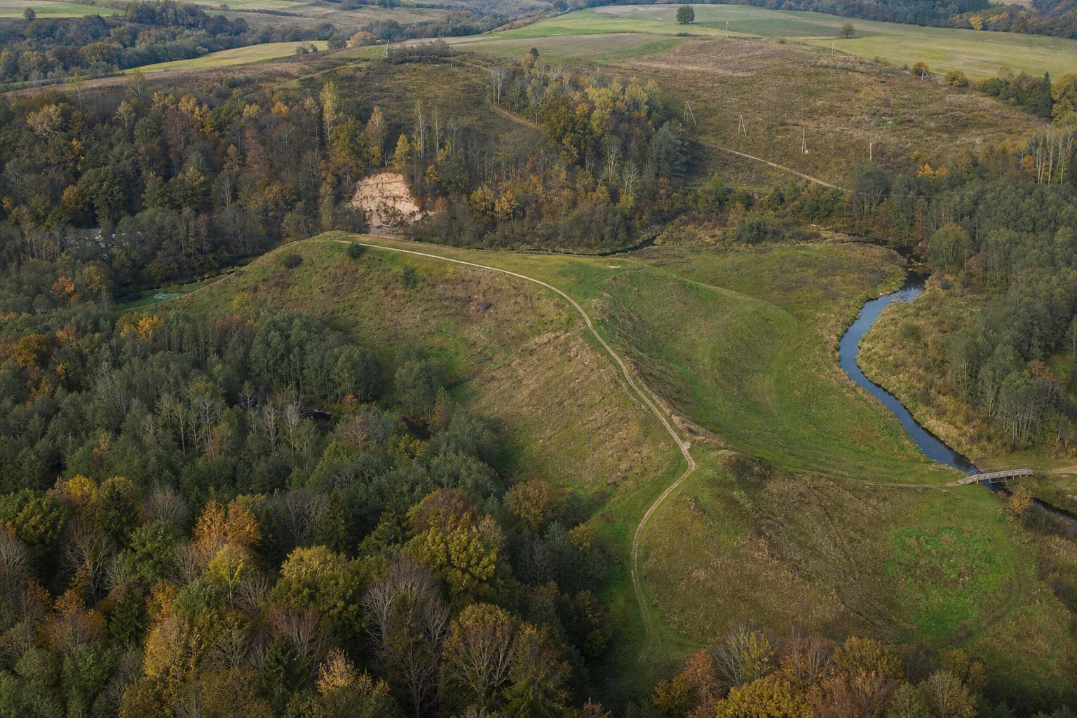
The hillfort occupies an elevated promontory on the left bank of the Dūkšta. The stream encloses it from the east, north, and west, while the southeastern side joins higher ground. This position created a natural defence, but flowing water has also worn away the steep slopes for centuries.
The Encyclopaedia of Lithuania records an irregular oval platform of about 112 by 60 metres and slopes 15-16 metres high. The eastern part of the platform and almost the entire rampart have collapsed into the stream. The Cultural Heritage Register also documents erosion, the effects of earlier damming and embankments, and work undertaken to stabilise the slopes.
An outer bailey adjoins the southern end of the main hillfort. It is an irregular triangle about 45 metres long and up to 40 metres wide. Visitors should not mistake the entire open meadow for one unchanged castle platform: the present terrain contains surviving, collapsed, and managed sections.
Archaeology records long use from prehistory to the fourteenth century
In 1970, archaeologists led by Vytautas Daugudis excavated 82 square metres of the platform. Further work followed in 1998, 2002, 2008, and 2009. The excavated areas reported by the Encyclopaedia of Lithuania total about 607.5 square metres. Set against a platform measuring 112 by 60 metres, this also means that much of the site remains unexcavated.
The surviving cultural layer is about 0.7-1.2 metres deep. Finds include handmade pottery with brushed and roughened surfaces, wheel-thrown pottery, iron knives and awls, clay spindle whorls, bronze and iron ornaments, flint flakes, whetstones, horse-and-rider fittings, and metal-smelting waste.
The evidence spans the second half of the first millennium BCE through the fourteenth century. It reveals more than defence: spindle whorls, tools, and production debris point to daily labour and crafts. The Encyclopaedia states that finds are held by the National Museum of Lithuania, so visitors must never search for or remove archaeological material from the hill.
A defensive link between Kernavė and Vilnius is not a story of one documented battle
The Encyclopaedia associates Bradeliškės and nearby Buivydai Hillfort with a defensive system between Kernavė and Vilnius. Promontories in the Dūkšta valley could help control movement through river corridors, while fourteenth-century material fits a period when the region faced the threat of the Teutonic Order.
The idea that a timber castle stood on the hill is best understood as an interpretation grounded in archaeology and topography. The checked sources do not preserve its name, the exact plan of every structure, or a chronicle account of a specific battle at Bradeliškės. Picturesque stories should therefore not be presented as documented events.
Pakilta and Brodeliškės Hillfort are genuine alternative names recorded by encyclopaedic and heritage sources. They do not denote another nearby hill. Select the exact Bradeliškės Hillfort map entry, and treat Buivydai as a separate but related archaeological site.
The 3D panel restores lost volume as an interpretation, not a medieval photograph
A special panel beside the Dūkšta Nature Trail presents an earlier form of the hillfort based on archaeological research and a visualisation by architect Dalius Regelskis. From the marked viewing position, aligning a red line with the present terrain helps viewers imagine larger slopes, timber defences, and an earlier course of the Dūkšta.
The panel is an interpretive tool, not a direct image from the Middle Ages. It communicates how much erosion has altered the hill, but it cannot prove the shape of every tower or the number of buildings. The most useful sequence is to inspect the panel first, then walk along the platform and compare its lines with the actual valley.
The slopes are a protected archaeological surface. Stay on established paths and steps, do not climb eroded edges, dig, or light fires. Rain can make the ground slippery, and the complete Dūkšta trail includes many ascents and descents, so sturdy footwear is essential.