- Place
- Lazdijai District Municipality
- Region
- Dzūkija
- Type
- circular walking trail over the Prelomčiškė hills beside Lake Dusia
- Address
- Prelomčiškė village, Lazdijai District
- Coordinates
- 54.30430, 23.66003
- Visit duration
- 1 hour 20 minutes-1.5 hours; longer with viewpoint and hillfort stops
- Best time
- mid-to-late May for snowdrop anemones, late June-July for colourful grassland, and spring or autumn for waterbirds
Prelomčiškė Nature Trail, Prelomčiškė Hills Pedestrian Trail, Pėsčiųjų pažintinis takas „Prelomčiškės kalvomis“
The loop describes the whole walk separately from the hillfort
Prelomčiškė Hills is a 3.2 km circular walking route on Lake Dusia's northwestern shore. Its separate southern start and finish are beside a rest area about 1.5 km south of Prelomčiškė Hillfort, so the route is more than the short climb to the hillfort.
The checked southern access point is 54.304305, 23.660026. It marks the rest area and entrance to the loop, not the hillfort summit or the whole route. The official Saugoma.lt object coordinate, 54.305, 23.657, is a general trail marker, so this page uses the more precise entrance point for navigation.
Park information suggests about 1 hour 20 minutes for the loop, but allow 1.5 hours or more for the panoramas, plants, and hillfort. The distance is modest, yet the hills, uneven meadow surface, and stops make this more involved than a quick walk on a level path.
Glacial hills open a Dzūkija sea panorama
The Prelomčiškė hills lie within Barčiai Landscape Reserve. The State Service for Protected Areas links the relief to the last glaciation, while the reserve protects lake terraces, a shore-dune belt, small moraine landforms, and the botanically and entomologically valuable slopes on Dusia's western shore.
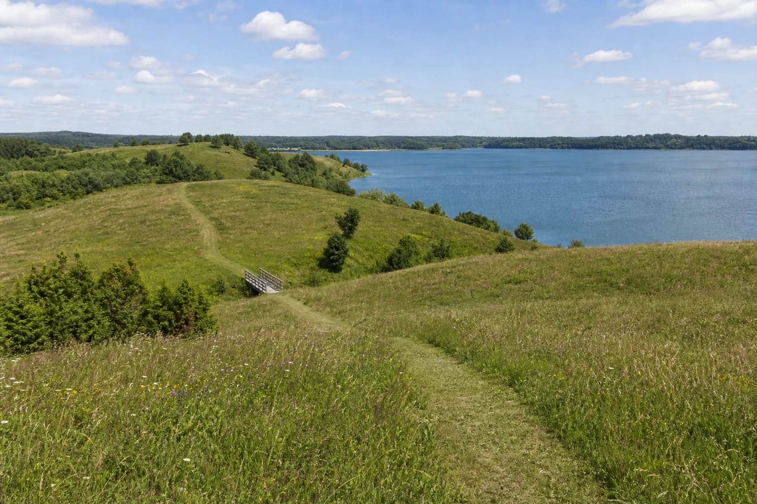
The ridges overlook Dusia, the largest lake in Dzūkija and Lithuania's third-largest by area. Official photographs show how the panorama changes with elevation: grassland and a line of trees fill the foreground in one view, while the lake occupies almost the entire horizon in another.
The route's highest point rises about 25 metres above Lake Dusia. This is open grassland rather than a fenced cliff viewpoint: stay on the mown path, do not let children run straight down the slopes, and expect wind and very little shade on the exposed hills.
Dry steppe meadows are the trail's main natural value
The dry grassland on the Prelomčiškė hills is a distinctive habitat of warm slopes with limited moisture. Directorate activity reports identify the Prelomčiškė steppe grassland as a site of continuing habitat-management work, where mowing helps keep the meadow open and also defines the line followed by visitors.
The official trail description lists snowdrop anemone, Anemone sylvestris, and cross gentian, Gentiana cruciata, among its rare plants. White snowdrop anemones generally appear in mid-to-late May; in late June and July, cranesbills, bedstraws, knapweeds, wild thymes, medicks, and green strawberries bring colour to the meadow. Timing varies with the year's weather and management.
Picked flowers fade quickly while their loss lasts longer in the habitat, so photograph plants from the path and leave them in place. Do not create shortcuts, drive a car or bicycle over the meadow, or widen one trail into several parallel tracks.
The hillfort, bridge, and Dusia shore form one route
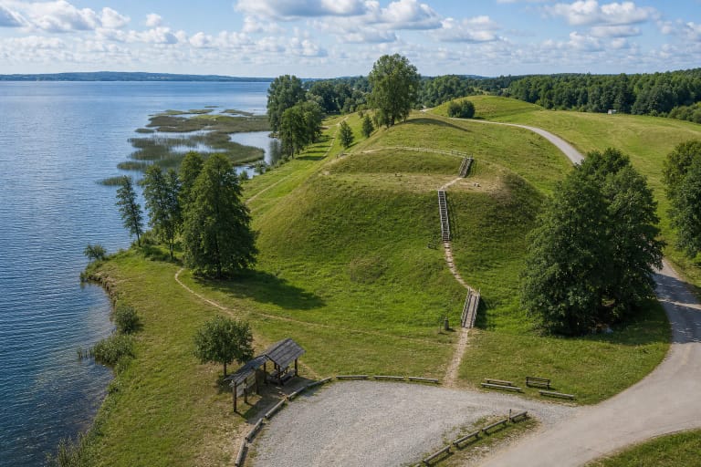
In the north, the route reaches Prelomčiškė Hillfort, which Saugoma.lt describes as a Yotvingian-period site used until the thirteenth century. Trail and hillfort are separate destinations: the loop explains the wider hills and grassland, while the dedicated hillfort page covers the archaeology and investigations.
A wooden bridge crosses the stream beside the hillfort, and wooden steps climb to its summit. The official gallery shows a low, long bridge below the steep turf-covered slope, so this section deserves a slower pace than the open meadow after rain.
Larger flocks of coots, ducks, whooper swans, and other birds can be seen on Dusia and its shores in spring and autumn, while signs of beaver activity occur throughout the year. Watch from the trail, keep away from nesting areas, and do not force a route to the water where there is no clear public access.
Practical walking depends on surface and season
Part of the loop follows a mown path through the meadow and part an asphalted local road. There is no continuous boardwalk, lighting, or shelter from the sun; after rain, wear shoes with reliable grip, and on a hot day bring water, a hat, and tick protection.
Saugoma.lt clearly states that the trail is not adapted for visitors with mobility disabilities. Its hilly relief, natural surface, and hillfort steps also mean that the complete loop should not be planned with a wheelchair or a small pushchair.
The official object description lists no ticket office or fixed opening hours. Even so, check current directorate notices for maintenance work, events, or temporary restrictions before travelling; on arrival, leave the car at the rest area and use the map on the information board.