- Place
- Prelomčiškė, Lazdijai District Municipality
- Region
- Meteliai Regional Park
- Type
- state-protected complex used from the first millennium to the thirteenth century, with 9-12-metre slopes, two bank-and-ditch lines, a three-hectare foot settlement, and a panorama over Lake Dusia
- Address
- Prelomčiškė village, Šventežeris eldership, Lazdijai District
- Coordinates
- 54.31251, 23.65500
Prelomčiškės piliakalnis, Prelomciškės piliakalnis, Eglynai Hillfort, Prelomčiškė Hillfort and Settlement
The free viewpoint is easy to reach by car, but stairs rather than a level path lead to the summit
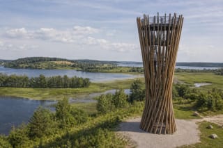
The hillfort stands in Prelomčiškė village on the western shore of Lake Dusia, coordinates 54.312505, 23.655002. A brown sign from regional road 2509 Rūda-Šventežeris-Teizai-Kavalčiukai directs drivers along a paved local road to parking on the north side. Information panels stand at the foot, a small bridge crosses the stream, and timber stairs climb to the enclosure. There is no ticket, gate, or opening schedule.
The walk from the parking area is short, but the 9-12-metre slope is steep and the steps can become slippery after rain, frost, or snow. The State Service for Protected Areas explicitly marks the site as unsuitable for visitors with reduced mobility. A wheelchair may reach parts of the foot infrastructure, but the viewpoint requires the staircase. Do not cut straight up the slope, where footsteps damage both turf and the archaeological layer.
For a longer walk, combine the hillfort with the separate 3.2-kilometre Prelomčiškė Hills circuit. Its southern start lies roughly 1.5 kilometres away at about 54.304194, 23.659444; the loop follows mown grass and asphalt and normally takes around one hour twenty minutes. It is not simply an extension of the summit steps, so photograph the map panel before setting out and prepare for tall grass, sun exposure, and ticks.
The surviving 16.5-by-35-metre enclosure is only part of a broader defensive summit later levelled and cultivated
The hillfort occupies a natural knoll at the mouth of an unnamed spring-fed stream, with water and Lake Dusia protecting its north and east approaches. VLE and the Lithuanian hillfort inventory measure the surviving oval, north-south enclosure at about 16.5 by 35 metres. The protected-areas description rounds the broader, levelled summit to almost 40 metres across. These are different ways of measuring a damaged landform, not two separate sites.
The strongest defence faced south, where the hill joined higher ground. A bank roughly 40 metres long, 15 metres wide, and four metres high rose here; its outer slope, approximately seven metres high, fell into a ditch three metres wide and about half a metre deep. Beyond stood another bank, one metre high and six metres wide, followed by a second ditch around three metres wide. The outer line is now nearly destroyed, making the principal bank and the overall profile easiest to read on site.
Sources give slope heights from 9-10 to 12 metres: the lower figure measures the distinct defensive face, while the higher captures the difference from the lowest foot. The protected-areas account says stone, clay, and an upright-log palisade reinforced the summit edge. This is a reconstruction of the earthen defence system, however, not a full timber wall excavated intact along its entire circuit.
The early settlement and thirteenth-century Yotvingian stronghold represent different phases of use
The complex carries the broad date first millennium to thirteenth century. That does not mean one castle stood continuously for a thousand years. The earliest clear foot-settlement layer belongs to the first half of the first millennium, when a community made smooth, brushed, and rough hand-built pottery, spun thread, sealed structures with clay, and worked iron.
The thirteenth-century phase is associated with the Yotvingians, a western Baltic people inhabiting what is now southern Lithuania and adjoining parts of Poland and Belarus. The massive southern bank and position above a lake route support the interpretation of a wooden stronghold during an age of warfare. No chronicle provides its name and no excavation has exposed a complete castle plan, so a probable wooden fort is more accurate than invented numbers of towers or a fictional destruction battle.
The foot settlement covered about three hectares south, west, and north of the hill, within a protected complex of roughly 4.2 hectares. It was not a mere appendage but the setting for food production, crafts, and families. Archaeology therefore continues under meadow and road verges well beyond the visible stairs and bank. Unauthorised digging and metal detecting are prohibited.
Roadside excavation in 2012 and 2018 found a hearth, spindle whorl, and waste from iron smelting
Archaeologists surveyed the hillfort in 1954, 1977, 1989, and 2001. They recorded a cultural layer about 70 centimetres thick on the northern enclosure edge and more than one metre thick in its centre. Five small test pits in 2006 produced more than ten fragments of hand-built pottery with smooth and brushed surfaces. None of these campaigns excavated the entire hill, so most remains preserved and unexamined.
Road work in 2012 prompted twenty test pits totalling forty square metres. Three contained an intensive 20-80-centimetre layer from the first half of the first millennium, with hand-built pottery, a clay spindle whorl, daub, and iron-smelting slag. In 2018, fifteen further pits and survey along 740 metres showed that a 0.5-1.15-metre early layer extended south beyond the previously mapped settlement boundary. One pit preserved a hearth hollow with burnt pottery and fired clay.
A much later layer occupies the same landscape. A sixteenth- to seventeenth-century manor horizon was noticed west of the hill in 2001; finds assigned to the seventeenth and eighteenth centuries in 2012 included an iron knife, forged nail, a 1655 copper shilling of John II Casimir, and animal bones. They do not show that Iron Age residents used a seventeenth-century coin: archaeologists explicitly separated the periods. A Roman sestertius sometimes misattributed through careless reading was actually reported at Pagramantis Hillfort in the preceding article of the same volume.
Ploughing, grazing, and levelling around 1960 altered what now appears to be a natural grassy hill
Animals grazed both the slopes and summit in the first half of the twentieth century, while the enclosure and foot were cultivated for many years. The State Service for Protected Areas records that the enclosure and bank were levelled around 1960, damaging the cultural layer and almost erasing the outer bank and ditches. Today's smooth meadow is not an untouched thirteenth-century surface.
That damage also explains archaeological patterns: soil may have been ploughed from the enclosure into its edges, while the road destroyed part of the western foot layer. Dense turf now helps protect the surface from rain erosion. Visitors can assist simply by using stairs and marked paths, lighting no fires on the enclosure, digging nothing, keeping vehicles off the slope, and leaving no newly built stone arrangements.
No reconstructed castle or display case of artefacts stands on top. The exhibits are the landform, the principal bank read with the eye, the information panel explaining the scale of settlement, and the lake view. Remembering the measurements before arriving makes the reduced southern bank and broad foot meadow far more legible than searching for masonry walls that never belonged here.
The Dusia panorama, St Anne festival, and legend of Onelė preserve living memory rather than archaeological proof
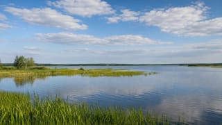
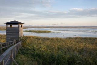
The view from the west-shore hillfort crosses Dusia, the largest lake in Dzūkija and Lithuania's third largest by area. Sunrise appears above the opposite shore, while spring and autumn bring concentrations of migrating waterbirds. To the south, the walking circuit crosses dry, steppe-like grasslands where narrow-leaved anemones flower in May and thyme, cranesbills, knapweeds, and other warmth-loving plants follow in summer. Do not pick protected plants.
A local tale says the devil courted a beautiful woman named Onelė while disguised as a young man. She agreed to marry if he built a wedding hill in two nights, then, becoming suspicious, brought a rooster. Its premature crow made the devil and his helpers sink into Dusia, leaving the mound unfinished. This is a legend that gives imaginative form to the landscape and Onelė's name; it does not replace the archaeological date of the first millennium to the thirteenth century.
A St Anne festival, Oninės in Lithuanian, is traditionally held at the hillfort in late July. Access, parking, and the atmosphere differ from an ordinary independent visit that day, so confirm the programme through Lazdijai District notices. On 13 July 2026, the exact Google Maps listing averaged 4.8 out of 5 from 849 reviews. That high and relatively stable score chiefly reflects the panorama and visitor access, not surviving castle buildings.