Lazdijai District Municipality
Meteliai Regional Park
Meteliai Regional Park lake
54.28400, 23.74100
1-2 hours for shore and viewpoint; longer for water routes
summer for water and visitor stops; spring and autumn for birdwatching
Metelys, Metelis
Lake Metelys between Dusia and Obelija
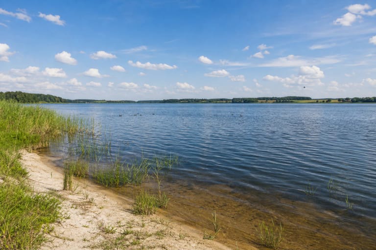
Lake Metelys is one of the main water bodies of Meteliai Regional Park. VLE states that it lies in Lazdijai District Municipality, 10 km southeast of Simnas and 5 km north of Seirijai, between Lakes Dusia and Obelija. This lake system forms the core of the park landscape.
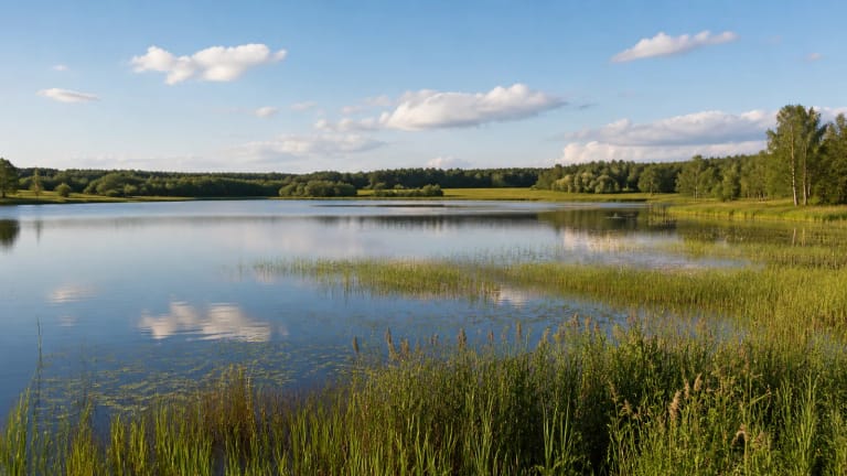
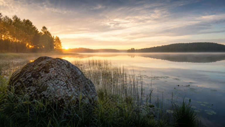
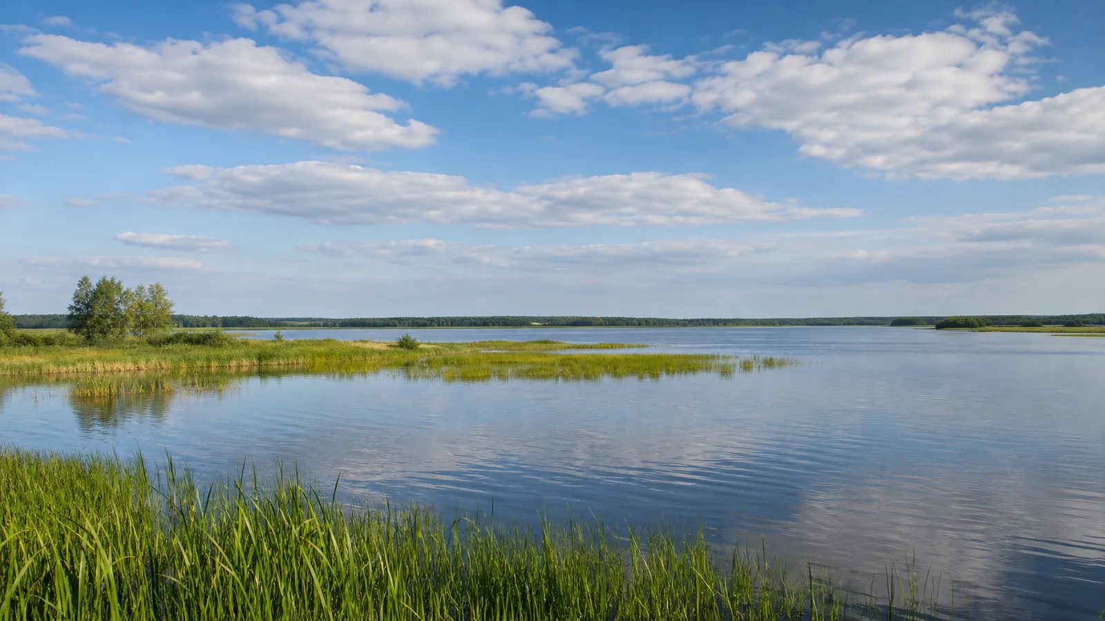
VLE gives Metelys an area of 1,289.5 ha, length 6.8 km from northwest to southeast, maximum width 2.7 km, and surface altitude 105.1 m. Its maximum depth is 15 m and average depth 6.8 m. It is a large open lake best understood in relation to surrounding meadows, reedbeds, and neighbouring waters.
Mixed origin, shores, and Metelytė flow
VLE notes that the basin is of complex origin: part is a glacial channel, while another part was hollowed by a dead-ice block. The shoreline is not very indented and measures 18.8 km; most shores are low and partly marshy, while northeastern and southwestern shores are steeper, abraded, and preserve remains of four terraces. The southeastern shore is wooded by Širvintas and Statiškės forests.
The catchment is 55.6 km2; the Metelytė, a Peršėkė tributary, flows through the lake, while Dubelis and several short streams enter from the south, placing the lake in the middle Nemunas basin. VLE gives summer water transparency as 2.5-5 m and throughflow about 12 percent; freshwater limestone deposits occur on the terrace near Meteliai village.
Waterbirds, reedbeds, and landscape reserve
Metelys is known for birds. VLE notes abundant waterbirds: ferruginous ducks, greylag geese, great bitterns, moorhens, and spotted crakes breed here, while pike, tench, bream, crucian carp, carp, roach, perch, and eels live in the water. Reed and bulrush belts are dense but not continuous, especially around marshing bays.
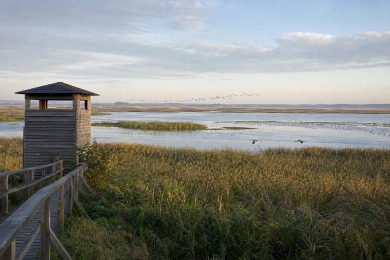
According to Saugoma.lt, Metelys and its surroundings belong to Meteliai Landscape Reserve in Meteliai Regional Park. Large water areas, reeds, and shore meadows are important habitats, so spring and autumn migration are best experienced from official stops and viewpoints rather than sensitive shores.
Heritage on the shores
Cultural heritage also gathers around Metelys. VLE notes Papėčiai ethnocultural village and hillfort on the northeastern shore, Meteliai on the western shore, and the mythological Laumė Stone on the eastern shore. In Širvintas Forest, the Old Oak and Hollow Oak are botanical natural monuments.
These places show that the shore is not only natural landscape but also deep cultural memory. Laumė Stone recalls older Baltic worldview, while the hillfort and ethnocultural village show long life by the lake; folklore about the lake should be read as a separate memory layer.
Water-level history and boating rules
VLE mentions that a water-measuring station operated by the lake in 1926-1932, and in 1968 Metelys was dammed, raising its water level by about 0.7 m. The modern landscape is therefore not an untouched prehistoric state; twentieth-century hydraulic decisions also shaped shores, shallows, and reedbeds.
For visitors, the Dzūkija-Suvalkija Protected Areas Directorate publishes special boating rules for Lakes Metelys and Obelija, including restrictions for motorized craft and seasonal rules. Because such rules can change, check the official directorate page before launching a boat.
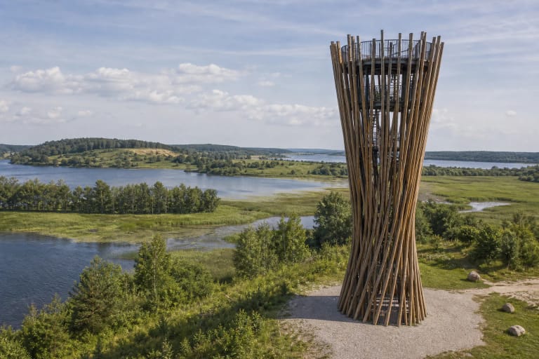
How to visit Lake Metelys
For a first visit, choose Meteliai Observation Tower and official shore stops. From a higher point you can see how Metelys relates to Dusia, Obelija, and surrounding meadows, and the trip can be combined with Papėčiai Hillfort and Meteliai town.
If you want to swim or boat, plan around official places, not a random map point. This protects shore vegetation and leaves quieter zones for birds. For a broader trip, combine Metelys with Obelija, Dusia, and nearby Žuvintas Biosphere Reserve.