- Place
- Plokščiai Eldership, Šakiai District Municipality
- Region
- Suvalkija
- Type
- approximately 3.3 km nature and heritage route through Plokščiai village, the Vaiguva valley, and its cultural stops
- Address
- Plokščiai, Šakiai District Municipality
- Coordinates
- 55.07607, 23.17398
- Visit duration
- 1.5-2.5 hours for the main route of approximately 3.3 km with stops
- Best time
- from late spring to early autumn, when the valley is green and the Vaiguva section is easier to explore; use more careful footwear after rain
Plokščiai Educational Trail, Plokščių pažintinis takas, Plokščių Nature Trail
One route brings together water, village life, and heritage stops
Saugoma.lt gives Plokščiai Nature Trail as approximately 3.3 km and identifies five principal stops: the Vaiguva stream-street, Plokščiai-Vaiguviškiai Hillfort, Šventaduobė and its spring, the church, and the Paths of Suffering memorial. Local visitor information also describes a roughly 7 km total trail network with additional village and Nemunas-shore stops. These figures refer to different route extents rather than one mistaken measurement.
The coordinate 55.076068, 23.173983 marks a representative place on the route rather than a gate into a closed loop. Saugoma.lt gives the broader object coordinate as 55.079, 23.172; use the latest diagram and signs on site to follow the chosen version.
Allow about 1.5-2.5 hours for the core 3.3 km with stops, and at least half a day for the wider 7 km network. This is not one continuous woodland footpath: village streets, paving blocks, grassy valley slopes, waterside tracks, and rougher heritage access all occur along the way.
The Vaiguva stream-street gives the trail an unusual beginning
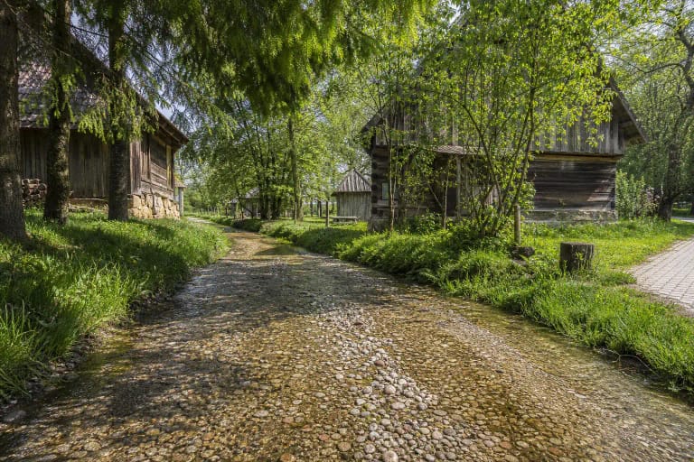
The Vaiguva stream-street is Plokščiai's distinctive feature: the stream runs through the settlement, and its channel becomes a recognisable part of everyday movement and village landscape. Saugoma.lt notes that the drivable section extends for more than half a kilometre, so in places visitors can walk beside the water or wade through it.
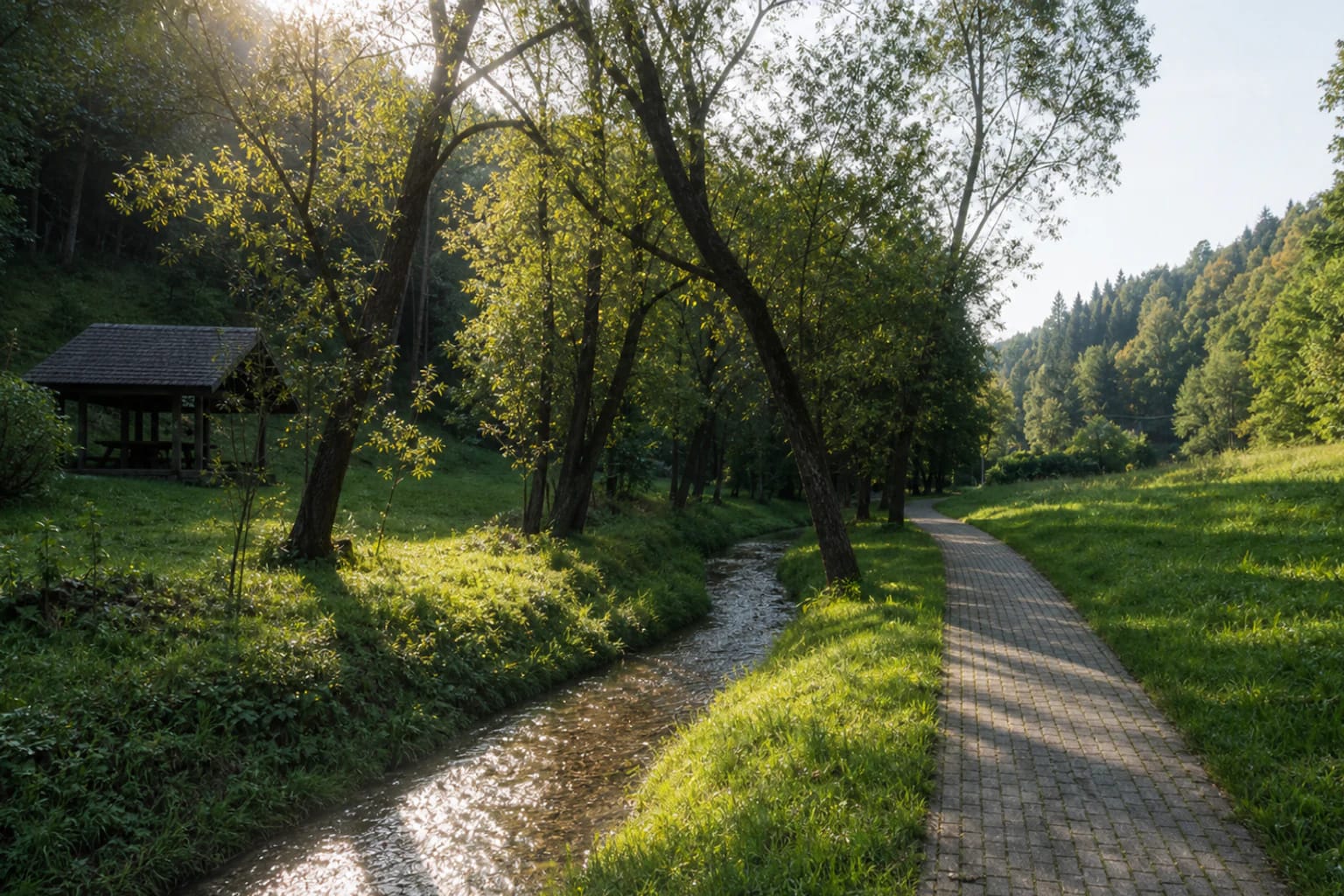
Pebbles show through the streambed, while cold water, grassy banks, and tree shade replace the usual street scene. This is not a decorative canal or a dedicated recreation zone, however: water level, mud, and stones can be slippery after rain, and homes along the channel deserve privacy.
If you wade, choose only a clearly safe place, wear footwear with a firm sole, and keep small children away from deeper or faster water. Leave cars where they are legally allowed, do not obstruct local movement, and treat the stream as a living part of the village rather than a play feature when water is high or cloudy.
Šventaduobė is both a valley spring and a sacred trail stop
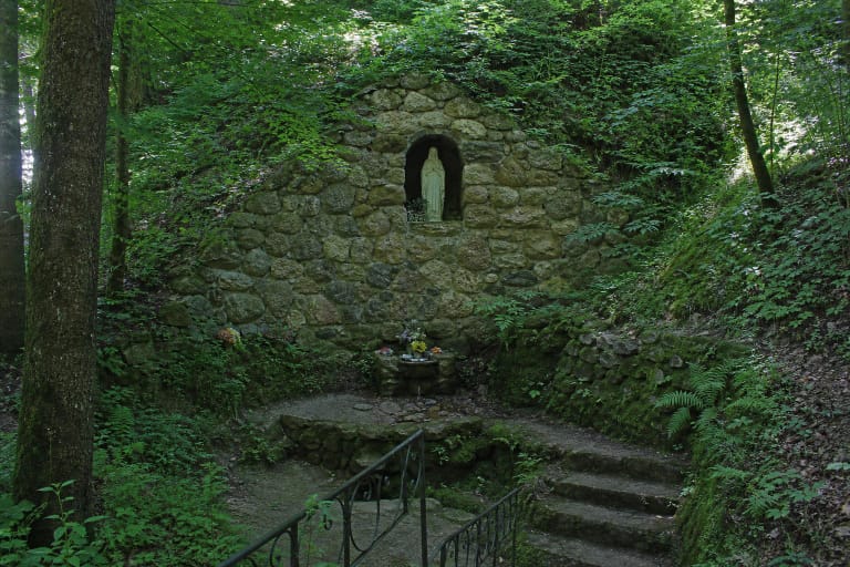
From the Vaiguva valley the trail reaches Šventaduobė, a place wrapped in local legend beside the Plokščiai Spring. A fieldstone altar and wall mark the site, while the natural hollow brings together landform, water, and the village's religious memory. The separate spring guide distinguishes documented history from the stories attached to the place.
The official trail description mentions the possibility of tasting the spring water, but an old description is not a current guarantee of drinking-water quality. Bring your own water for the walk, and do not drink from the spring unless current official information confirms that it is appropriate.
The route down to the grotto and spring lies in a hollow, so it can be wet and slippery after rain. Be quiet, do not climb on the altar or fieldstone wall, leave no rubbish, and remember that during worship this is a sacred place rather than an ordinary picnic shelter.
The hillfort and village heritage broaden a nature walk
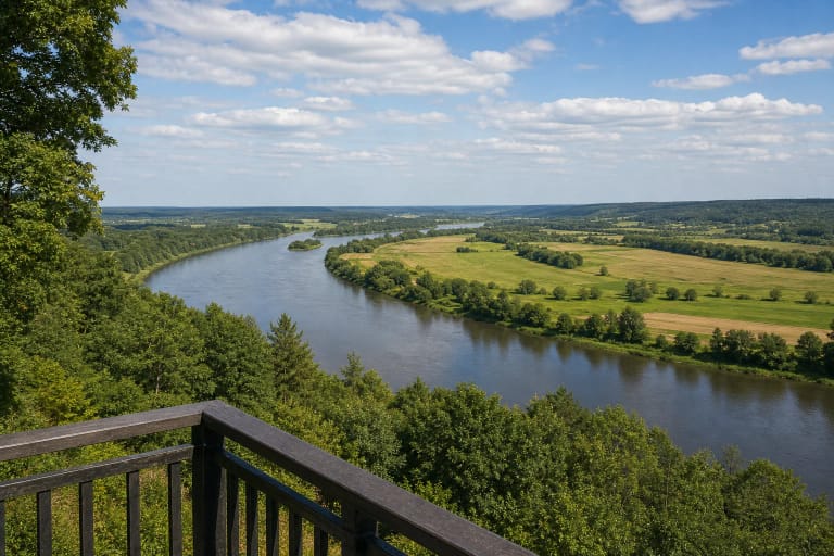
The trail continues past Plokščiai-Vaiguviškiai Hillfort, a high place enclosed by deep hollows beside the Vaiguva. The Panemuniai Regional Park description lists it, the Didžiupis-Vaiguva valleys, and the Šventaduobė spring among the protected values of Nemunas Landscape Reserve. Stay on the worn path across the slopes, especially when roots and wet grass are slippery.
After walking through the village, the route reaches the Church of the Name of the Blessed Virgin Mary in Plokščiai. The Encyclopaedia of Lithuania records the present church as built in 1868 and notes the 1573 bell in its tower. This is an important cultural stop, but visitors should fit their visit around services and keep the quiet expected in a church.
Another part of the route descends towards the Paths of Suffering memorial, unveiled in 1990. The Encyclopaedia of Lithuania records that about 25 Lithuanian partisans fought in Plokščiai Volost after the Second World War, while Soviet authorities deported about 260 residents and imprisoned 74. The memorial is dedicated to this history of repression and resistance, so quiet respect is more appropriate than picnicking or play.
In practice, take the trail slowly and bring dry footwear
The surface changes along the route: there are village streets, grassy valley edges, paths beside the stream, uneven sections, and places where you may want to step closer to the water. Firm, non-slip footwear is more useful than light city shoes, especially after rain or in autumn.
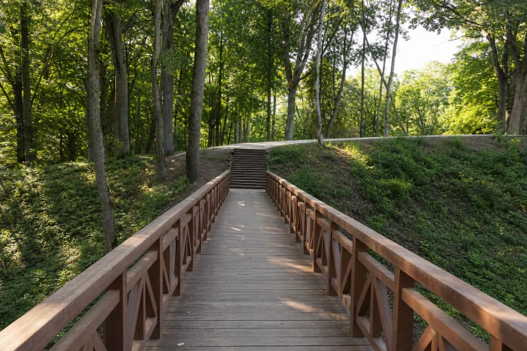
The 2025 Šakiai District Municipality activity report confirms that part of a pedestrian path in Plokščiai Eldership was renewed. It does not say that the whole 3.3 km route was resurfaced, so the photographed section paved with concrete blocks should not create an expectation of a uniform hard surface throughout.
With children, agree in advance where it is safe to approach the water, and stay on worn paths near the hillfort and hollow. Winter, flooding, or a storm can change conditions from those shown in summer photographs, so check the latest municipal or protected-area notices before travelling.