- Place
- Gelgaudiškis, Šakiai District Municipality
- Region
- Suvalkija
- Type
- approximately 2.5 km nature and heritage trail through a historic manor park and the deeply folded woodland above the Nemunas valley
- Address
- Gelgaudiškis Manor Park, Parko g., Gelgaudiškis, Šakiai District
- Coordinates
- 55.07914, 22.98026
- Visit duration
- 1.5-2.5 hours for the full park circuit with stops; longer if visiting the manor house separately
- Best time
- a dry day in spring or autumn; the Nemunas valley is more visible without leaves, while ravine slopes and timber can be slippery after rain
Gelgaudiškis Educational Trail, Gelgaudiškis Manor Park Nature Trail, Gelgaudiškis Park Nature Trail
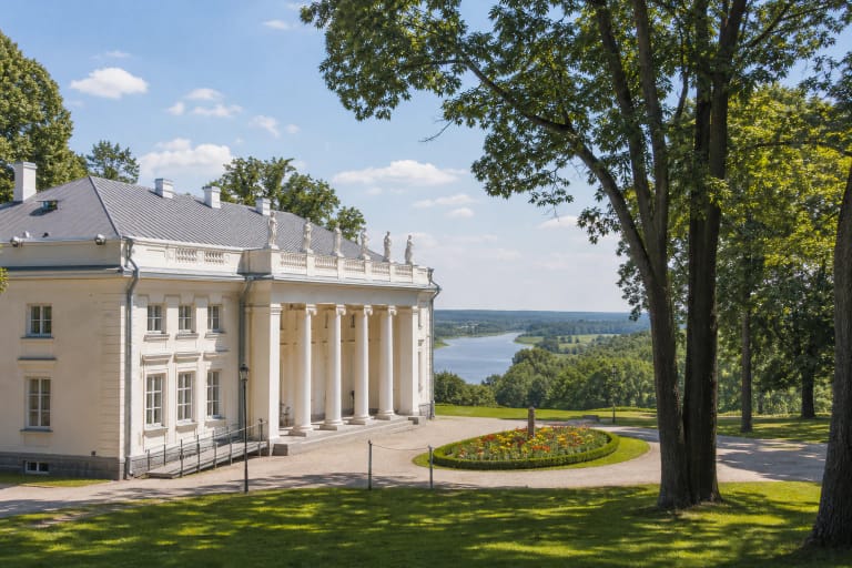
The Trail Begins at the Manor House but Forms Its Own Park Route
Saugoma.lt places the start of the route at Gelgaudiškis Manor, from where the path enters the park. The exact Google listing is pinned deeper among the trees at 55.079135, 22.9802609, while Saugoma.lt marks the attraction still farther east at 55.078, 22.989. The points differ because this is a long route rather than a single doorway or viewing platform. The Google coordinates on this page are therefore a representative point; begin by the manor house and follow the current signs on site.
A Šakiai District municipal publication gives the restored trail a length of 2.5 km. An older local route description calls it 2 km, which explains why both figures appear online. The practical distance depends on whether you take every branch towards the spring, Devil's Hill, Pakalniškiai, and the burial grounds. Allow 1.5-2.5 hours for the full circuit with time to read boards and pause at the stops.
This is not a second Gelgaudiškis Manor page. The house matters as the route's starting point and the centre of the park composition, but walking is the main experience: formal avenues and the parterre gradually give way to denser park woodland, rolling slopes, ravine bridges, and the spring. Set aside additional time if you also want to enter the manor, join a tour, or attend an event.
The Star, Assessor's Grave, and Devil's Hill Form the Route's Recognisable Core
The most distinctive design element is the Star, a forest clearing from which eight straight rides radiate. Saugoma.lt cautiously suggests that this feature may have been used for hunting. An official current photograph shows a tall carved timber post, simple log benches, a grassy centre, and several path corridors opening between mature trees.
From the Star the route reaches an approximately 3 m high tree-covered mound called the Assessor's Grave and the steep-sided Devil's Hill. Stories about a cruel estate judge, his love for a serf, or the origin of the hill's name are local legends, not documented biographies or archaeological conclusions. The landforms are real; the narratives attached to their names should be read as folklore.
The municipality's manor-park description also lists the Baron Cemetery, associated with the Keudell barons, and a spruce recorded as 42.54 m tall and 103.2 cm in diameter and called the tallest in Sūduva. A tree's condition can change, so follow present signs and do not approach a fenced or storm-damaged trunk solely because older literature records impressive measurements.
The Park's History Is Legible in Its Avenues and Eight Radial Rides
The Dzūkija-Suvalkija Protected Areas Directorate describes the nearly 119 ha park as one of Lithuania's largest. Its main axis is a four-row silver maple avenue, while a small-leaved lime avenue linked the upper and lower grounds. A common-oak avenue with steps descended from the house towards the Nemunas. The opening portion of the trail is therefore a planned cultural landscape, not an accidental urban wood.
When the Keudell family rebuilt the estate in the nineteenth century, the park was extensively reshaped with avenues, a terraced garden, ponds, and drainage channels. The Komar family, who acquired the property around 1900, enlarged the park and created a picturesque link to the old forest. The directorate attributes the Star's eight radial rides to this phase, together with the addition of European and grey horse chestnuts, Austrian pines, and eastern white pines to the native stands.
Municipal sources also identify European larch, European beech, red oak, red-flowered horse chestnut, and more than 400 large oaks. The cavities in the four-row silver maple avenue provide habitat for common mergansers. Use on-site labels or a reliable tree guide, since similar deciduous trees and pines are not always easy to distinguish at a distance.
The Ravined Nemunas Margin and Šilupė Spring Explain Why This Short Trail Is Not Flat
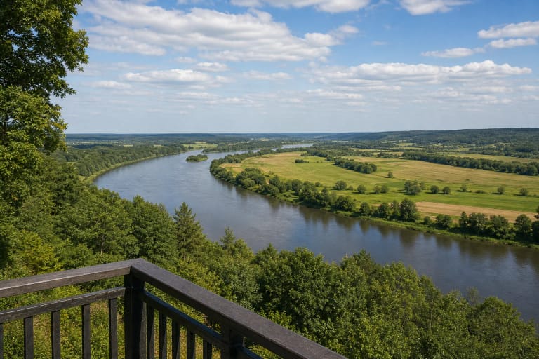
The Lithuanian Geological Survey describes the Gelgaudiškis valley margin as a sandier strip of deeply cut, wooded slopes beside the ancient Nemunas valley. Gelgaudiškis is bordered by the 8.1 km Šilupė to the east and the 5.7 km Lapymas to the west. In their lower interfluve, sandy cover lets water seep down more readily, while clay or loam beneath it helps springs emerge on the slopes.
Gelgaudiškis Spring lies on the eastern edge of the forest park at the head of a branching ravine, about 250 m west of the Šilupė channel. The survey places the outflow roughly 25-30 m above the stream; water drains down the gully into the Šilupė and travels another 1.8-2 km with it to the Nemunas. The spring branch therefore reveals an actual valley watercourse, not an ornamental estate pond.
Although older accounts mention people drawing and tasting the spring water, that is not a standing guarantee of present microbiological quality. Bring your own drinking water and do not drink from the spring without current official confirmation. Stay on the built paths and bridges rather than scrambling across the wet ravine sides.
Renewed Paths and Bridges Improve the Route but Do Not Make the Whole Circuit Step-Free
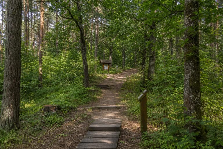
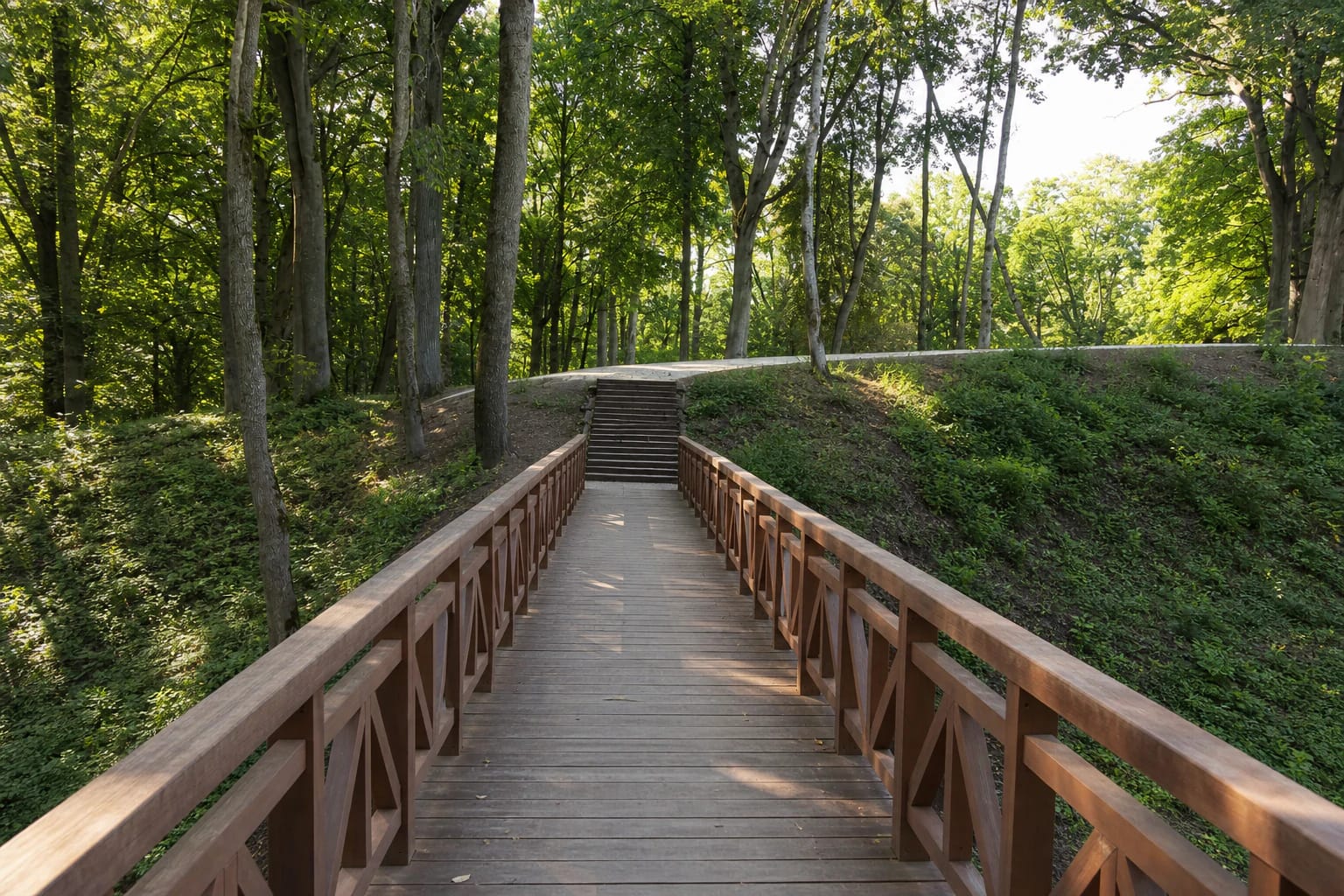
On 6 June 2024, the protected-areas directorate announced completed improvement works in Gelgaudiškis Manor Park. Oak, lime, and spruce avenues were restored, paths and bridges renewed, ravine slopes stabilised, lost valuable planting replaced, and small landscape features installed. Official photographs show wide pale-surfaced paths, long timber bridges with railings, and steps crossing the wooded terrain.
Renewed does not mean uniformly hard-surfaced. The deeper park still has gradients, steps, timber, roots, and damp sections, so the complete circuit cannot be treated as reliably step-free or universally wheelchair accessible. Keep small children close around ravines, bridge railings, and steep slopes, and wear footwear with grip after rain.
The park is both cultural heritage and protected landscape. Do not cut across slopes, drive on woodland paths because a navigation pin looks close, or climb on the mounds associated with legends. If windthrow, repair work, or a temporary notice closes a section, turn back and follow the newest route signs.
Google Lists Round-the-Clock Access, but Walk in Daylight and Check Manor Services Separately
On 15 July 2026, the exact Google Maps card was titled Gelgaudiškis Educational Trail, had an average rating of 4.6 out of 5 from 46 reviews, and listed 24-hour access. The official trail pages publish no separate admission fee, gate, or staffed timetable. A 24-hour map label does not mean that the woodland is lit, bridges are inspected daily, or snow is cleared in winter.
Daylight helps with signs, uneven ground, and the park's design details. Side light is especially attractive in the avenues in the morning or late afternoon, while late autumn and early spring reveal more of the Nemunas valley and the direction of Panemunė Castle between bare trunks. Summer foliage narrows views but provides more shade.
The manor exhibition, theatrical tours, concerts, and other services have separate and changeable hours and prices. If you want to combine the woodland circuit with the interior, consult the manor's official current information before travelling. Leave your car only in a legally marked place near Parko Street or the manor approach, without blocking avenues or service tracks.