- Place
- Kaunas District Municipality
- Region
- Kaunas Reservoir Regional Park
- Type
- a nearly 3 km one-way lakeshore nature trail
- Address
- Between Pakalniškiai Hillfort and Girionys, Kaunas Reservoir Regional Park
- Coordinates
- 54.85500, 24.03200
- Visit duration
- 1.5-2.5 hours for one direction and the return; the trail itself is nearly 3 km
- Best time
- a dry day from May to October; spring-fed slopes, roots, and steps can be slippery after rain
Pakalniškių pažintinis takas, Pakalniškiai Educational Trail
A nearly 3 km one-way route, not a circular trail
Pakalniškiai Nature Trail runs between Pakalniškiai Hillfort and Girionys. The official Kaunas Reservoir Regional Park page gives a length of nearly 3 km and stresses that either end can be used as a start. For drivers this is the key practical fact: you can walk to the other end, but the car remains at the start, so plan to return on the same route, choose another lakeshore branch, or arrange transport in advance.
Saugoma.lt gives 54.855, 24.032 as a location point for the trail, not as a single gate or car park. Because the route can be started at either end, match navigation to your chosen trailhead and decide in advance how you will return to the car.
This trail suits visitors who want more than a flat stroll beside the water. The route rises and falls through the Girionys erosion hills, so nearly 3 km should not be treated like a city pavement distance. Grippy footwear, water, and time for the return matter more here than speed.
The Kaunas Lagoon shore keeps changing its distance from the water
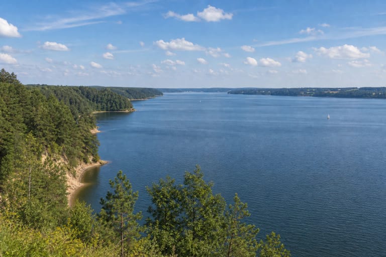
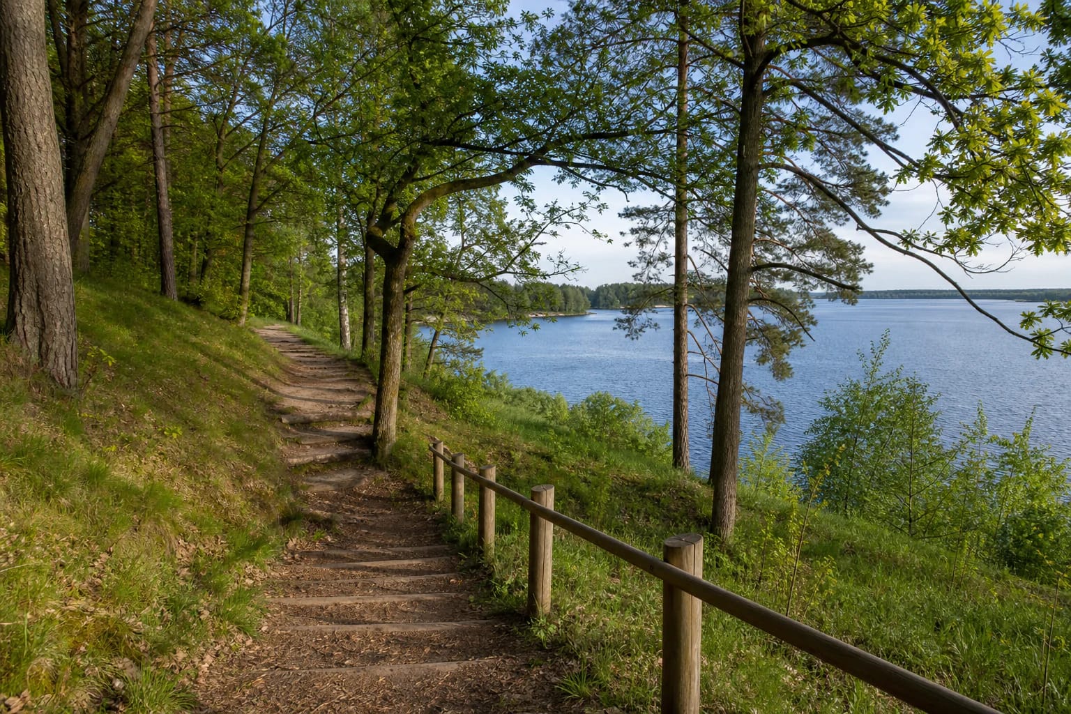
The trail winds along the Kaunas Lagoon, approaching the water in some places and climbing into woodland in others before opening a view from the slope. VLE's account of the regional park highlights high, steep-sided shores, exposures, and habitats of springs with forming tuffs. The experience is therefore a changing relief of water, forest, and slope, not one continuous beach line.
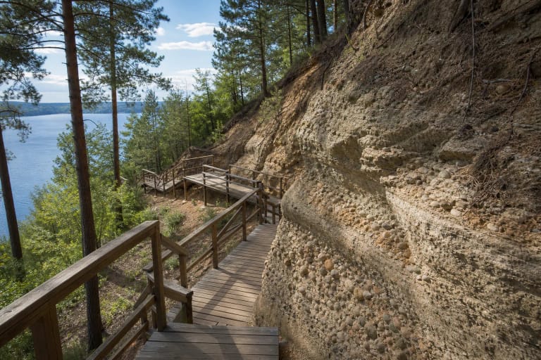
Some sections use natural ground, roots, forest litter, and hillside surfaces. Rain quickly changes grip, while paths near the water can depend on the lagoon level. If a shore section is flooded or badly worn, do not create a new route across the slope - use a marked branch and return safely.
Higher points open lagoon panoramas, but a viewpoint is not permission to stand on an exposure edge. Erosion and loose slope deposits are not railings. Keep children close near steeper sections, and do not step beyond a marked edge for a better photograph.
Tuffs are the trail's geological laboratory
The regional park description invites visitors to look for tuffs - sedimentary rocks forming in springs along the Pakalniškiai route. Their texture can resemble a peach stone, and the formations range from tiny grains to larger blocks. They are not decorative stones to take home but a natural feature of the spring environment.
Tuffs form slowly, so the trail rewards looking beyond the blue water. Spring-fed slopes, damp ground, small formations, and plants reveal the path of groundwater. Do not dig into slopes, pick at the formations, or walk through spring outlets, because this can damage the habitat.
The Vaišvydava shore with its springs and forming tuffs is part of the European Natura 2000 network. That status explains why the right pace is slow and careful: the trail is for understanding a protected landscape, not collecting samples from it.
Hillfort, dugout remains, and boards with hands-on tasks
Pakalniškiai Hillfort is the trail's final highlight and highest point. Its own page supplies the archaeological and panoramic context, while on this route the hillfort is also a clear landmark at one end of a one-way journey. The view from it makes most sense together with the lagoon landscape created after the Nemunas was dammed.
Along the way, visitors may find remains of a dugout dating from the First World War. It is a sign of local memory, not an invitation to enter unstable hollows or disturb the ground. Information boards and educational tasks help visitors notice details that a panorama alone would miss.
The official park description mentions ten pull-out arrows in its educational tasks, rest areas, and viewpoints. Small fixtures can be repaired or changed, so plan the outing around the whole landscape rather than one particular board or play element.
Trailheads, the visitor ticket, and a responsible return
From Girionys, the main trail board is at the car park by the college and stadium. From the Pakalniškiai Hillfort side, the official park page suggests the roadside beside the servitude road or the shopping-centre car park. These are practical landmarks, not a promise that every space will always be free. Never park on grass, a private road, or the forest floor.
The Kaunas Reservoir Regional Park page lists a one-euro single-visit visitor ticket as support for park maintenance and mentions buying it by SMS. Price and purchase details can be updated, so check the official information before travelling. The trail does not require a guided tour, although the park offers guides separately for groups.
There are no rubbish bins along the route; the park's request is simple: take away what you bring. Do not drive over the forest floor, collect tuffs, break plants, or create new shore paths. If weather worsens, turning back on a familiar section is safer than trying to shorten the route across a slope.