Kaunas City, Kaunas District, and Kaišiadorys District municipalities
Kaunas District
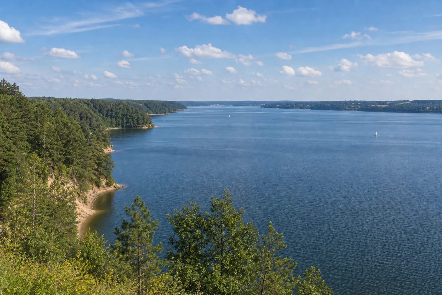
Lithuania's largest artificial body of water
Miškininkų g. 2, Vaišvydava, Kaunas district
54.84300, 24.04200
2-4 hours for one route, a full day with trails or a boat trip
May-October for trails, panoramas, and water routes
Kauno tvenkinys
Kauno Marios: Lithuania's Largest Artificial Body of Water
Kauno Marios is the largest artificial body of water in Lithuania. It is the reservoir of the Kaunas Algirdas Brazauskas Hydroelectric Power Plant in the Nemunas valley. VLE gives its area as 63.5 km², length about 80 km, maximum width up to 3.3 km, maximum depth 24.6 m (22 m by other data), and average depth 7.3 m; the very winding shoreline is about 200 km long.
This is not a lake in the usual sense. Kauno Marios appeared after the Nemunas was dammed, so its shores, 5 islands, outcrops, and bays are closely tied to the former river valley. VLE distinguishes three sections: in the lower part near the dam the water has flooded the whole valley and the reservoir is deepest, in the middle only part of the valley is flooded, and in the upper section the Nemunas flows almost in its old bed.
The Hydroelectric Plant and the Story of Flooded Settlements
VLE connects the creation of Kauno Marios with the construction of the Kaunas hydroelectric power plant: works began in 1955, the Nemunas was dammed in 1959, and the plant's units began operating in 1960.
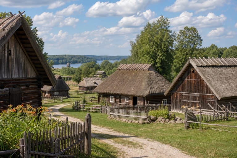
The project changed a large part of the Nemunas valley. VLE states that 45 settlements were relocated from flooded areas, including Rumšiškės, while Darsūniškis and Birštonas are protected from flooding by embankments, drainage canals, and pumping stations. Kauno Marios is therefore not only a recreation zone but also a dramatic example of landscape transformation.
The reservoir also has a clear engineering function: VLE notes that it holds back spring ice drift, protects Kaunas from floods, and regulates Nemunas runoff. On the right bank operates the Kruonis Pumped Storage Hydroelectric Plant, whose water level is 109.5 m above the reservoir.
Routes in Kauno Marios Regional Park
Kauno Marios Regional Park protects more than water. In the park context, Saugoma.lt highlights routes through outcrops, forests, shores, bird areas, and cultural sites.
Visitors often choose the Arlaviškės, Pakalniškiai, and Žiegždriai trails, viewpoints, rest areas, and water routes. A single day can feel very different depending on the plan: slope trail, boat, beach, or a historical story about the flooded valley.
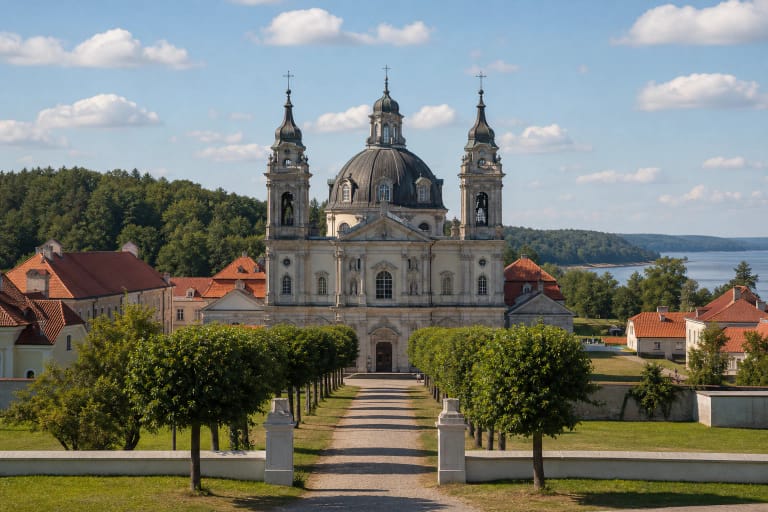
Kauno Marios by Pažaislis
On the Kaunas side, one of the most recognizable accents is the Pažaislis area. VLE mentions that the most visited beach is by the Pažaislis ensemble, so this place often becomes the first encounter between city residents and the reservoir.
If you want more nature, do not stop at the beach alone. Information from the regional park visitor center helps choose trails, viewpoints, and quieter shores.
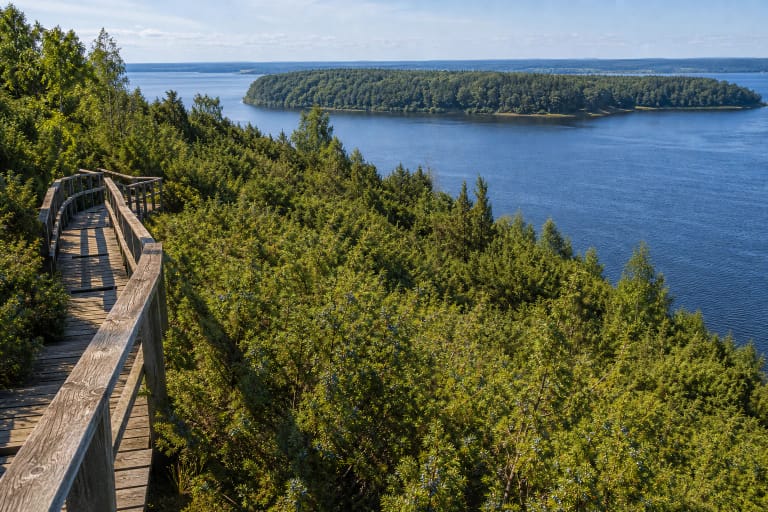
Shores and Outcrops of Kauno Marios
In places the shores of Kauno Marios are high, cut by erosion forms, and marked by outcrops. This gives the water body a scale that many visitors do not expect so close to Kaunas.
After rain or in winter, slopes may be slippery, so use installed trails and viewpoints. Unauthorised descent down outcrops is both dangerous and damaging to protected shores.
How to Plan a Trip to Kauno Marios
For a first visit, choose one side of the reservoir: the Vaišvydava and Pažaislis area, the Arlaviškės direction, or the Rumšiškės side. Trying to circle everything in one afternoon usually ends in rushing.
In summer, bring sun protection and water, and expect popular places to be crowded on weekends. For a calmer experience, choose morning, evening, or less-known regional park trails.