- Place
- Alytus District Municipality
- Region
- Dzūkija
- Type
- thermokarst lake in the Merkys basin
- Address
- Lake Niedulis, Alytus District
- Coordinates
- 54.39254, 24.35589
- Visit duration
- 30-90 minutes at a chosen lawful access point; a longer walk depends on the shore condition and route
- Best time
- a dry late spring, summer, or early autumn day; low shores can be wet after rain
Niedulis Lake, Lake Niedulis near Daugai, Niedulis
Lake Niedulis is near Daugai
Lake Niedulis lies in Alytus District Municipality, in the Dzūkija region, about 3.5 kilometres northeast of Daugai. It is a separate natural lake in a mosaic of fields, woodland, and smaller water bodies, not the name of Daugai's town beach.
The name deserves careful checking. Niedulis is not Niedus or Niedis in Lazdijai District, which lies in the southern part of Lake Veisiejo, and it is not Niedulė, the stream flowing out of this lake. The point on this page concerns the Alytus District lake near Daugai.
The VLE coordinate is a representative point for the whole lake, not a particular road, beach, or entry to the water. Before travelling, assess roads, property boundaries, and whether the chosen shore is actually lawfully accessible.
A thermokarst lake with an oval basin
Lake Niedulis is a thermokarst lake. Its basin formed when a buried block of glacial ice melted, giving it a different origin from the long glacial troughs that are also common in Dzūkija.
The lake covers 52.7 hectares, has an oval shape, and is about 0.9 kilometres across. Its surface elevation is 131.8 metres, the maximum depth is 7 metres, the average depth is 3.7 metres, and the catchment covers about 10 square kilometres.
A small area does not mean that every shore is equally easy to reach. Shallow margins, wet ground, and an uneven bottom matter when planning a walk, fishing, or any approach to the water.
Low and partly wet shores
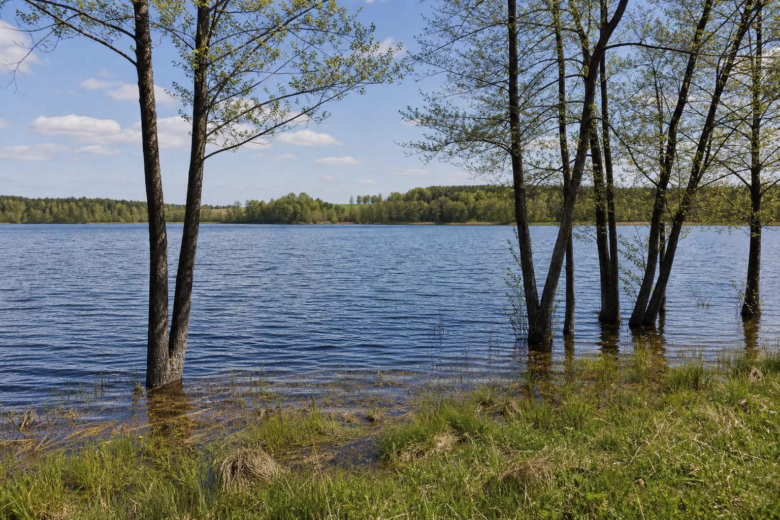
The shoreline of Lake Niedulis is winding. VLE gives its length as about 2.9 kilometres, and describes the shores as mostly low and wet. Woodland partly surrounds the western side, so the open water view changes into a more enclosed scene of trees and shallow water.
The littoral is narrow, about 20-60 metres, with its widest sections on the southwestern and northeastern shores. This can make a good photography setting, but after rain the ground may be wet, slippery, and difficult to cross.
Stay on firm ground near the water, do not damage grass or reeds, and do not drive a car to the shoreline. If a route turns into wetland or private land, turn back and look for another lawful access point.
The Niedulė carries water towards the Varėnė
The Abisdra and several other small streams flow into Lake Niedulis. The Niedulė flows out and is a right tributary of the Varėnė. The water route continues from this small lake into the wider Merkys system, so clean shores matter beyond this one site.
The official water-body basin list links Niedulis to water-body code 11040121, the Merkys sub-basin, and the Nemunas basin. Another official list identifies it as an Alytus District water body with inventory number 56-56 and an area of 52.7 hectares.
VLE gives the lake's throughflow as 142 percent. For visitors, this hydrological detail is a reminder that the lake is not a closed pond: water enters and leaves it, and pollutants can travel onward.
Lake Niedulis in the Daugai landscape
Lake Niedulis is close to Daugai, a town beside the larger Lake Didžiulis. Daugai adds a cultural and historical layer to the trip, with a church, old square, hillfort, and lakeside setting to explore.
Niedulis itself is not a town lake with a continuous promenade. Its value lies in a smaller-scale landscape of low shore, shallow water, woodland edge, and open ground. It rewards slow observation of the lake's form rather than a search for extensive facilities.
You can combine the trip with other Alytus District sites such as Lake Obelija, Alovė Outcrop, or Pivašiūnai Church. Check distances and actual access in advance because a straight line on a map does not always correspond to a public road.
How to visit responsibly
Allow 30 to 90 minutes for one chosen shore access and a short walk. A longer walk depends on the road surface, weather, wetness of the shore, and whether the route crosses private plots.
A dry late spring, summer, or early autumn day is usually more comfortable. In autumn, reflections and low light bring out the shore, but wet ground becomes harder to cross in cooler weather and after rain.
Park only where permitted, do not light fires on an improvised shore, do not launch onto an unfamiliar part of the lake, and take all rubbish with you. Keep dogs under control so they do not disturb wildlife or other people by the water.