- Place
- Zarasai District Municipality
- Region
- Aukštaitija
- Type
- lake and urban lakeshore landscape
- Address
- Zarasai, Zarasai District
- Coordinates
- 55.72957, 26.22246
- Visit duration
- 2-4 hours for the shore, observation circle, and Great Island; longer if you choose activities on the water
- Best time
- May to September during the day, when a shore walk can be combined with the island and town route
Zaraso ežeras, Zarasas
Lake Zarasas on Zarasai’s western edge
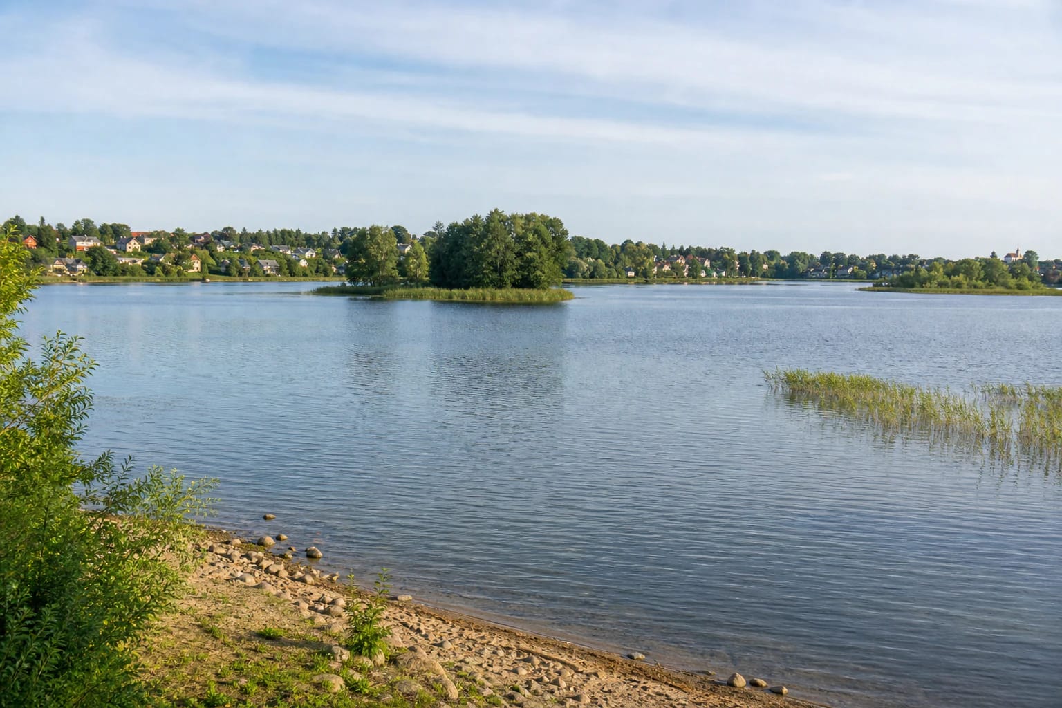
Lake Zarasas lies on the western edge of Zarasai and is one of the waters that defines the town’s landscape. From the town side, the view includes open water, an indented shore, bays, islands, and settlements on the opposite bank.
VLE describes the lake basin as the hollow left by a block of glacial ice. It is oval, covers about 323.4 hectares, extends 2.8 kilometres from north to south, and is up to 2.1 kilometres wide. Its maximum depth is 36.6 metres and its average depth 11.5 metres.
A lake of four islands
Lake Zarasas has four islands: Italijos, Putinų, Liepų, and Great Island. Great Island covers 39.43 hectares in the northern part of the lake and is connected to Zarasai by a bridge. It is therefore walkable from town rather than requiring a boat crossing.
Great Island is a separate, intensively used recreation and event landscape. The Zarasai tourism centre lists the town’s main beach, active-recreation areas, a children’s playground, and seasonal services there. Those facilities belong to the island, not to every part of the Lake Zarasas shore.
The shoreline is highly indented and measures 11.4 kilometres. Higher, steeper banks alternate with a gentler eastern shore, so the lake looks different from different points around town.
The shore, beach, and town walk
Several ways of visiting meet along Lake Zarasas: walk the town path, stop beside the water, look across the islands from the eastern shore, or cross the bridge to Great Island. The municipality’s public-space project lists renewed pedestrian and cycle paths, leisure areas, a beach and bathing site, children’s and sports areas, and a vehicle approach and turning area on the island grounds.
The lake’s largest beach is on Great Island, but this lake page is not the island beach’s timetable or price list. Seasonal cafés, events, water activities, and island rules can change, so check the relevant provider’s current page.
The Zarasai Observation Circle above the water
The 17-metre Zarasai Observation Circle was built on the eastern shore of Lake Zarasas in 2011. It is not a tower with one enclosed platform but a circular raised walkway where the islands and town shore form one panorama.
Treat the circle as a separate attraction rather than the single starting point for the whole lake. After the panorama, you can descend towards the Great Island shore path, but choose the distance, surface, and current conditions for your group and the weather.
Water connections and lake ecology
The Nikajus, Lazdinis, also called Aklė, and Petruniškė flow into Lake Zarasas, while a stream leaves it for Lake Zarasaitis. Lake Zarasas belongs to the Daugava basin, and VLE gives its annual water exchange as 124 percent.
The nearshore shelf is sandy or gravelly in places, but the lake bed is complex: sapropelic mud covers it, with many shallows and deeper hollows. Reeds and bulrushes grow in the bays. The calm appearance from shore is therefore not a reliable guide to depth when wading or boating.
Great Island is also a biodiversity site. The tourism centre mentions mature trees, the Red Data Book plant cross gentian, fire-bellied toads, and signs of rare beetles. Stay on paths and avoid damaging shore habitats.
Planning a swim and understanding the map point
Zarasai District Municipality’s 2024 environmental monitoring report includes the Lake Zarasas bathing site in its monitoring network. It says that on the listed May-to-September 2024 sampling dates, the bathing site’s microbiological indicators did not exceed the hygiene-standard limits then applied. This is a historical report, not a promise about today’s water quality.
Before swimming, check the latest municipal notices, weather, on-site signs, and the conditions at the particular beach you choose. Supervise children, avoid dense reed beds, and respect separated boating or event areas.
The 55.729572, 26.222458 coordinate on this page is VLE's representative point for Lake Zarasas, not a guaranteed single entrance, beach, or car park. Use the signs for the particular attraction you have chosen: the observation circle, island approach, and bathing site are not the same address.