- Place
- Bubiai Eldership, Šiauliai District Municipality
- Region
- Kurtuvėnai Regional Park
- Type
- a forest-surrounded lake in the Pageluvis Landscape Reserve
- Address
- Pageluvis Forest, Bubiai Eldership, Šiauliai District
- Coordinates
- 55.80230, 23.09821
- Visit duration
- 1.5-3 hours, depending on the Pageluvis lake-district loop you choose
- Best time
- a dry day from late spring to autumn, when woodland paths are less wet and the lake district's relief is easier to read
Barsukynas, Ežeras Barsukynas
Lake Barsukynas is one of the Pageluvis lake district's water bodies
Lake Barsukynas lies in Bubiai Eldership, Šiauliai District, within the Pageluvis Landscape Reserve of Kurtuvėnai Regional Park. VLE and protected-area descriptions place it among the remnant and thermokarst lakes of Pageluvis, separated by wooded hills. The important experience is not just open water but the relationship between the small lakes and the forested relief.
The lake covers 3.6 hectares and has about 0.8 kilometres of shoreline. The coordinate 55.8023045, 23.0982076 is a representative point in the woodland, not a car park or developed beach address. Save the trailhead as well as the lake pin before setting out.
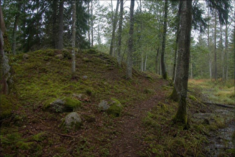
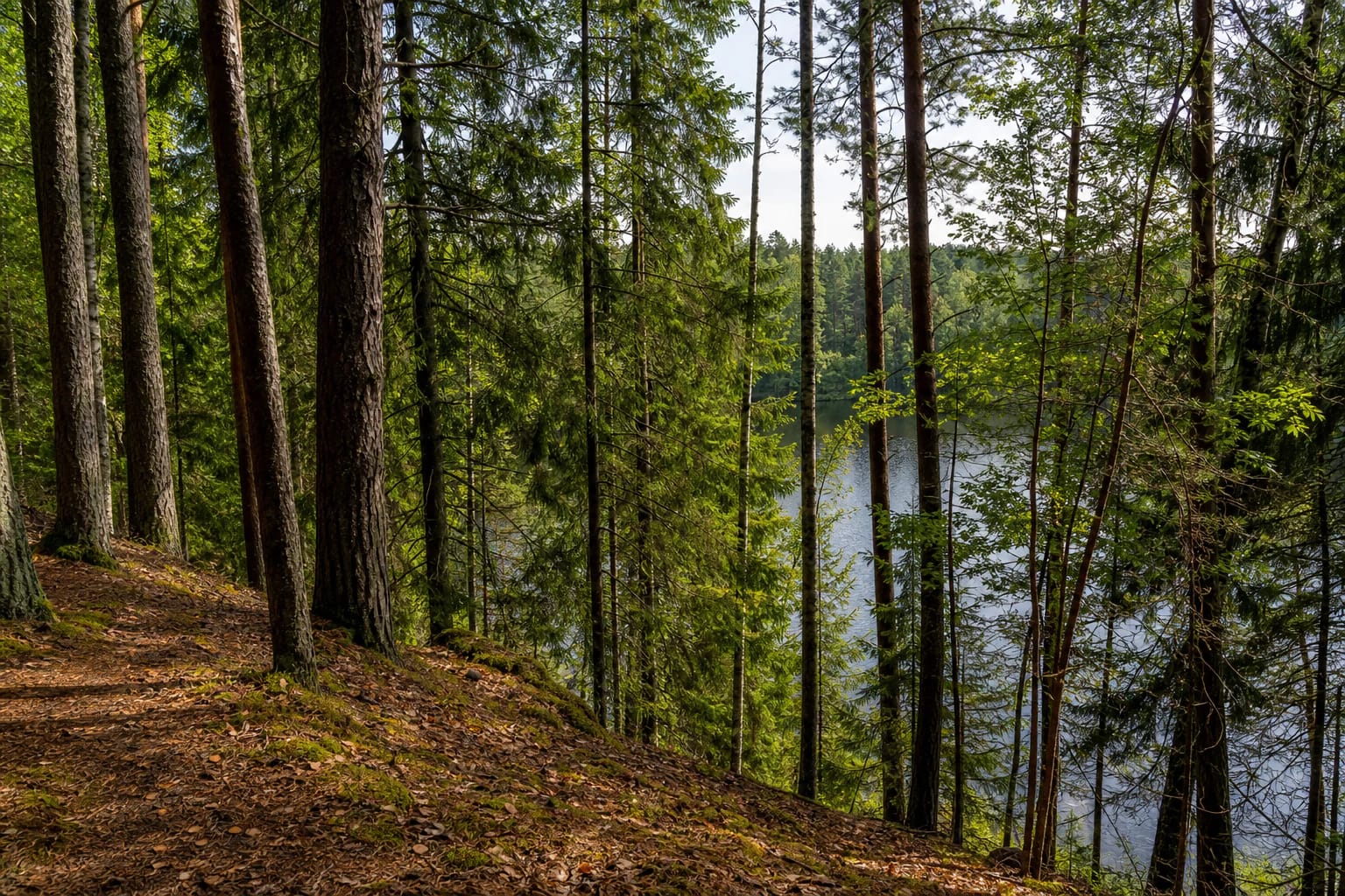
The landscape is restrained: small patches of water appear between dense spruce, pine, and deciduous trees, while needles, leaves, and uneven ground cover the forest floor. Barsukynas is better suited to slow lake-district exploration than to a stop beside a fully developed shore.
A partly boggy lake sits between the esker and neighbouring small lakes
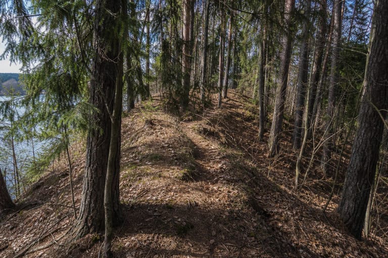
The Barsukynas esker curves around the northern part of the partly boggy lake. The esker and the lake are two different natural features: one is a ridge of glacial deposits, the other is a water body within the wider lake district. This distinction matters because Pageluvis I Hillfort belongs to the esker landscape, not to Lake Barsukynas itself.
The Pageluvis Landscape Reserve protects a lake-rich stretch containing Barsukynas, Geluva, Dubukas, Širva, Kurtuva, Bijotė, and other small lakes. The protected-area service describes the chain of around ten lakes as one of the park's important hydrographic values. The condition of the water bodies is tied to the protection of woodland, wetlands, and slopes.
A boggy shore may not offer a convenient route to the water. Stay on the marked path, do not disturb wet ground, and do not search through reeds for an unofficial access point that the official route does not identify.
The Barsukynas esker reveals a landscape shaped by the last ice age
VLE describes the Barsukynas esker as a narrow, elongated ridge covered by trees and shrubs. It is about 700 metres long and 100-230 metres wide, with an average relative height of about 16 metres and a maximum relative height of 23.4 metres. Some slopes are steeper than 15 degrees, so walkers need to watch their footing as well as the lake.
The esker formed at the end of the last ice age, roughly 12,000-10,000 years ago, as sand, gravel, and occasional boulders accumulated in a melting-glacier channel. Today forest covers the landform, and its shape is best understood by walking along the ridge and slopes rather than looking from one viewpoint.
Pageluvis I and Pageluvis II Hillforts were identified on the middle and eastern parts of the esker. This Lake Barsukynas page should not be used as hillfort navigation: the archaeological sites are separate places with a different visitor focus.
The practical approach is the Pageluvis lake-district trail
The Žemaitija Protected Areas Directorate lists the 3.1 km Pageluvis lake-district short trail, route 5-M, beginning at Lake Geluva beach at 55.79776, 23.103825. It passes Pageluvis I and II Hillforts, the Barsukynas esker, and the shores of Lakes Barsukynas and Dubukas, with an optional detour to the partly boggy Lake Niauka.
The 6.6 km long route, 5-D, begins at the same place. It continues past Lake Širva, the Zuikiškė Oak, Lake Kurtuva and its stream, and Lake Bijotė, with optional detours to Lake Juodežeris and Lake Niauka. Choose the loop according to daylight, ground conditions, and the time needed to return to the start.
The trailhead coordinate and the Lake Barsukynas coordinate mark different places. Drive to Lake Geluva beach as the route start, then reach the lake on foot using current signs and the park map. Waymarking in woodland can be renewed or changed, so check the official route page before travelling.
A natural shore calls for a quiet and careful visit
The official sources checked do not describe Lake Barsukynas as a separate developed bathing site, a serviced beach, or a place with a permanent lifeguard post. Do not infer bathing conditions from the fact that the lake is marked on a map. Follow signs on site and the current rules of the protected area.
Forest slopes, roots, needles, and wet leaves can become slippery after rain. Wear shoes with good grip, walk in daylight, and keep children close beside the water and boggy edges. Do not cut straight down the esker slope when the trail leads elsewhere.
Leave the car only in a lawful place near the chosen route start and keep forest roads clear. Do not light fires, pitch a tent, or drive to the water where park signs do not allow it. The place is most valuable when its natural ground cover and quiet lakeshore remain undisturbed.