- Place
- Kalvarija Eldership, Kalvarija Municipality
- Region
- Suvalkija
- Type
- a small lake beside Jurgežeriai village with a documented recreation-area context
- Address
- Jurgežeriai village, Kalvarija Eldership, Kalvarija Municipality
- Coordinates
- 54.42346, 23.16024
- Visit duration
- 45 minutes-1.5 hours; longer if you use the recreation-area setting or fish under current rules
- Best time
- a dry late-spring, summer, or early-autumn morning; grassy shores and approaches may be harder after rain
Lake Jurgežeriai, Jurgežeriai Lake near Kalvarija
Jurgežeriai Lake is not the same as Jurgežeriai Reservoir
Maps around Jurgežeriai name two separate water bodies: Jurgežeriai Lake and Jurgežeriai Reservoir. This page and the public card checked on 1 August 2026 concern Jurgežeriai Lake, not the similarly named reservoir. Check the selected map point before travelling so navigation does not take you to the wrong water body.
The coordinate supplied on this page is representative of the lake, not a promise of a public beach or car park. Assess water safety, lake quality, and the condition of any facilities through current official notices and on-site signs.
The public map point 54.42346, 23.16024 is a lake-centre reference. It is not labelled as a gate, car park, or exact entrance to the recreation area, so plan the last road section using local signs and lawful access.
A small, low, and quiet Suvalkija lake
A public water-body catalogue gives Jurgežeriai Lake an area of about 3.9 hectares and roughly 700 metres of shoreline. Those figures explain its scale: one stop can reveal much of the water, but visitors should not expect a long resort beach or a maintained trail around the whole lake.
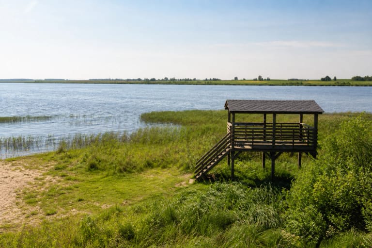
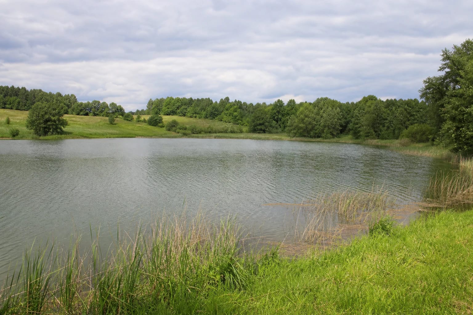
Place photographs show a small open basin with strips of reeds and grass, gently rising meadows, and a tree-covered horizon. The shore is not uniform: grass reaches the water in some places, while reeds or wetter ground take over elsewhere. Natural surfaces can be slippery after rain.
Jurgežeriai Lake lies in Kalvarija Municipality near Jurgežeriai, Kumečiai, and other small settlements. Its low, rural waterscape is closely tied to surrounding fields and Jurgežeriai Forest, with the gently sloping shore, meadows, and tree line defining its character.
The recreation-area history is documented, but its current services are not
Kalvarija Municipality's strategic development plan says that Lake Orija, Jurgežeriai Lake, and the Šešupė dam are becoming recreational-tourism attractions. The same document mentions a recreation area beside Jurgežeriai Lake. This is useful municipal planning context, but an older strategy is not a current service catalogue.
In 2024 the municipality announced that children's and young people's summer holidays were organised at VšĮ Gintaras Recreation Area, Ežero Street 2, Jurgežeriai village. This confirms a named stationary camp site and its use during that period, but it does not promise that the camp or its facilities are freely open to every lake visitor.
The page therefore separates three things: the water body itself, the recreation area named in municipal documents, and services offered by a camp or private operator. If you want to use land associated with the camp or an operator, check permission, hours, and rules in advance.
Access begins with reading the map carefully
Because the point is a centroid rather than an entrance, do not plan the journey only by distance from Kalvarija. Check that navigation uses a public road to the chosen access point instead of ending in a field, a forest track, or camp grounds. Road conditions can change with season and weather.
Park only where signs or a lawful marked space permit it. Do not drive across grassy shores, block residents' roads, or climb over fences. If the approach crosses a recreation-area property, follow the operator's directions even when the lake itself appears public.
The visit is more like a quiet waterside stop than an interpretive trail with a sequence of boards. Bring suitable footwear, allow time to explore the shore, and do not judge the place by whether it has every comfort of a resort beach.
Fishing and lakeside recreation need current rules
Local water-body data associate Jurgežeriai Lake with recreational fishing, and public descriptions name the angling club Orija. Treat this as orientation, not automatic permission to fish: before travelling, check who manages fishing, which permit is required, and which conditions apply that day.
The municipal sources checked do not publish a public Jurgežeriai Lake ticket desk, general admission fee, or opening hours. That does not mean every shore is accessible at any time. Respect private land, camp grounds, angling infrastructure, and temporary restrictions.
For swimming, choose only a clearly suitable place, assess depth and the lake bed, and supervise children closely. A shore photograph cannot prove that the water has been tested or that bathing is safe on a particular day.