- Place
- Kampiniai, Kalvarija eldership, Kalvarija Municipality
- Region
- Suvalkija
- Type
- the hillfort component of a nationally significant archaeological complex with a settlement at its foot
- Address
- Kampiniai village, Kalvarija eldership, Kalvarija Municipality
- Coordinates
- 54.44737, 23.19824
- Visit duration
- 20-40 minutes to read the hillfort relief from a lawful public position, excluding the approach
- Best time
- a dry day in spring or early autumn, when low vegetation leaves the flattened enclosure visible and there is no reason to cross growing crops
Kampinių piliakalnis, Apšutkalnis, Kampiniai Hillfort with Settlement
The exact pin marks the archaeological site, not an entrance
Kampiniai Hillfort is in Kampiniai village, Kalvarija eldership, within Kalvarija Municipality. This is the administrative location recorded by the Cultural Heritage Register, even though Google Maps may incorrectly place the listing in Marijampolė Municipality. The exact site coordinates are 54.4473681, 23.1982411. The pin falls on the archaeological monument and does not identify a car park, entrance, or lawful trailhead.
On 15 July 2026, the exact Google Maps listing was named Kampiniu piliakalnis, carried place ID ChIJp9WWdQAn4UYRWaf9TaIrbks, and averaged 5.0 out of 5. The average came from a single review. It clears the project's 4.5 selection threshold, but it is not a robust measure of long-term visitor opinion: one new rating could change it sharply.
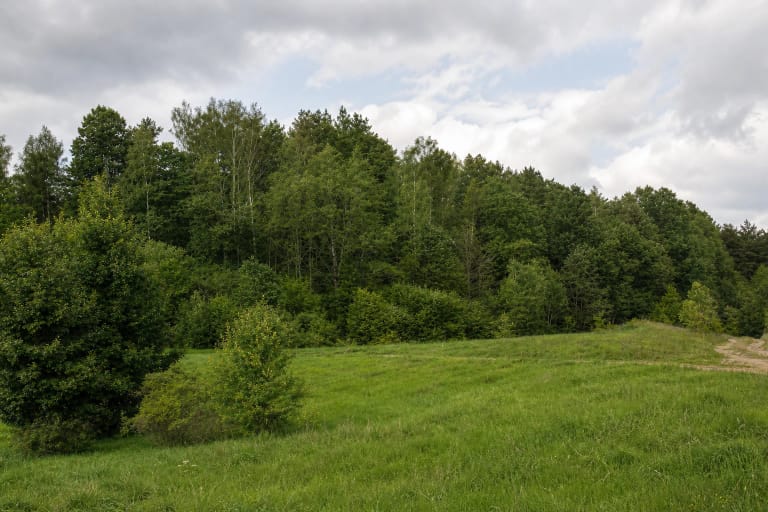
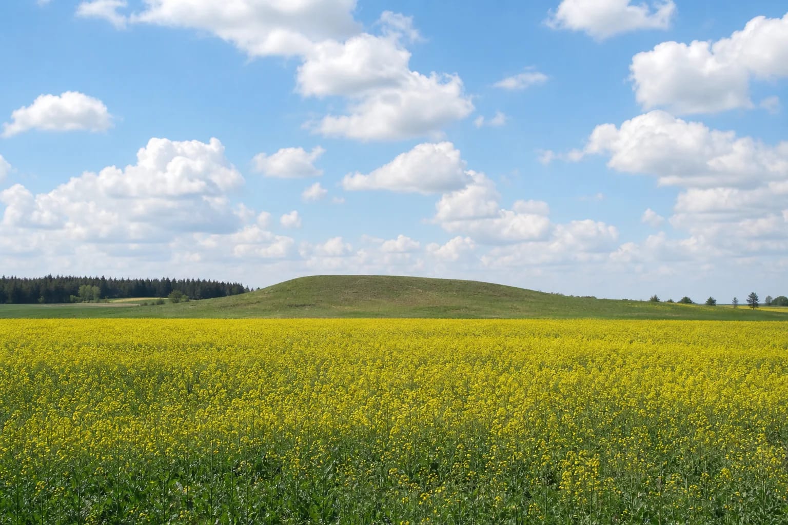
Current photographs show neither a tall wooded hill nor a reconstructed fort. They show a low grassy ridge that barely rises above the fields, with a broad flattened top, level cultivated land around it, and bands of trees in the distance. The photographs do not establish the presence of a path, steps, information panel, benches, or any other visitor infrastructure.
Earthworks altered a 50 by 20 metre enclosure and slopes up to 11 metres
The register describes the hillfort as an isolated rise amid fields that were once wet and were later drained. Its oval enclosure runs east-west and measures about 50 metres by 20 metres. The southern and southeastern parts stand higher. Most slopes are steep and reach up to 11 metres, while the northern slope is gentler. A drainage channel lies to the west.
This is not an untouched landform. The register records damage from long-term ploughing and drainage, pits dug into the summit, and bulldozing of the northern part of the enclosure and its slope. Visitors should not expect a regular bank, ditch, or sharply raised defensive terrace. The significant feature today is the hill's low overall silhouette and its position within what was formerly wet ground.
Most of the hillfort is now fallow and covered in grass, while cultivated ground remains close to the southern foot. A grassy appearance does not give permission to cross the monument from any direction. Its archaeological relief must be protected, and the surrounding crops and private service drives are not visitor paths.
Complex 21066 comprises hillfort 17321 and settlement 17322
The Cultural Heritage Register names the protected site Kampiniai Hillfort with Settlement and assigns it code 21066. It consists of the hillfort called Apšutkalnis, component 17321, and settlement 17322 at its foot. This is a state-protected archaeological and landscape complex of national significance, dated to the second half of the first millennium CE.
The registered territory of the entire complex now covers 35,258 square metres, or about 3.53 hectares, and its visual protection subzone covers 296,226 square metres. These figures must not be presented as the area of the settlement alone. Different areas in older publications belong to earlier documentation, so this page uses the current register figure for the whole complex.
Settlement evidence was documented on low rises at the northeastern and southeastern feet of the hillfort. The register records a dark, damp cultural deposit up to 0.4 metres deep, with daub, burnt stones, and archaeological finds. This component is not visible as a separate village or interpreted display, and ploughing and drainage have also disturbed its surface.
The 1994 investigation separated an empty summit sample from finds at the foot
In 1994, archaeologist Povilas Tebelškis opened sixteen test pits measuring 1 by 1 metre across the hillfort and its foot, a total excavated area of 16 square metres. Pits 1 to 6 were on the southern part of the enclosure. The published investigation summary reports no cultural deposit or archaeological finds in them. Finds from the foot therefore cannot be transferred to the summit, and the excavation did not document building remains there.
The results at the foot were different. In pits 7 and 8 at the southeastern foot and pit 11 at the northeastern foot, a 25-40 centimetre dark, damp layer began 25-45 centimetres below the surface. It contained stones, fired daub, and handmade pottery. Some sherds had abundant crushed-granite temper and an uneven surface; others were made from more homogeneous clay and had a smoothed surface.
This material dated the settlement at the foot to the second half of the first millennium CE, but the investigated area was small. It demonstrates surviving deposits in specific places, not a plan of buildings across the hill. Digging, collecting sherds, using a metal detector, or otherwise disturbing the soil is prohibited.
The name Apšutkalnis, a stone projectile, and a Midsummer recollection
Apšutkalnis is the traditional name included in the official title of the hillfort component. It identifies the same place, not a second hillfort. Archival material mentioned the site by at least 1935, archaeologists inspected it in 1989, and temporary registration and investigation in 1994 were connected with the planned restitution of land. These are documented stages in heritage administration, not a date for the hillfort's first use.
In the autumn of 1991, while a pond was being dug south of the hill, J. Čiuplys found a stone projectile about 9.5 centimetres in diameter in displaced soil. The published report identifies it as a projectile, but a find from disturbed ground is not as precise as evidence recovered from an intact excavation layer. Its original position, period, and use cannot be securely established from those circumstances.
The 1994 researchers also recorded local testimony that the top had been levelled and that Midsummer bonfires had long been lit on it. This is valuable evidence of local memory, not proof of prehistoric ritual or an unbroken ancient tradition. The present flattening of the hill should first be understood through the ploughing and earthmoving documented by the register.
Plan the visit from local roads, never from the A5 highway
The official sources checked do not publish a verified final approach, car park, path, steps, information panel, toilet, or other visitor infrastructure. A round-the-clock schedule displayed on Google Maps is not an official opening time, and the sources likewise do not confirm an admission charge or a policy of free access. The map pin identifies the hillfort itself and must not be interpreted as an instruction to drive to the summit.
Approach the area only by local connector roads and obey current traffic, property, and access signs. Never stop on the A5 carriageway or shoulder, walk across the highway, or try to reach the hill directly from it. Leave a vehicle only where parking is lawful and where it will not block farm machinery or residential access. A field track is not automatically a public road or permission to drive.
If a signed and permitted pedestrian route exists on the day of your visit, stay on it. If there is no such route or signs restrict entry, observe the hillfort from a lawful point on a public road. Do not cross crops, climb fences, or use a private drive without permission. Dry weather, daylight, and binoculars make it easier to read the low silhouette even when the enclosure cannot lawfully be approached.