- Place
- Elektrėnai Municipality
- Region
- Neris Regional Park
- Type
- inhabited street-and-strip village in Kulis (Grabijolai) Landscape Reserve
- Address
- Grabijolai, Kazokiškės Eldership, Elektrėnai Municipality
- Coordinates
- 54.83925, 24.86878
- Visit duration
- 45-90 minutes for the village itself; allow longer only for a separate walk in the surrounding valley
- Best time
- in dry weather and daylight, ideally on a weekday or a quiet spring or autumn morning
Grabijolai, Grabijolai ethnographic village, Grabijolai street-and-strip village
A living settlement rather than an open-air museum
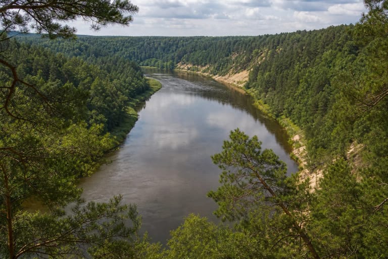
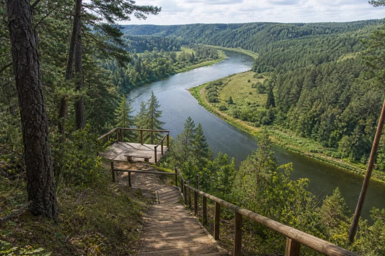
The Grabijolai visited by travellers stands on the left bank of the Neris in Kazokiškės Eldership, Elektrėnai Municipality. A separate village with the same name lies opposite in Dūkštai Eldership, Vilnius District. There is no bridge here, so apparent proximity on a map does not create a direct crossing or drive between the two banks.
VLE records 14 residents in the 2021 census, while the protected-areas authority wrote in 2024 of roughly ten permanent residents and 25 homesteads, many used mainly in summer. Those figures are dated, but their meaning is important: Grabijolai is not an abandoned stage set. People live here, tend gardens, work and rest.
The village lane and signed park facilities are public; residents' yards, porches and interiors are not. The phrase 'living museum' is useful only as an image, not as a legal identity or access rule. Photograph from the public lane, do not pass through gates without invitation, and avoid aiming cameras into windows.
The village is not a KVR locality, but its landscape has legal protection
Lithuania's State Commission for Cultural Heritage explicitly states that the ethnographic village of Grabijolai in Elektrėnai Municipality is not entered in the Cultural Heritage Register. The village therefore has no collective KVR code, registered status, KVR valuable-properties act or separate KVR locality boundary. Surviving timber buildings and a traditional plan do not make it a state-protected KVR village.
Protection operates through a different instrument. Government Resolution No. 731 of 11 July 2016 defines the purpose of Kulis (Grabijolai) Landscape Reserve as conserving the wooded, ravine-cut Neris valley, Grabijolai and land belonging to it on both sides of the river, and the village plan. The exact reserve boundary is mapped in the resolution's annexes; it is not simply the public lane or the edges of private yards.
Individual KVR sites within the valley retain their own territories. For example, the nationally significant Grabijolai ancient settlement, KVR 44521, protects a third-to-seventh-century archaeological layer on a Neris terrace. It demonstrates early occupation in the locality, but it neither turns the present village into one archaeological property nor moves its documented beginning into the third century.
Read the settlement plan instead of hunting for one famous house
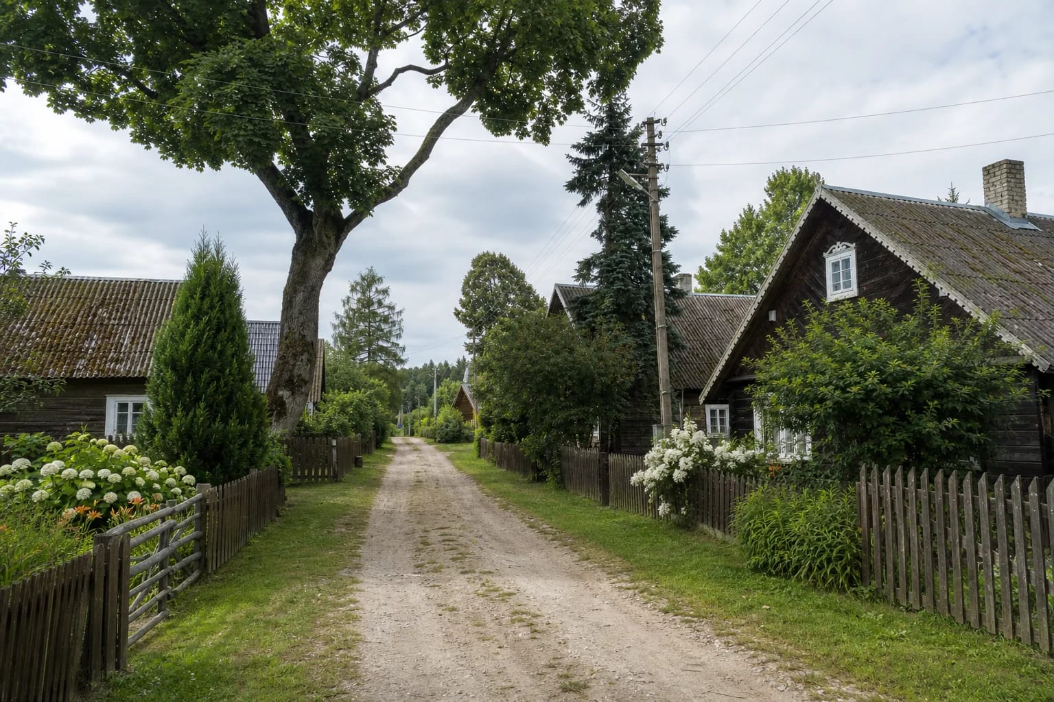
Grabijolai makes sense while walking its only lane, locally called Neries kelias, or Neris Road. Homesteads stand compactly on both sides, with long narrow property and field strips running perpendicular to the street. Dwellings generally present a gable end to the lane and farm buildings continue farther back, so the village structure remains legible without entering a private yard.
This is the street-and-strip village type that became widespread in Lithuania after the sixteenth-century Volok Reform. Typology is not a founding certificate: it does not prove that named Grabijolai was established during the reform itself. What survives is an historically evolved planning logic rather than a scene frozen in one precisely dated year.
Old timber buildings, carved window surrounds, low wooden fences and traditional flower gardens survive along the lane. Yet this remains a changing domestic environment with roofs, additions and repaired details of different dates. It is more honest to value the overall scale and homestead rhythm than to label every visible feature an untouched eighteenth or nineteenth-century relic.
The documented village story begins in 1795
Grabijolai first appears in written sources in 1795 as a nine-homestead village belonging to the Zapalina folwark. Homesteads multiplied as families settled beside one another, narrowing the plots perpendicular to the street and encouraging houses to face it gable-first. The village marked 230 years from that earliest known mention in 2025.
The Neris separated the settlement but also connected it. A ferry crossing operated here and a timber bridge once spanned the river; VLE says it burned at the beginning of the First World War. Those links help explain why the village's historic land story reaches both banks, although today's visitor must drive around the river.
Between the world wars, the Lithuanian-Polish demarcation line followed the middle of the Neris here. A Lithuanian border-police post operated in the Elektrėnai-side village, while the opposite bank belonged to the Polish-administered Vilnius region. The peaceful river view therefore holds a former state frontier as well as an everyday village history.
The three brothers belong to oral memory, not a founding charter
Local tradition says the village began with three brothers who received land here. A timber sculpture installed in 2015 for the 220th anniversary represents one blacksmith and two carpenters. It matters as an expression of community memory, but VLE clearly attributes the origin story to local residents.
The popular claim that the name Grabijolai derives from the Lithuanian word grabas, meaning coffin, needs the same caution. The official and encyclopedic sources reviewed for this page do not establish one uncontested linguistic origin. It can be repeated as a local interpretation, not presented as settled etymology.
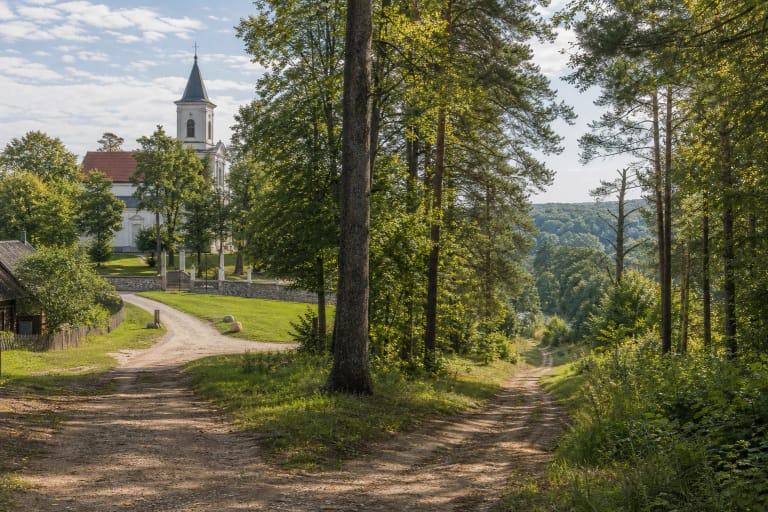
Ancient settlements, burial mounds, hillforts and story-laden hills and stones surround the village. Together they show the extraordinary time depth of the Neris valley, but their evidence should not be collapsed into one timeline. A third-to-seventh-century archaeological layer, the named village's 1795 record and a later oral tale of three brothers answer different historical questions.
Leave the car at the village entrance and continue on foot
The pin at 54.839246, 24.868779 marks the visitor parking point shown on the park's official route map at the beginning of the village, not its centre or a private home. The protected-areas authority asks visitors not to drive along the narrow lane because intensive traffic disturbs residents and damages the old stone pavement. Walk into the settlement from the car park.
There is no entrance gate, ticket office or museum timetable for the inhabited village, so no admission is sold for walking the public lane. That does not mean unlimited access. Follow park signs, keep out of private fields and yards, make fires only where explicitly permitted, do not sit on residents' fences, and carry rubbish away.
The lane and surviving old pavement are uneven in places, and official sources do not advertise the complete village walk as fully wheelchair accessible. Judge conditions against the weather and individual needs; in dry conditions, the first street view can be experienced from the approach near the car park. Do not assume toilets, an accessible parking bay or other facilities without checking them first.