- Place
- Grabijolai, Kazokiškės Eldership, Elektrėnai Municipality
- Region
- Neris Regional Park
- Type
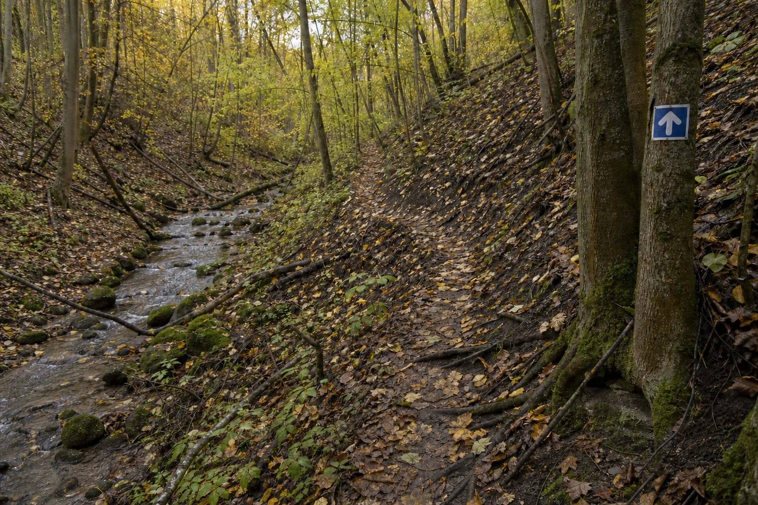
- a marked, approximately 4 km out-and-back wild walking trail in Neris Regional Park
- Address
- Grabijolai Nature Trail car park at the beginning of the village's only street, Grabijolai
- Coordinates
- 54.83925, 24.86878
- Visit duration
- about 2 hours in the official description; allow 2-3 hours with stops or on wet ground
- Best time
- dry weather from late spring to autumn, in daylight; slopes and ravines can become slippery after rain or during a thaw
Grabijolų pažintinis takas, Grabijolai hiking trail, Grabijolai walking trail
Start at the village street, not at Saugoma.lt's map point
Use 54.8392458, 24.8687786 for navigation. Neris Regional Park links this point to Grabijolai hiking trail, while the present protected-areas directorate states that the trail car park is at the beginning of the village's only street. The pin therefore represents the entrance and parking-start zone, not the centre of a particular painted bay.
Saugoma.lt displays a different coordinate, 54.843999970895, 24.862114986799. It lies farther along the route area and is useful for placing the attraction on a regional map, but the official text does not identify it as a car park. Do not attempt to drive there on field tracks: leave the car at the designated area by the beginning of the village street and continue on foot.
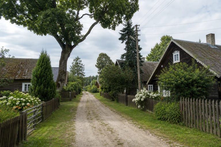
Grabijolai is an inhabited village, not an open-air museum. Do not drive farther along its narrow street in search of a supposedly closer trailhead, block entrances, or mount the edge of the old paving. There is no bridge over the Neris at Grabijolai, so approach from Kazokiškės in Elektrėnai Municipality rather than following a road visible on the opposite bank.
Four kilometres is the complete walk to the oak and back
The official figure of approximately 4 km covers the complete out-and-back walk, not 4 km in one direction. The trail begins in Grabijolai, reaches Alkai Oak after roughly half the distance, turns there, and returns to the village almost the same way. It is not a loop, so there is no need to budget for 8 km or search for a second finish.
Direction arrows mark the entire route; the park's English description specifies white arrows on blue backgrounds. Because the return follows almost the same line, note junctions and the reverse direction of markers on the outward walk. Grass, leaf fall, or storm debris may temporarily obscure the trodden line, so save the official route page or an offline map before setting off.
The park gives a duration of about two hours. That is realistic in dry conditions without long stops, but photography, reading panels, or cautious descents after rain can extend the visit to two or three hours. Start early enough to return in daylight, as the wooded ravines are unlit.
Wild describes the surface, not a marketing theme
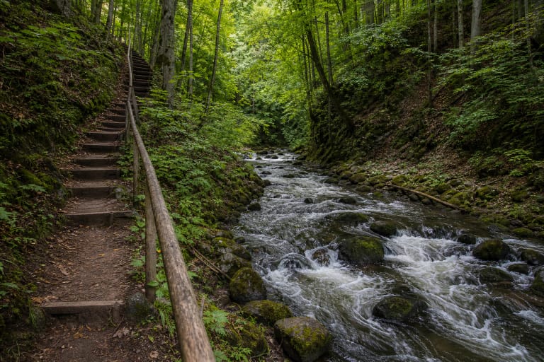
There are no timber stairs, gravel paths, or continuous comfortable surface. The trodden route crosses meadows, field margins, former village tracks, steep slopes, and deep ravines. Around the Sweet Stream, expect damp earth, stones, roots, and uneven ground concealed by leaves; after heavy rain or a thaw it can become slippery as well as muddy.
Wear sturdy water-resistant footwear with a slip-resistant sole. Long trousers are useful through tall grass, while walking poles and spare socks can help after rain. Snow or ice may hide the trail edge in winter, and dense summer growth can make markers harder to read; daylight after several dry days is the safest choice.
The narrow natural surface, steep slopes, and ravines make the complete route unsuitable for wheelchairs and pushchairs. It is officially described as a walking trail and is impractical for a bicycle, although that is not a claim of a published legal ban. For children, assess the uneven ground rather than distance alone: it suits only those who can walk securely on rough terrain under continuous adult supervision.
From the Sweet Stream to the park's thickest oak
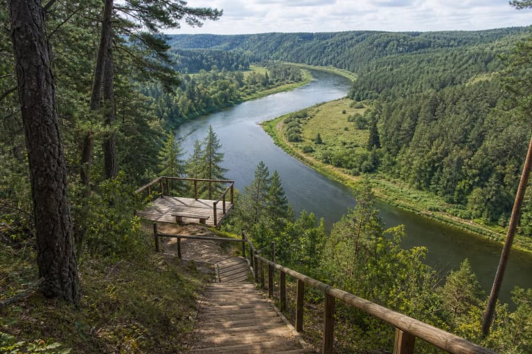
The first named natural feature is the Ilgoja rivulet, locally called Saldusis, or the Sweet Stream. Official photographs show a modest stony flow in a wooded ravine, not a waterfall or constructed promenade. The route continues through Alkos, also called Uolkos, Hills, where slopes and deeply cut gullies give the Neris valley unusually pronounced relief for Lithuania.
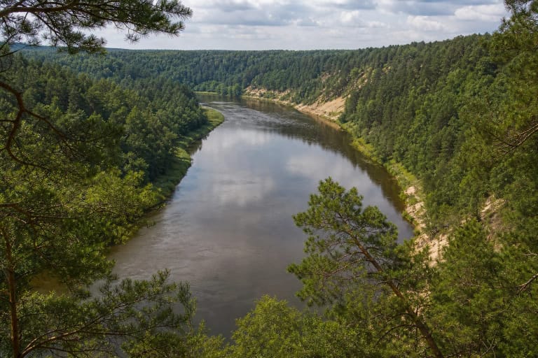
Cultural traces include the foundations of the former Zapalina manor site on a high river slope and Paalkiai Hillfort. Both have been reclaimed by vegetation, so do not expect a restored manor or an open castle panorama. The trail also approaches a section of the Neris associated with mythological stones, but neither the rocky river nor its banks justify leaving the marked line by a hazardous shortcut.
Alkai Oak is the turning point of the standard route. A 2025 directorate account calls it the thickest oak in Neris Regional Park and records a circumference of 5.12 m. The Sweet and Salty streams both belong to the wider Grabijolai landscape, but the official 4 km trail description explicitly names the Sweet Stream as a waypoint; do not assume an extra branch to the Salty Stream is part of the standard route.
The route starts in a village but does not grant access to yards
The trail genuinely begins in the ethnographic village of Grabijolai before moving into meadows, field margins, and former rural tracks. It is not a four-kilometre architectural circuit through the settlement. Allow separate time to walk quietly along the single public street, and never treat gates, yards, gardens, or verandas as extensions of the path.
The park states that the route crosses both state-owned and private land. Follow the arrows, do not climb fences, cut through crops, or ignore new signs and barriers. Where a marker follows the edge of a field, it permits passage on that line rather than roaming across the whole parcel.
Campfires are forbidden along the route, and all rubbish must be carried out. Quiet behaviour matters to the small Grabijolai community as well as wildlife: keep the narrow street clear, avoid loud gatherings, and do not photograph through the windows of occupied houses.
Admission, facilities, and changing trail conditions
The official route descriptions checked on 19 July 2026 published no compulsory admission charge, ticket office, gate, or set opening hours. Nor do they promise toilets, drinking water, bins, or rest infrastructure throughout the route. Treat it as an open protected-area walking trail and carry water, a charged phone, and everything needed for several hours.
On the same date, the official Saugoma.lt object page remained published and the checked pages displayed no closure notice. That is not a live engineering inspection: heavy rain, storms, fallen trees, mowing, or temporary restrictions on private land can alter passage. Recheck current Saugoma.lt and directorate notices before travelling, and always obey barriers on site.
If markers have disappeared, a slope has washed out, or dangerous windfall blocks the way, do not improvise a diversion across private property. Turning back is the appropriate response. The trail's value lies in its minimally developed landscape, which is precisely why plans must remain flexible.