- Place
- Meteliai Eldership, Lazdijai District Municipality
- Region
- Dzūkija
- Type
- a circular forest and wetland nature trail between Lakes Dusia and Metelys
- Address
- 2 Seirijų Street, Meteliai, Lazdijai District
- Coordinates
- 54.28400, 23.74100
- Visit duration
- 1.5-2 hours for the main loop with stops; the shorter 2.9 km branch takes less time
- Best time
- late spring to autumn; spring and autumn are good for migratory waterbirds, but wet weather calls for careful footing
Bijotai Nature Trail, Bijotai-Širvintas Forest Trail, Pedestrian trail through the Bijotai-Širvintas forests
The trail begins at the Meteliai visitor centre
The Bijotai-Širvintas Forest Nature Trail begins and ends at the Meteliai Regional Park visitor centre, near the swings. The Saugoma.lt object card gives the official trailhead coordinate as 54.284, 23.741.
This is a circular route of about 3.5 kilometres between Lakes Dusia and Metelys. It is not simply a straight forest road: it follows the narrowest sandy land between two large lakes and crosses several different landscape terraces.
Cars can be left in the asphalt parking area by the visitor centre, but that facility is the trailhead infrastructure, not an invitation to drive deeper into the forest. Check park notices before travelling and keep cars off the walking trail.
A sandy inter-lake corridor with hummocks and wetlands
In Bijotai Forest, the trail passes ridges of sandy hummocks formed on a higher lake terrace. Small disappearing ponds and wetlands between them show how water and sand continue to reshape one inter-lake landscape.
The lower Metelys terraces open into the semi-natural Kemsinė Meadow, wetter broadleaf woodland, and an intermediate wetland. This variety is the trail's main attraction: within a few kilometres, the habitat changes through its moisture, soil, and vegetation rather than through decorative installations.
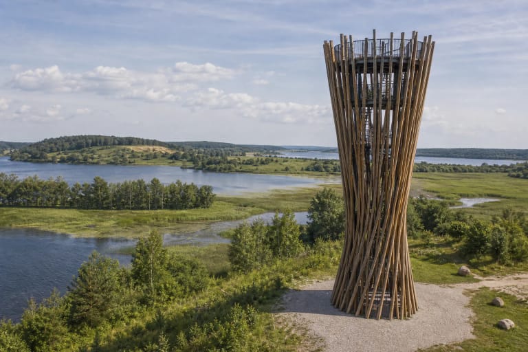
On the Lake Dusia side, the route gives a view towards the large open water. Migratory waterbirds can be seen in spring and autumn, but do not disturb them or leave the trail for sensitive shore areas.
Forest diversity in a short loop
The official description mentions dry pine forest with juniper, a group of old oaks, hornbeam woodland, and wet black alder forest. These are not one uniform woodland, so notice how tree species and undergrowth change as the trail rises from wet ground onto drier sandy sections.
Širvintas Forest includes a key forest habitat where no forestry activity is carried out. Fallen trees and deadwood are left to decay because they support fungi, insects, birds, and natural forest renewal. A tidier-looking forest would not be a healthier forest here.
Hornbeams that are distinctive in southern Lithuania also grow in the trail surroundings. Do not pick plants, break branches, or collect deadwood for a fire: material that looks like a spare branch is part of the habitat.
Wet ground and boardwalks
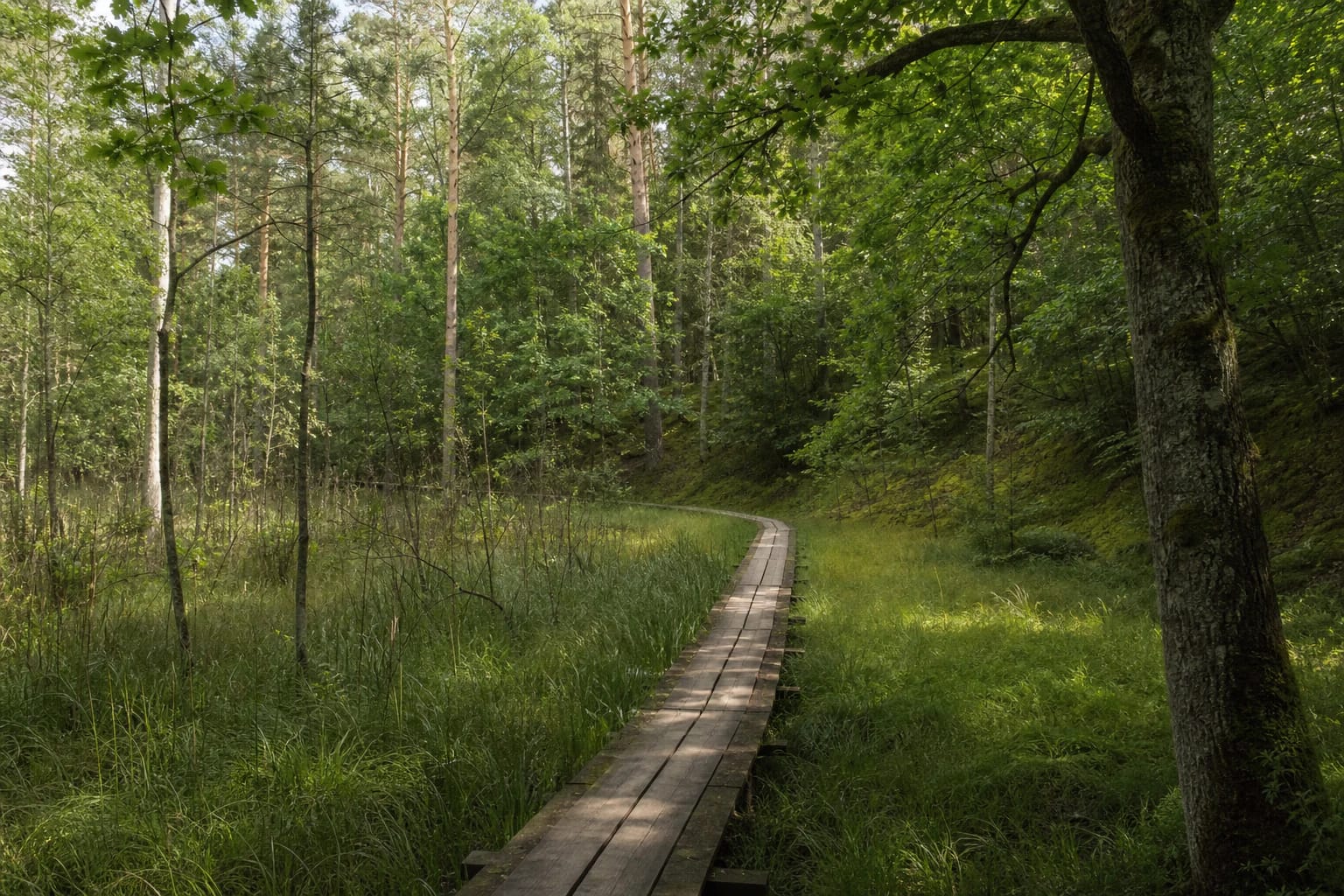
The intermediate wetland supports bog bean, marsh calla, common cranberry, and round-leaved sundew. Wet ground is not an optional extra that can be crossed in any direction, so stay on the built passage and do not widen the worn route.
Lazdijai Tourism Information describes a natural sand-and-soil surface and a floating plastic boardwalk through the wetland. After rain, thaw, or strong wind, boards may be slippery and the forest path soft. Wear shoes with good grip.
Saugoma.lt states that the trail is not adapted for people with mobility disabilities. This is practical access information: natural ground, wet areas, and uneven boards mean that each group should assess its own ability before setting out.
Markings and route options
The trail is marked with green and white stripes on tree trunks, and information boards stand at the more interesting points. Walking clockwise is recommended so that the wetter sections and interpretation stops follow the route's natural story.
The main loop takes about 1 hour 15 minutes without long photography or nature-watching stops. About 350 metres from the start, the route forks; choosing the right branch gives a shorter option of about 2.9 kilometres.
The regional park directorate can arrange guided visits and educational activities, but these need to be booked in advance. On a self-guided walk, bring water, keep your phone charged, and do not assume that a short route needs no planning.
The Širvintas oaks and responsible visiting
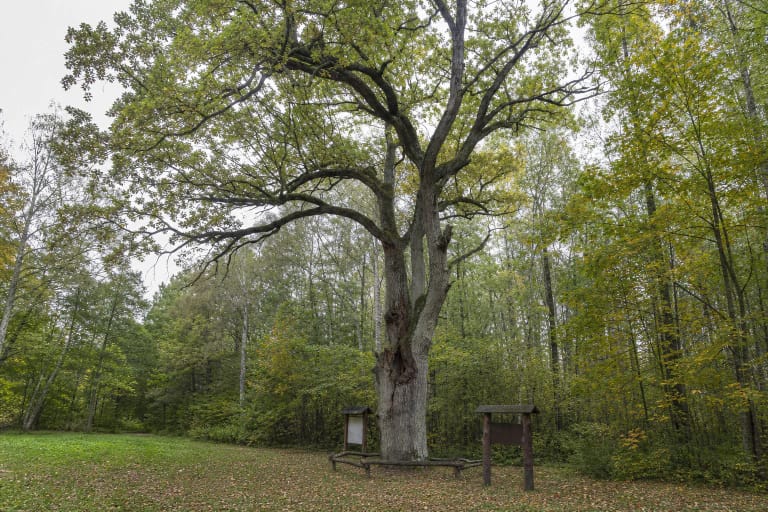
The trail connects with two separate veteran trees in Širvintas Forest: the Great and Hollow Širvintas Oaks are listed about 0.8 and 1 kilometre from the trailhead. They can be visited as separate stops, but the oak pages and the forest trail are not one single object.
Do not climb over the root zones of protected trees, touch fragile trunk sections, or drive across the forest floor. Apply the same rule throughout the route: do not light fires, leave rubbish, let dogs roam, or damage the edge of the wetland.
The best pace here is slow. Stop at the information boards, watch insects and birds, and give waterbirds space in spring and autumn. The trail's nature is preserved by how little a visitor changes it.