- Place
- Verkiai eldership, Vilnius City Municipality
- Region
- Vilnius
- Type
- a glacial tunnel-valley lake in Verkiai Regional Park with public recreation areas
- Address
- Žaliųjų Ežerų Street, Verkiai Regional Park, Vilnius
- Coordinates
- 54.79062, 25.32573
- Visit duration
- 2-4 hours for the lakeshore, viewpoint, and recreation; less if you visit only the main beach
- Best time
- a sunny day from late spring to early autumn; choose a morning or weekday for a quieter beach visit
Balsys, Balsio ežeras, Kryžiokai Lake, Kryžiokų ežeras
Lake Balsys is one lake, not the whole Green Lakes trail
Lake Balsys lies on the northeastern edge of Vilnius in Verkiai Regional Park. It is also known as Kryžiokai Lake, so both names are useful when checking directions. This page describes the water body and its shores, not the separate Balsys beach or the nature route around the Green Lakes.
The coordinate 54.79062205, 25.32572580 supplied on this page marks the lake area, not a car park or a particular entrance. The main beach, shore trail, and viewpoint are different destinations, so choose the access that matches your planned activity.
It is best to decide before travelling whether you want to swim at the managed beach, walk part of the shore, or see the lake from a viewpoint. One central point cannot describe every entrance, slope, and parking option around a 5.2-kilometre shoreline.
A 55-hectare lake in a long tunnel valley
VLE gives Lake Balsys a length of about 2 kilometres, a maximum width of 0.45 kilometres, a surface elevation of 113.7 metres, and an area of 55 hectares. Its maximum depth is 38.8 metres at the southeastern end and its average depth is 15.2 metres. The winding shoreline is 5.2 kilometres long, so one map pin cannot represent the entire shore.
Balsys is a tunnel-valley lake: its long, narrow, steep-sided basin was shaped by meltwater flowing beneath a glacier. Groundwater in the Green Lakes contains much dissolved carbonate, giving the water a greenish cast. The colour is not a fixed dye; sunlight, sky, water clarity, and the viewing angle all affect how it looks.
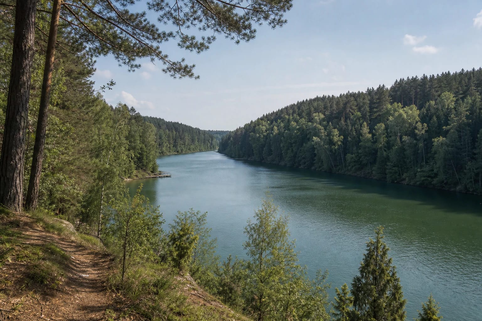
The shores are mostly high and forested with Gulbinai and Kryžiokai woods, rising as much as 40 metres above the water in places. The northwestern shore is more marshy, while the narrow littoral zone consists of gravel and pebbles. Photographs from the viewpoint show a forest-framed lake basin, not an alpine landscape, and the relief is worth reading from several points along the shore.
The beach is one part of the Lake Balsys shore
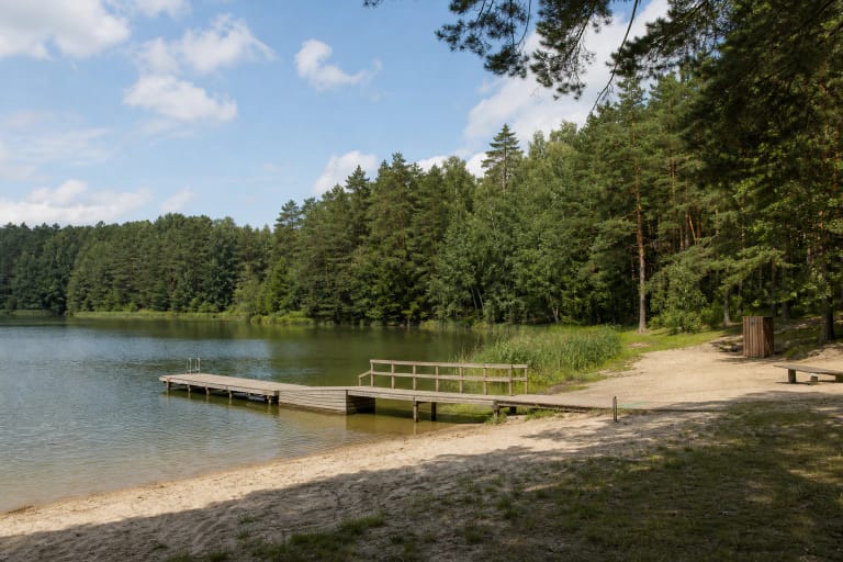
VLE describes Balsys as a recreation lake with two beaches, a path around the lake, and a viewpoint on the southeastern shore. The main Balsys, or Green Lakes, beach is currently managed by Grinda. Its official description lists three piers, changing cabins, a children's bathing area, toilets, drinking water, bicycle stands, a barbecue area, sports courts, and pedal-boat and paddleboard rental.
The beach holds Blue Flag status, and Grinda says that its managed Vilnius beaches organise lifeguard work, regularly test water and sand, and maintain the equipment. This means the main bathing area has more services than a wild shore, but it does not make all 5.2 kilometres of shoreline equally developed.
The nearest public-transport stop to the main beach is Verkių Riešė, and Grinda lists paid parking. The coordinates for the lake card are not the same as the beach entrance. Follow signs on arrival and do not drive onto lawns, woodland paths, or tree-root zones.
The viewpoint and lakeside paths require sure footing
Walking and cycling routes run around Balsys, and a viewpoint is established on the southeastern and eastern shore. Saugoma.lt describes a cycling route reaching the Balsys shore and its eastern view, while VLE confirms a path around the lake and a viewpoint. It is a good place to see the greenish water meet the high forested slopes.
The popular loop around Balsys is not the same as a short walk from the beach to a pier. Slopes may include steps, natural woodland ground, roots, and slippery sections, and a full circuit takes longer than a quick descent to the water. Check the current path condition and any diversions on site before setting out.
The main beach has an accessible route to the water and supervised assistance for safe access to the bathing area. That should not be expanded into a claim that the entire lakeside loop is step-free: steep sections, stairs, and woodland surfaces can make parts of the shore unsuitable for wheelchairs.
The Green Lakes protect more than a beautiful view
Lake Balsys belongs to Verkiai Regional Park, established in 1992 and covering 2,529 hectares. The Green Lakes and their surroundings form the Green Lakes Landscape Reserve, protecting tunnel-valley basins, woodland, slopes, and rare habitats. The value of the site is not only its water colour, but the complete lake-and-forest relief.
The area supports lady's slipper orchid, one of Europe's major populations of the species. Flowers, mosses, springs, and the woodland floor are not souvenirs: stay on marked paths, do not search for plants by leaving the trail, and never pick or trample protected vegetation.
A safe visit combines two different kinds of behaviour: use the marked beach facilities and follow lifeguard instructions in the bathing area, then stay on existing paths elsewhere along the lake, avoid unstable slopes, and take rubbish away. Check same-day water-quality notices, flags, and weather before swimming because a well-managed beach does not remove the risks of a deep lake.