- Place
- Zarasai District Municipality
- Region
- Aukštaitija
- Type
- lake
- Address
- Lake Avilys, Zarasai District Municipality
- Coordinates
- 55.75384, 26.07753
- Visit duration
- 1-3 hours for a chosen shore and lake views; plan a separate longer route to explore the wider landscape
- Best time
- late spring to early autumn; a calm day best reveals the islands and reed-fringed shallows
Aviliai, Avilys Lake
Lake Avilys lies west of Zarasai
Lake Avilys, called Aviliai as an alternative name by the Encyclopedia of Lithuania, lies about 8 km west of Zarasai. The encyclopedia gives an area of 1,258 ha, a length of 8.1 km, a maximum width of 4.5 km, a surface elevation of 154.2 m, a maximum depth of 13.5 m, and an average depth of 3 m. These figures show the scale of the place: this is a broad lake landscape, not one bathing beach.
The name can be confusing because Aviliai is also used as an alternative lake name and nearby place names sound similar. This entry is specifically about the lake whose shores sit in the rural landscape of Zarasai District.
Islands, bays, and reed-fringed shores
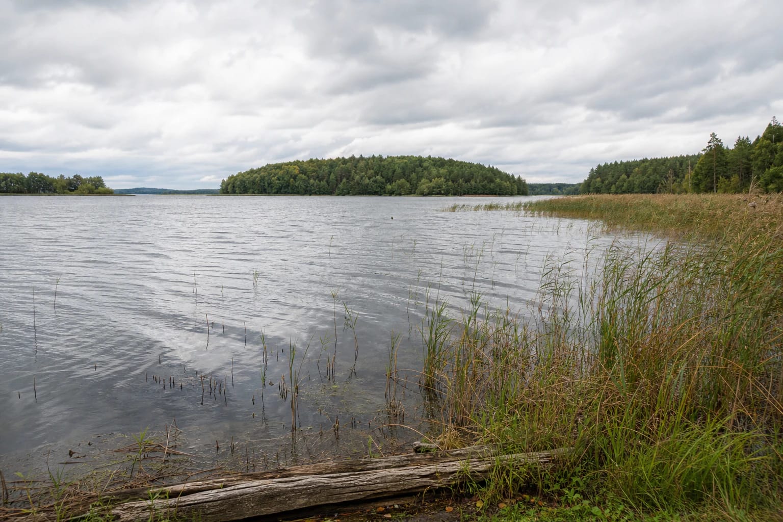
Lake Avilys has a very indented shoreline measuring 39.4 km. It contains about 31 islands with a combined area of roughly 60 ha, most of them in the south-eastern part. The encyclopedia names Ąžuolų, Liepų, Ledų, Sumnė, Relinė, and Varnų islands, but not every island has a convenient or lawful approach from land.
Moraine hill chains surround the northern and southern sides. Shores are often low and locally marshy around stream mouths, while the western side rises higher. This variety is best read from a particular shore rather than through a search for one beach that represents all of Avilys.
The lake's water network and wildlife
More than 15 streams flow into Lake Avilys. The encyclopedia highlights the 3.4-km Kiaulinis as well as Izita and Imbradas. The Avilė flows out of the lake into the Auslas, and the water system belongs to the Dysna basin. This network helps explain the differences between shores, from more open sandy or gravelly edges to muddier stream mouths.
The encyclopedia mentions waterbirds such as bitterns and black-throated divers in the lake environment, and records 28 fish species. That does not promise a particular sighting during a short visit, but it is a good reason to keep quiet near the water and avoid trampling sensitive reed beds.
Why official sources give different area figures
The Encyclopedia of Lithuania gives Lake Avilys an area of 1,258 ha, while an official water-body table checked for this page lists 1,224.1 ha. This guide does not try to declare one figure the only correct one: official datasets may have been compiled at different times and may use different calculations for the water body's boundary or area.
The practical conclusion for visitors is that Avilys is a large, highly indented water space, so the coordinate on this page is a representative point in the lake landscape. It is not presented as a particular beach, car park, boat launch, or single entrance.
What to know before travelling to Avilys
The official sources checked for this page do not confirm one universal visitor centre, marked nature trail, or lake-wide beach address. When choosing a shore, assess the approach, private-property boundaries, wet low ground, and signs on site. Do not leave waste, damage reed beds, or travel to an island unless there is a clear lawful way to do so.
The Environmental Protection Department prohibits on Lake Avilys the use of self-propelled watercraft powered by an internal-combustion engine with a water-jet pump, such as personal watercraft. This is not a blanket permission for every other water activity: check the current rules before boating or fishing and follow local restrictions.
Lake Avilys in the Imbradas landscape
Zarasai District Municipality describes Imbradas Eldership through Lakes Imbradas and Avilys and the surrounding villages. It is therefore better to plan a visit as a quiet landscape journey rather than a single-point stop, allowing for water, woodland, settlements, and road conditions.
If you need a defined bathing area or services, choose an officially described Zarasai town shore. If your aim is Avilys's scale, islands, and reed-fringed banks, allow time for the approach and for a responsible visit to the particular shore you choose.