- Place
- Strėva area, Trakai District Municipality
- Region
- Trakai District
- Type
- 7.5-9 km circular hiking route through the Spindžius woodland and lakes Natura 2000 area
- Address
- Start at the Lake Stanka rest area beside the A16 road, Strėva, Trakai District
- Coordinates
- 54.58708, 24.69871
- Visit duration
- 3-5 hours; longer after rain or with extended stops at lakes and the sinkhole
- Best time
- late May-June for plants or a dry early-autumn morning; the trail becomes harder after heavy rain
Žaliasis takas, Spindžius Forest Green Trail, Aukštadvaris Green Trail
7.5 or 9 km: planning the Green Trail
Saugoma.lt gives a length of 7.5 km, while a 2025 route suggestion from the protected-areas directorate describes approximately 9 km. The difference may reflect a chosen starting point, route updates, or measurement method. Treat it as roughly a 9 km hike when planning.
The official start is associated with the rest area in Strėva village on the western shore of Lake Stanka, beside the A16 road. The Google pin at 54.5870817, 24.698714 is a representative trail point rather than a single gate; official coordinates for the starting rest area are approximately 54.588, 24.704.
The route is circular, but numerous forest roads branch from it. Photograph the map at the start, follow waymarks, and keep an independent map on your phone. When an app conflicts with current directorate signage, follow the official signs and never enter a closed section.
Emerald lakes and the upper Strėva
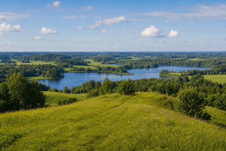
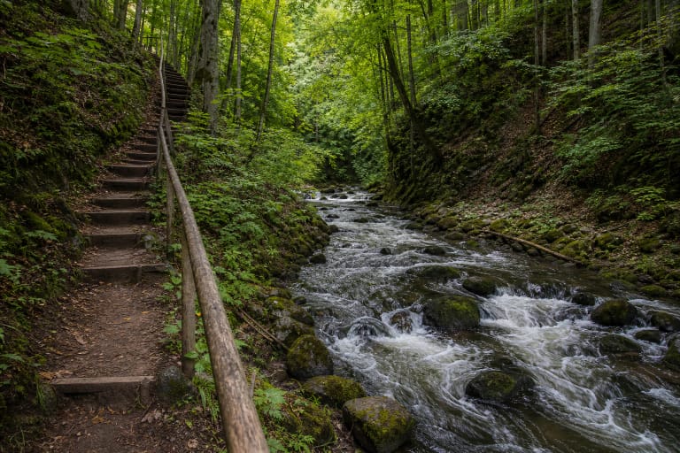
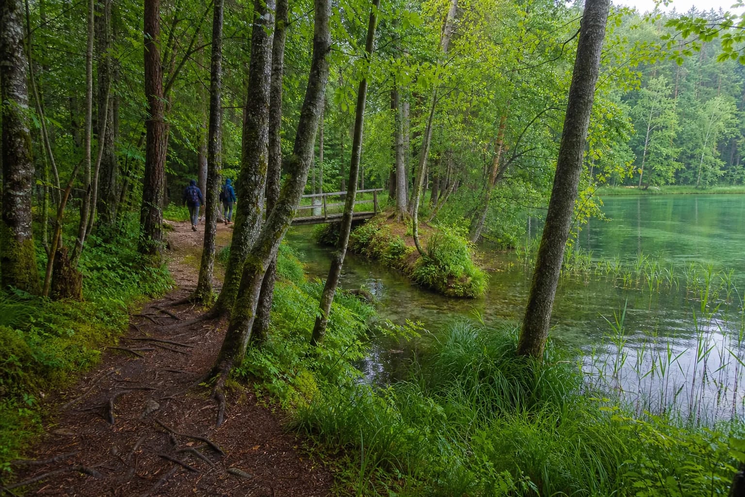
The trail links the shores of lakes Stanka, Spindžius, and Spindžiukas with sections of the River Strėva. Water beneath wooded slopes often appears green, making the lakes the route's defining image, although colour varies with light, bed, vegetation, and weather.
An official rest area stands at the channel between Spindžius and Spindžiukas. It is appropriate for a short break, not for leaving litter, building a new fire site, or walking through the fragile shore. Small mires and quaking ground are protected landscape features and may not bear a person's weight.
Roots, leaves, and clay-rich shores become slippery after rain. This is not a continuous boardwalk, so shoes with reliable tread are essential. It suits a child only when they can independently complete a long, uneven woodland route.
Natura 2000 old forest and rare plants
Spindžius Forest belongs to Natura 2000. Saugoma.lt records 13 natural habitat types of European Community importance, including western taiga and swamp deciduous forest, and 26 plant species listed in Lithuania's Red Data Book. This is a biologically valuable woodland and wetland complex, not a landscaped park.
From late May into June, broad-leaved marsh orchids may flower in wet areas, while the so-called orchid hill supports lady's-slipper orchids, lesser butterfly orchids, and rare red helleborines. In 2023 the directorate counted 11 flowering red helleborines and noted that the species is known from only a few Lithuanian sites.
These figures never promise a sighting on a particular day. Do not leave the path to search, touch or pick flowers, and avoid publicly mapping precise locations. The best visit recognises habitat diversity without disturbing it.
Strėva sinkhole and Drabužininkai burial mounds
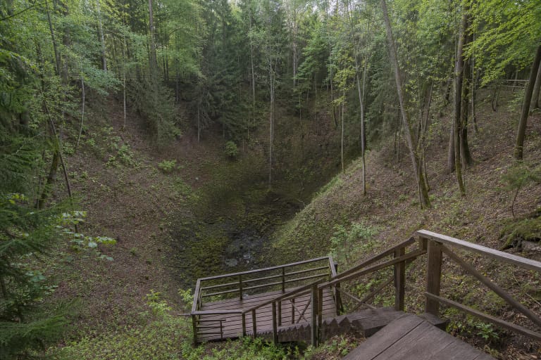
The circuit passes the Strėva sinkhole, a wooded depression sometimes compared with the better-known Devil's Pit. A tavern said to have sunk into its bottom belongs to local legend, not documented history. Observe the landform from the path rather than descending its steep slope.
Another stop is Drabužininkai burial mound cemetery, a registered cultural property on wooded high ground between lakes. Its burial mounds are easily mistaken for natural hills, making the interpretation panel and careful reading of relief more useful than walking over the earthworks.
Never dig, lift stones, or look for finds. This is an archaeological burial place entitled to respect and legal protection. Nature and cultural heritage meet on the hike, but neither is an adventure-play area.
Free access, safety, and the best season
The Green Trail is a free outdoor route without a ticket office, gate, or fixed hours. The directorate may nevertheless close sections after tree falls, forestry work, flooding, or infrastructure repairs, so check official notices before a longer journey.
Carry water, food, a charged phone, tick repellent, and a rubbish bag. Reception can be uneven, and weather may change during a 3-5 hour hike. Waymarks become difficult after dark, so leave a generous daylight margin.
Google Maps showed 4.7 out of 5 from more than 2,300 reviews on 21 July 2026. Popularity does not alter protected-area rules: remain on marked paths, build no new fires, keep noise low, and leave rare-species habitats undisturbed.