- Place
- Vilkija Eldership, Kaunas District Municipality
- Region
- Vilkija and the Nemunas Valley
- Type
- a landscaped Nemunas Valley viewpoint at Vilkija
- Address
- Vydūno Avenue 2, Vilkija, Kaunas District
- Coordinates
- 55.03556, 23.58677
- Visit duration
- 20-45 minutes; longer when combined with Vilkija centre and the riverfront
- Best time
- morning or evening, when side light brings out the Nemunas bends and valley relief
Vilkija Viewpoint, Vilkija Observation Platform
The viewpoint welcomes visitors arriving in Vilkija
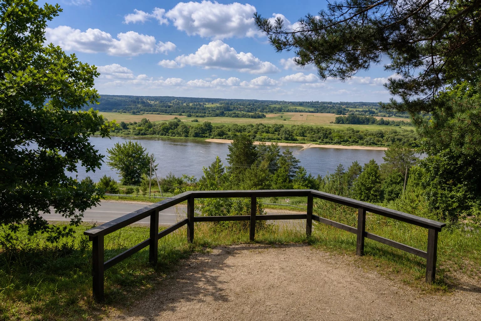
Vilkija Observation Deck stands by the town entrance on Vydūno Avenue. It is one specific landscaped viewpoint, mapped at approximately 55.035565, 23.586769, rather than a name for Vilkija hill or the entire Nemunas riverfront.
The deck has benches and a protected edge, making it a convenient place to pause before exploring Vilkija. Its outlook is directed towards the Nemunas Valley and its bends rather than one individual town building.
Vilkija has other outlooks, including viewpoints around the church, so choose the Vydūno Avenue deck in navigation. The landscape-panorama list published in e-TAR identifies more than one viewpoint in Vilkija, making the exact address important for reaching the deck described here.
The Nemunas bends unfold from the town slope
The deck looks over the broad Nemunas Valley, river bends, opposite bank, and green Panemunė spaces. Read the landscape in layers: the nearest slope first, then the ribbon of water, followed by the patchwork of fields and woodland beyond it.
The panorama changes with season and weather. Summer fills the valley with rich green, autumn separates the woodland groups by colour, and the leafless season exposes more of the relief and distant bank contours.
This is not a tall tower with several levels but a hillside observation deck. Its advantage is a wide view reached quickly, with the option of continuing on foot through the town.
A short stop can begin a Vilkija route
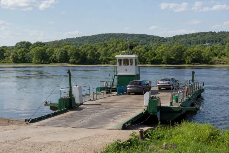
From the deck, Vydūno Avenue leads towards Louis Armstrong Square, Vilkija centre, and the Nemunas landing. The Vilkynė river ferry operates there, so the panorama stop can continue into a river and town-history experience.
The Antanas and Jonas Juška Ethnic Culture Museum is also nearby uphill in the town. Together, the sites make a day in which a natural view is followed by a story about the culture and people of the Vilkija area.
Allow 20-45 minutes for the deck itself. If you continue to the museum, centre, landing, or ferry, plan according to the chosen route rather than the size of one viewpoint.
Access is convenient, but the deck remains a sloping space
Because the deck is beside the town entrance, it is easy to reach by car or include in a Vilkija walk. Leave vehicles only in marked or lawful places, and keep Vydūno Avenue and other approaches clear.
The viewpoint is landscaped, but its sloping setting and edge mean that it is not a completely level plaza. After rain, frost, or late-autumn damp, timber and nearby surfaces may be slippery.
The municipal description does not confirm full wheelchair access. If a level route is essential, check the actual surface and approach conditions before travelling rather than relying on a panorama photograph.
Photograph the valley safely and without rushing
Morning or evening side light brings out the Nemunas bends and the relief of the separate banks. In a wide photograph, leave part of the timber deck in the frame so the viewpoint's position on the town slope is clear.
Do not lean over the railings, climb protective structures, or allow children near the edge without supervision. Storms, fog, ice, and wet timber can quickly change the conditions of a place that is normally easy to use.
Before setting out, decide whether the deck is a short travel stop or the first point of a longer Vilkija route. In either case, leave the site tidy and do not block the panorama for other visitors.