- Place
- Pypliai, Ringaudai eldership, Kaunas District Municipality
- Region
- Suvalkija
- Type
- a state-protected archaeological complex of national significance comprising a hillfort and foot settlement on the left bank of the Nemunas
- Address
- Pypliai village, Ringaudai eldership, 53456 Kaunas District
- Coordinates
- 54.92737, 23.75052
- Visit duration
- 45-90 minutes for the summit enclosure, rampart, ditch, settlement setting, and Nemunas panorama
- Best time
- a dry, clear day from spring to autumn; the slopes and ditch are easier to read without leaves, while summer is best for continuing through Kačerginė Forest
Pypliai Hillfort with Settlement, Pyplių piliakalnis, Pyplių piliakalnis su gyvenviete
The left-bank promontory protects a complete archaeological complex, not just a hill
Lithuania's Cultural Heritage Register assigns code 23729 to the Pypliai complex. It comprises the separately registered hillfort, code 5058, and the foot settlement, code 23730. The complex is of national significance and has been protected by the state since 2005. The register gives it a broad chronology from the first millennium to the beginning of the second millennium AD, not a construction date for one particular castle.
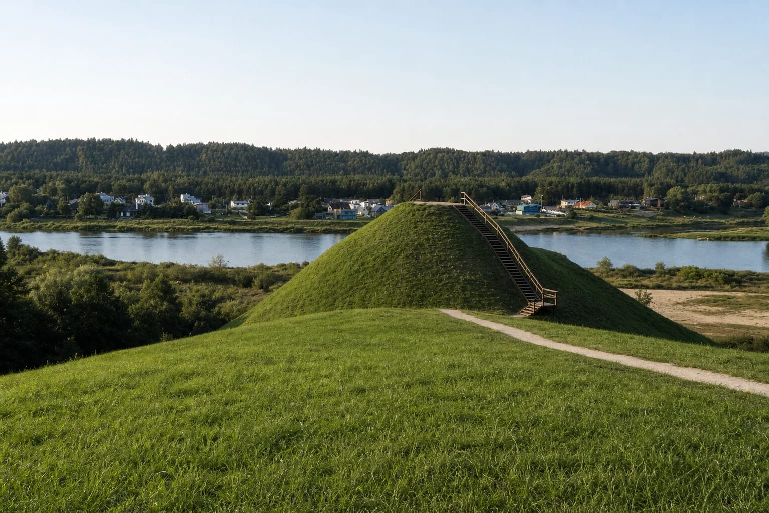
The hillfort was established on a promontory of an upper Nemunas terrace, at the eastern edge of Kačerginė Forest and opposite the mouth of the Nevėžis. The Nemunas valley protects it from the north and northeast, while gullies cut the approach from the east. The exact visitor pin is 54.9273661, 23.7505156. The point on Kaunas District's official site map is only about 21 metres away, independently confirming that the pin identifies the hillfort rather than the centre of Pypliai village.
Pypliai belongs administratively to Kaunas District, but its ethnographic region is Suvalkija. The hillfort is on the left bank of the Nemunas in Užnemunė, and VLE includes the southern part of Kaunas District within the area inhabited by Suvalkiečiai. On 15 July 2026, the exact Google Maps listing was titled Pyplių piliakalnis and showed 4.8 out of 5 from 917 reviews. Both the average and review count can change.
Sources differ by 50 metres on the enclosure's length, so there is no single safe figure
The current heritage-register entry gives a summit enclosure measuring 82 by 23.5 metres. AUTC and the publication of the 2017 excavations give 32 by 23.5 metres. Both figures come from authoritative records, and the published documents do not say whether the difference arose from measurement limits, an editorial issue, or another cause. The honest approach is to retain both values instead of pretending the discrepancy does not exist.
A rampart approximately six metres high and 23 metres wide rises along the southwestern edge of the enclosure. Its crest holds a small platform about eight metres in diameter. Beyond it lies a ditch roughly 17 metres wide and 1.5 metres deep, now partly silted. Natural slopes rise steeply for 20-30 metres, so the scale of the defences is easiest to understand by first looking at the rampart from below and only then climbing to the top.
The landform is not untouched. Trenches have damaged the enclosure's edges and archaeological deposit, and the 2017 investigators recorded erosion caused by visitor trampling on the rampart crest. The register's 2021 condition record notes a grassed enclosure, wooded slopes, steps, and paths. Mowing and leaf cover alter the view through the year, but the relationship between rampart and ditch remains the most legible part of the monument.
Excavation in 2017 found a much earlier camp and early iron production below the hillfort
Before the site was adapted for visitors in 2017, archaeologists excavated 18 test pits totalling 21.75 square metres, surveyed 1,140 square metres along planned paths, steps, and viewing points, and opened 217 square metres in detail within the planned parking area. The path routes produced no archaeologically valuable finds, but excavation in the southern settlement exposed several distinct phases of activity.
A concentration of flint blades and cores in a thin layer was interpreted as a Palaeolithic camp. Ancient plough marks beside it show that later cultivation disturbed this Stone Age deposit. This does not mean that a hillfort already existed in the Palaeolithic. The camp represents much earlier activity in a place that only later became the setting of a fortified settlement.
In another layer, archaeologists found an iron-smelting furnace cut into the natural ground and lined with sand and clay, together with iron slag, charcoal, handmade pottery, and traces of a possible sunken structure. The investigators associated these contexts with the second quarter of the first millennium AD. One concentration of coarse pottery was lifted in a block of soil and transferred to Kaunas City Museum, so the finds are not displayed on the hill itself.
Medieval finds indicate later use but do not reveal the castle's name
Earlier surveys of the foot settlement recovered handmade smooth and rough-surfaced pottery as well as partly wheel-finished pottery dated to the 14th century. In 1993, about 200 square metres of surviving cultural deposit were excavated on the first Nemunas terrace north of the hillfort, identifying both Early Mesolithic to Middle Neolithic activity and a phase in the 2nd-5th centuries AD. Pypliai is therefore a sequence of separate periods, not one continuously inhabited settlement.
During the 2017 excavation, the only object linked directly to the hillfort's late phase was a crossbow bolt head. Together with the 14th-century pottery, it supports medieval activity but names no castle, ruler, or battle. The register dates the whole complex broadly from the first millennium to the beginning of the second millennium AD, so individual finds must be read within their own layers rather than merged into one story.
In a heritage overview published by Kaunas Reservoir Regional Park, archaeologist Gintautas Zabiela places Pypliai within a possible outer ring of hillforts 8-12 kilometres from Kaunas's masonry castle. This is a valuable interpretation of the regional defensive landscape, but it does not itself prove that every listed hillfort operated at the same time or belonged to one centrally organised system.
Pilėnai is an unproven localisation theory, while three other narratives are folklore
Twentieth-century Lithuanian authors Zenonas Ivinskis and Kazimieras Paunksnis proposed Pypliai as a possible location of Pilėnai, whose defenders' deaths are associated in chronicles with 1336. Even the Kaunas District tourism description that repeats the idea says perhaps. Neither the heritage register nor the report on the 2017 excavations identifies Pypliai as Pilėnai, and a crossbow bolt head with 14th-century pottery does not establish the identity of a particular castle.
The heritage register also records the site's mythological value and several other narratives. People told that French soldiers built the mound by carrying earth in their caps, that a hole lies inside it, and that enemies burned a Lithuanian castle while its duke was away. These are folklore motifs. They explain neither the geological formation of the hill nor a documented war at Pypliai.
The secure conclusion is less dramatic but richer in evidence: a hillfort was established on a strategic Nemunas terrace, people lived and worked around its foot in different periods, and the place was still used in the Middle Ages. No source provides a confirmed castle name. Visitors should therefore keep the archaeological complex, the regional defensive interpretation, and later legends as three separate layers of meaning.
Steps and a stopping area make the visit easier, but the summit is not step-free
The heritage register's 2021 condition record lists paths, steps, a parking area, benches, and information boards at the complex. It does not describe parking capacity, the current surface, or winter maintenance, so larger groups and visitors arriving after storms should check present conditions. The summit is reached by steps and the slopes are steep, so step-free access to the enclosure has not been confirmed.
The heritage, archaeological, and protected-area sources list no hillfort opening hours, ticket office, or admission charge. Hours shown on the tourism-centre website belong to the institution's contact block and should not be treated as the hillfort's schedule. Check official notices before travelling for temporary events, maintenance work, or access restrictions.
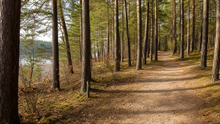
Allow 45-90 minutes on a dry day. The summit overlooks the Nemunas valley, the opposite bank, and the direction of Raudondvaris, although summer leaves obscure part of the panorama. A branch of the Kačerginė Springs Trail provides a longer approach through the forest. Keep to the steps and marked paths, do not climb the steep rampart face, and never dig, because the 2017 investigators had already recorded trampling damage on its crest.