- Place
- Alytus City Municipality
- Region
- Dzūkija
- Type
- woodland nature route overlapping the approximately 3 km ecological learning trail through Vidzgiris Botanical Reserve
- Address
- Vidzgiris Forest, Alytus
- Coordinates
- 54.38085, 24.00729
- Visit duration
- 3-4 hours for the full route of about 9 km; 1.5-2.5 hours for a chosen ecological learning trail circuit
- Best time
- April-October; the terrain is easier to read in early spring, while rain makes non-slip footwear essential
Vidzgiris Ecological Learning Trail, Vidzgiris Botanical Reserve Nature Trail, Vidzgiris Natural Trail, Vidzgirio pažintinis takas
One name covers two connected route scales
The name Vidzgiris Nature Trail usually refers to a green-marked woodland route of about 9 km, running south from the junction of Pulko and Vidzgirio streets. It is not circular, so anyone walking the full line needs to arrange a return or transport from the far end. In the southern forest, this route overlaps the official Vidzgiris Ecological Learning Trail rather than leading to a separate attraction.
Alytus City Municipality's 2003 report records that the ecological learning trail opened that year as part of the project 'Conservation of Biodiversity in Vidzgiris Botanical Reserve'. It is approximately 3 km long, and 18 nature stops present geomorphological, botanical, zoological, landscape, and cultural values. The official map shows a main route, a supplementary route, and shorter side paths, so the distance actually walked depends on the chosen combination.
The coordinates 54.380852, 24.007294 mark the southern visitor access on the Radžiūnai side, beside the learning trail and hillfort, not the northern start of the full 9 km route. Allow 3-4 hours for the longer line, or 1.5-2.5 hours for a learning-trail circuit with stops at the boards.
A 386.7 ha botanical reserve lies within the city's 452 ha forest
Alytus City Municipality describes Vidzgiris Forest as covering 452 ha within the city, while Encyclopaedia of Lithuania gives the botanical reserve itself as 386.7 ha. The reserve was established in 1960 to protect a natural southern Lithuanian hornbeam forest with oaks and other broadleaf trees. These figures are not competing measurements of one boundary: the forest is larger than the protected reserve within it.
Vidzgiris's defining feature is Lithuania's largest continuous hornbeam stand. Habitats of European Community importance listed here include broadleaf and mixed woods, hornbeam stands, ravine and slope forests, dry oak woods, alluvial forests, and springs where tufa forms. Hollows in old trees and decaying wood left on the ground are habitat, not evidence of an untended forest.
Official descriptions list hollowroot and intermediate corydalis, common ivy, and the liverwort Porella platyphylla among the rarer plants. The last of these grows on tree bark and is not a flowering toothwort. Do not pick plants, remove dead wood, or widen informal paths through sensitive undergrowth.
Eighteen stops explain ravines, pools, and the life cycle of an old forest
The first learning-trail stop introduces a ravine, a hollow cut by erosion from small water flows. Its opposing wooded slopes receive different amounts of sunlight, so their vegetation differs, while temporary streams can appear on the spring-fed floor. Stops at an edge meadow, developing hornbeam stands, a cleared patch, and the old hornbeam forest compare different stages of broadleaf woodland.
The newt pool, green-frog pool, and Kūmučiai pool are not constructed ponds. They are small wetlands that may dry for part of the year and remain important to amphibians. Do not wade into them or catch animals: the learning trail is designed to show how even temporary water supports forest biodiversity.
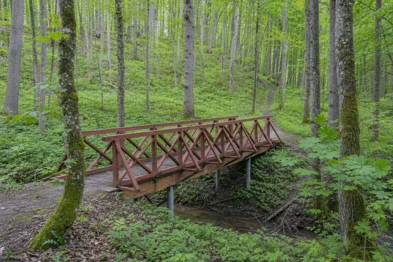
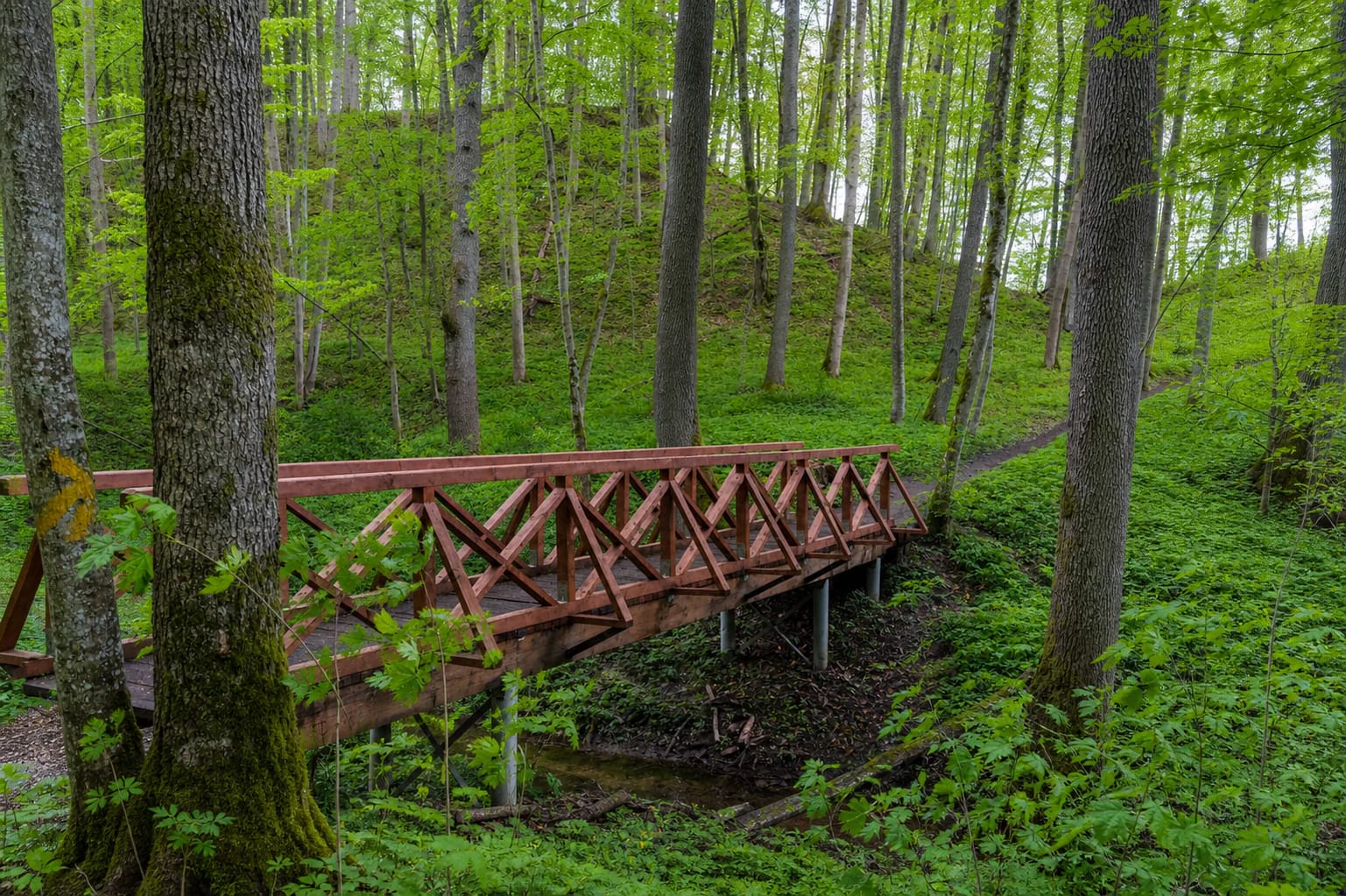
The Kirmija stop reaches a stream in a deep hollow. Floodwater erodes its slopes and exposes small scarps, while damp ground rich in dead wood supports mosses, fungi, and invertebrates. This is among the slipperiest parts after rain, so use the bridges and marked path even when a direct descent looks shorter.
The southern trail connects Kirmija, the hillfort, and Nemunas terraces
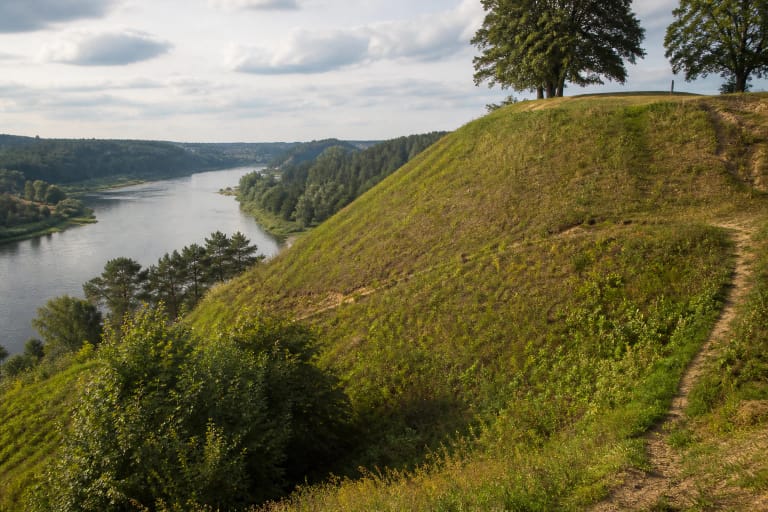
Stop 12 is Radžiūnai Hillfort, also known as Pilaitė. It occupies a high promontory on the left bank of the Nemunas, bounded by the Kirmija ravine to the west and the Nemunas to the south and east. Our separate hillfort guide gives the fuller archaeological chronology; on this trail, the essential point is its position between two valleys.
The official sequence then descends to the Kirmija mouth, a riverside meadow, an island, and the Nemunas terraces. During the spring thaw, sediment collects where the Kirmija meets the Nemunas, and a low floodplain appears again as the water recedes. Banks can be soft or undercut, so remain on the marked route beside the river.
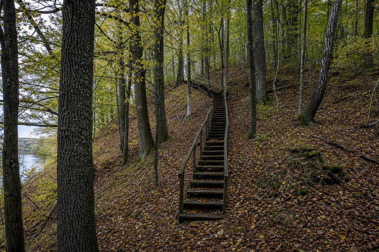
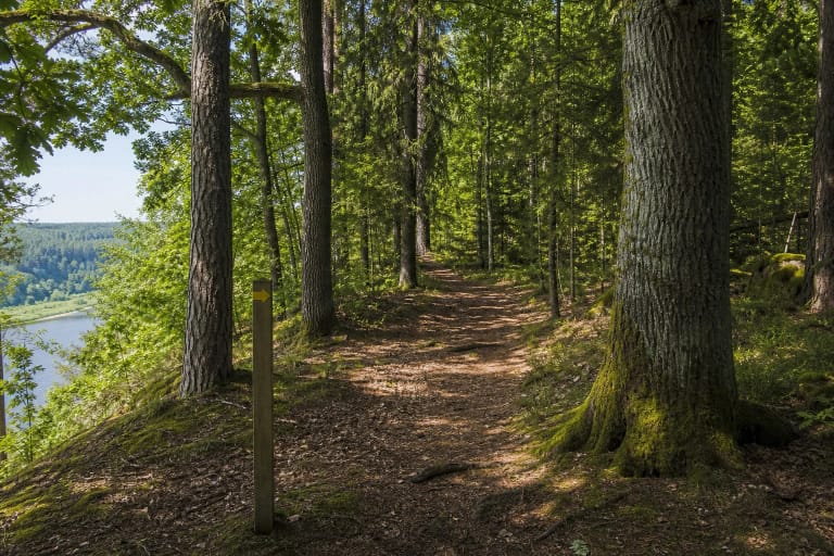
Timber steps, terraced paths, and a bridge over the Kirmija were installed around the hillfort access in 2003. Information boards, direction signs, and yellow marks on trees now help visitors follow the route. Timber infrastructure wears and becomes slippery after rain, so current on-site conditions and temporary warnings take priority over an older photograph or map.
Practical conditions depend on the section you choose
Most of the trail is natural forest ground with roots, leaves, and muddy stretches. The Kirmija hollow, Nemunas slope, and hillfort approach include steep climbs, steps, and bridges, so the complete route is not wheelchair accessible. Walk in daylight with grippy footwear, water, and a charged phone.
The official sources checked do not list a ticket office or fixed opening hours. The woodland trail is normally free to visit, but check Alytus City Municipality notices before setting out in case repairs, storm damage, or another temporary restriction affects access.
The northern start of the approximately 9 km route and the southern access marked on this page are different points. If you are not walking the entire linear route, use the official map to combine the main and supplementary trails in the south, follow the local signs, and do not drive onto forest tracks in search of a shorter approach.