Alytus, Alytus City Municipality
Dzūkija
hillfort with a foot settlement, the city's place of origin
Confluence of the Nemunas and Alytupis, edge of Alytus Old Town
54.39690, 24.07900
30-45 minutes; 1.5-2 hours with the bridge and old town
late spring to autumn; steep slopes can be slippery after rain
Vienuolyno kalnas, Joninių kalnas, Švento Jono kalnas
Alytus Hillfort: the beginning of the city
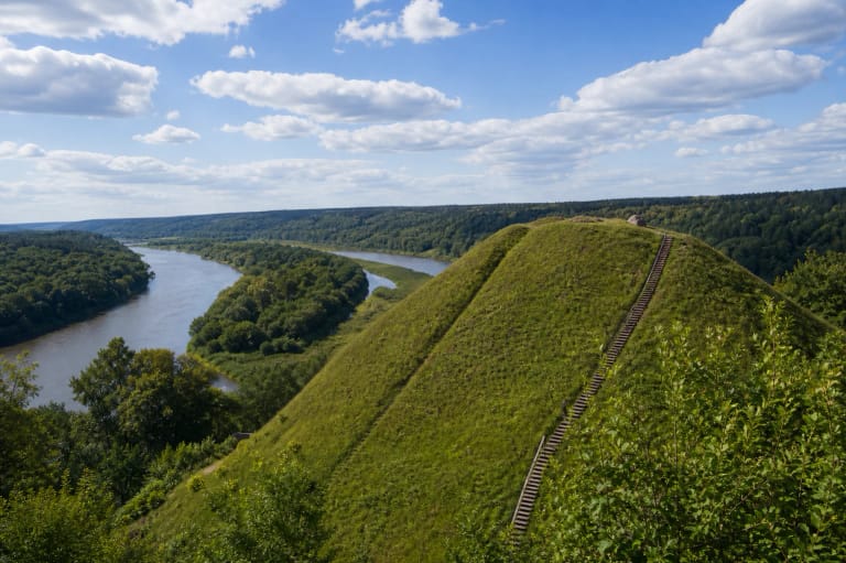
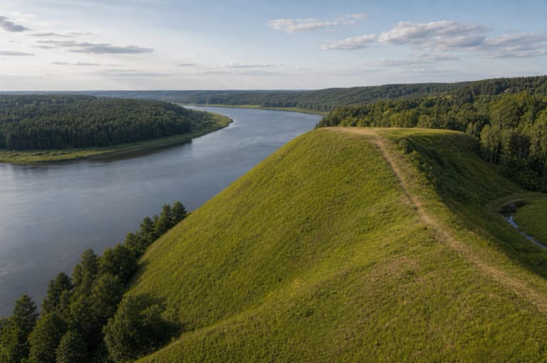
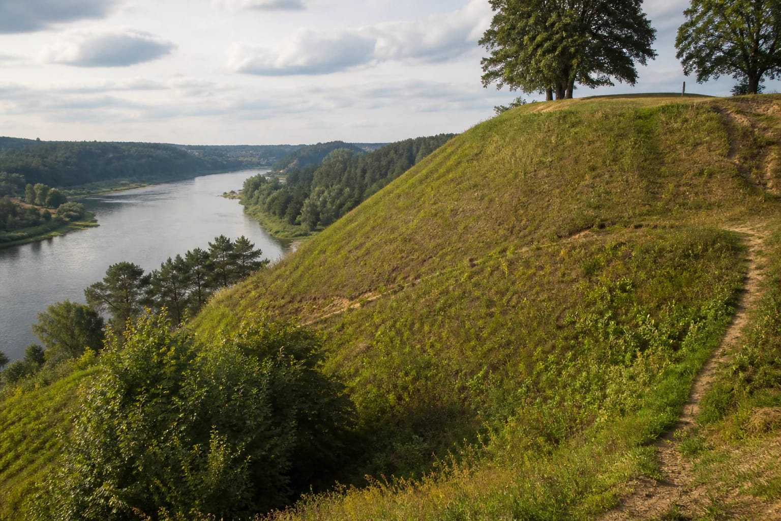
Alytus Hillfort rises at the confluence of the Nemunas and Alytupis, on the edge of the old town, on the right bank of the Nemunas. It is the city's place of origin: Alytus began to grow near the medieval castle that stood here. Locally the hillfort is also called Vienuolyno, Joninių, or Švento Jono Hill.
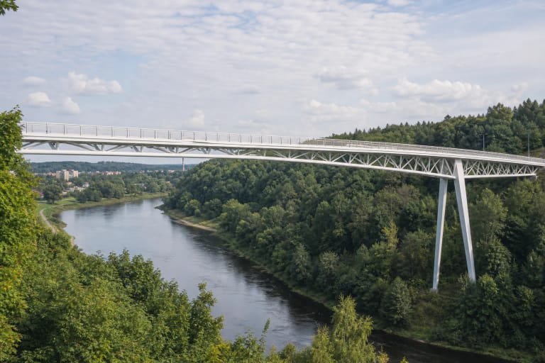
The hillfort is not large, but its historical and symbolic meaning is strong. From the steep hill you get a broad panorama of the Nemunas valley, making it easy to combine with the nearby White Rose Bridge and the old town.
Wooden castle and wars with the Order
In the thirteenth and fourteenth centuries a wooden Alytus Castle stood on the hillfort. Together with castles at Merkinė, Nemunaitis, Punia, Birštonas, and Kaunas, it formed a defensive line protecting routes to Trakai and Vilnius from the Teutonic Order. The main crusader war route into southern Lithuania passed through Alytus, so the region was frequently attacked.
Alytus was first mentioned in 1377 in Wigand of Marburg's chronicle as a military, economic, and administrative centre; that same year the wooden castle on the hillfort was taken by the crusaders. In 1382, according to the chronicle, Marshal Kuno von Hattenstein divided his army into three parts and attacked Punia, Alytus, and Birštonas. In 1387 Alytus town is mentioned in a document of Jogaila.
Hillfort dimensions and finds
The hillfort platform is quadrangular, about 25 x 15 m. The slopes are steep, about 20-25 m high, with the eastern slope lower; on the eastern edge is a semicircular rampart 40 m long and 2.5 m high. On three sides the hill is bounded by the Alytupis valley, the Nemunas, and deep ravines.
The foot settlement is dated to the second half of the first millennium and the eleventh to fourteenth centuries. In 1985-1986 archaeologists led by E. Svetikas investigated about 240 sq. m of the settlement and found a seventh- to twelfth-century cultural layer with hand-built and wheel-thrown pottery. The hillfort is listed in the Cultural Heritage Register.
Vienuolyno and Joninės Hill
Other names and stories are tied to the hillfort. Joninių or Švento Jono Hill links the site with the summer solstice festival, so a visit around Joninės feels especially fitting. The name Vienuolyno Hill comes from later city history.
Alytus and Mirgrausėlė also appear in a local legend associated with Alytus. It should be understood as folklore, not history. Such stories enrich the place but should not be confused with the documented castle history.
How to visit Alytus Hillfort
The hillfort is an open, freely visited site. In 2017 the area around it was improved with shelters, fire sites, paths, and a children's playground, and the opened view made the Nemunas confluence easier to see. The hillfort itself usually takes 30-45 minutes.
It combines well with White Rose Bridge, the old town, and riverside paths, forming a 1.5-2 hour route. The steep slopes can be slippery after rain, so wear comfortable shoes and use existing paths.