- Place
- Pavilnys, Vilnius City Municipality
- Region
- Aukštaitija
- Type
- working protected stretch of early twentieth-century street with a fieldstone serpentine alignment
- Address
- Žiedų Street, Pavilnys, Vilnius
- Coordinates
- 54.67373, 25.35735
- Visit duration
- 15-30 minutes for the road itself; 45-90 minutes when walking safely from Pavilnys and combining it with another sight
- Best time
- bright, dry spring, summer, or autumn weather; wet, icy, or leaf-covered stone requires particular care
Vilnius Serpentine, Tuputiškės Road Serpentine, Žiedų Street Serpentine
A short road whose value lies in its alignment
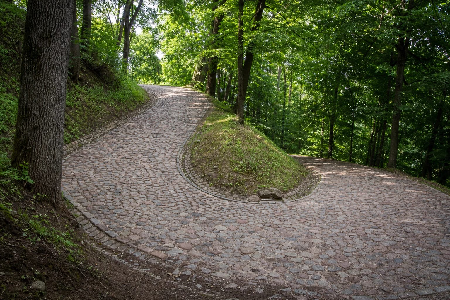
Tuputiškės Serpentine is not a separate attraction complex but a functioning stretch of Žiedų Street in Pavilnys. It winds across a wooded slope between Lower and Upper Pavilnys. The coordinate 54.673728, 25.3573499 marks a representative point on the protected road, not a car park or viewing platform.
After the 2021 works, the municipality gave a length of almost 200 metres and width of 4.5 metres. Those dimensions explain both its appeal and its limits: the bends are pronounced, but this is not a long mountain pass or a self-contained multi-hour hike.
It is often described as Lithuania's only serpentine. The phrase refers to this protected, intentionally winding, stone-paved road alignment, not a claim that no other road in the country has curves.
Railway Pavilnys and an early twentieth-century road
Pavilnys grew as a settlement for Vilnius railway workers in the early twentieth century. A better link was needed between the lower area beside the railway and the colony developing on the high slope, so engineers chose a winding line that reduced the gradient instead of a steep straight climb.
Popular accounts often date the serpentine to 1911, while official municipal and heritage information uses the more cautious early twentieth century. The year 1911 is therefore best treated as a widely repeated specific date rather than a fact expressed identically by every primary authority.
The serpentine entered the heritage list in 1997. Its current Cultural Heritage Register code is 2339 and its address is Žiedų Street. In 2025, the Cultural Heritage Department's assessment council updated its valuable features and defined territory.
What the Cultural Heritage Register protects
A 2025 decision assigned the serpentine regional significance. Its engineering value was classified as rare, its historical character as important, with planting and landscape values also recognised.
The significance does not rest on one old stone. It emerges from the historic curves, rounded-stone carriageway, the slope, and surrounding vegetation. Straightening the road or replacing its surface with ordinary asphalt would remove the essence of the monument.
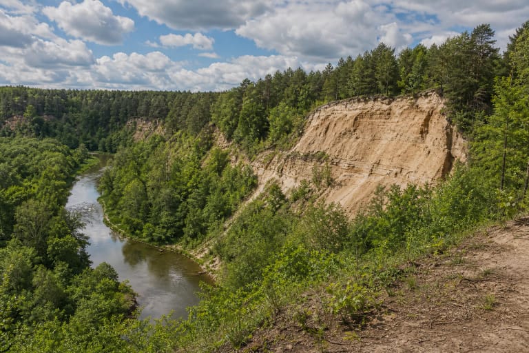
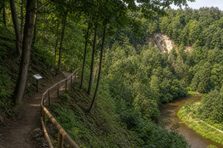
The serpentine lies within Pavilniai Regional Park, which protects the Vilnia valley and its erosional hills. The wooded corridor is not mere scenery: the terrain and vegetation make clear why a straight connection here would have been excessively steep.
The 2021 reconstruction retained the stone surface
Before reconstruction, rainwater and traffic had severely eroded the surface, producing potholes and channels. Vilnius City Municipality states that the almost 200-metre section was fully repaired in 2021 while preserving the historical alignment and fieldstone carriageway.
Workers used rounded stones rather than cut setts. Each was driven by hand into a bed of granite screenings, with a fine granite fraction filling the joints. The resulting surface looks irregular and can be felt when driving: this is not a defect but a deliberately retained material characteristic.
Separate pedestrian and cycle tracks were not installed because the original appearance was to be preserved. Municipal information from 2021 stated that only light vehicles could use the road. Current signs always take precedence over an older description.
How to look without obstructing traffic
There is no entrance fee or scheduled opening time because this is a public street. Even so, bright and dry conditions are best. Wet boulders, fallen leaves, ice, and sharp bends complicate both walking and driving.
The serpentine has no pavement and no official viewing bay. Follow road rules on foot, choose the safest visible edge, do not cross a bend where a driver cannot see you, and never place a tripod in the carriageway.
Do not park in a bend or at the mouth of the narrow section. Choose a lawful place beyond the protected road and walk back briefly. Pavilnys railway stop makes a car-free visit possible, but check the pedestrian connection and current train schedule before travelling.
Drivers should slow before each bend and be prepared to meet another vehicle in a confined space. The rounded-stone surface is uneven and can be slippery for cyclists, while tight curves restrict sightlines, so speed must remain very low.