Vilnius City Municipality
Vilnius
regional park - eroded landscape of the Vilnia River valley
Direkcija: Žaliųjų Ežerų g. 53, Vilnius; Pūčkorių atodanga - Pūčkorių g., Naujoji Vilnia
54.75100, 25.29500
2-4 hours for the Pūčkoriai loop; a full day for several trails
late spring to autumn; Antakalnis bunkers are closed September-April
Pavilniai Regional Park and the Vilnia valley
Pavilniai Regional Park lies within Vilnius itself. It protects the scenic, deeply incised valley of the Vilnia, also called the Vilnelė, together with its eroded hills and ravines. The park was established in 1992 and is managed by the Pavilniai and Verkiai Regional Parks Directorate.
The park is often called one of Lithuania's smallest regional parks; its area is about 2,176 ha. That description is best treated as a common shorthand rather than a strict record, because several parks are similar in size. What matters most for visitors is that this is a real nature and recreation oasis at the edge of the city.
An eroded landscape
The landscape formed at the end of the last glaciation, when meltwater carved into the edge of the Medininkai moraine massif along today's Vilnia valley. This process created picturesque erosion hills, steep spurs, and broad-bottomed ravines.
One of the highest points is Laimis Hill in Liepkalnis, about 235 m above sea level; it is also the highest point in Vilnius. Forests cover about 73 percent of the park, which is why Pavilniai functions as one of the capital's green lungs.
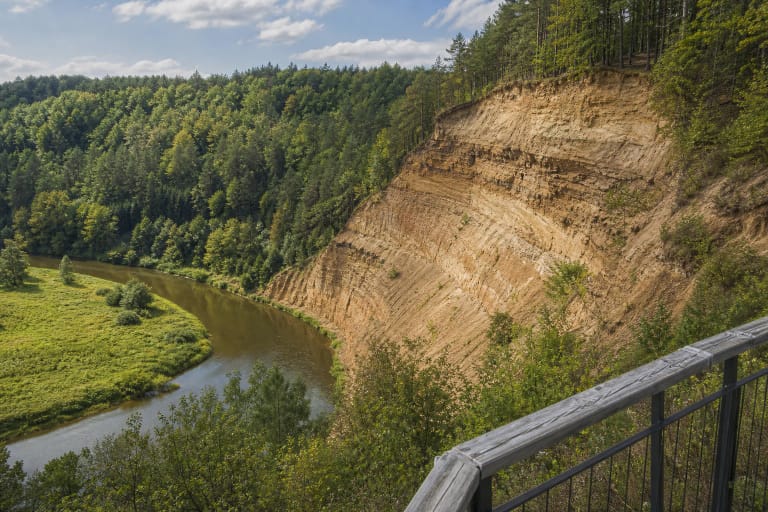
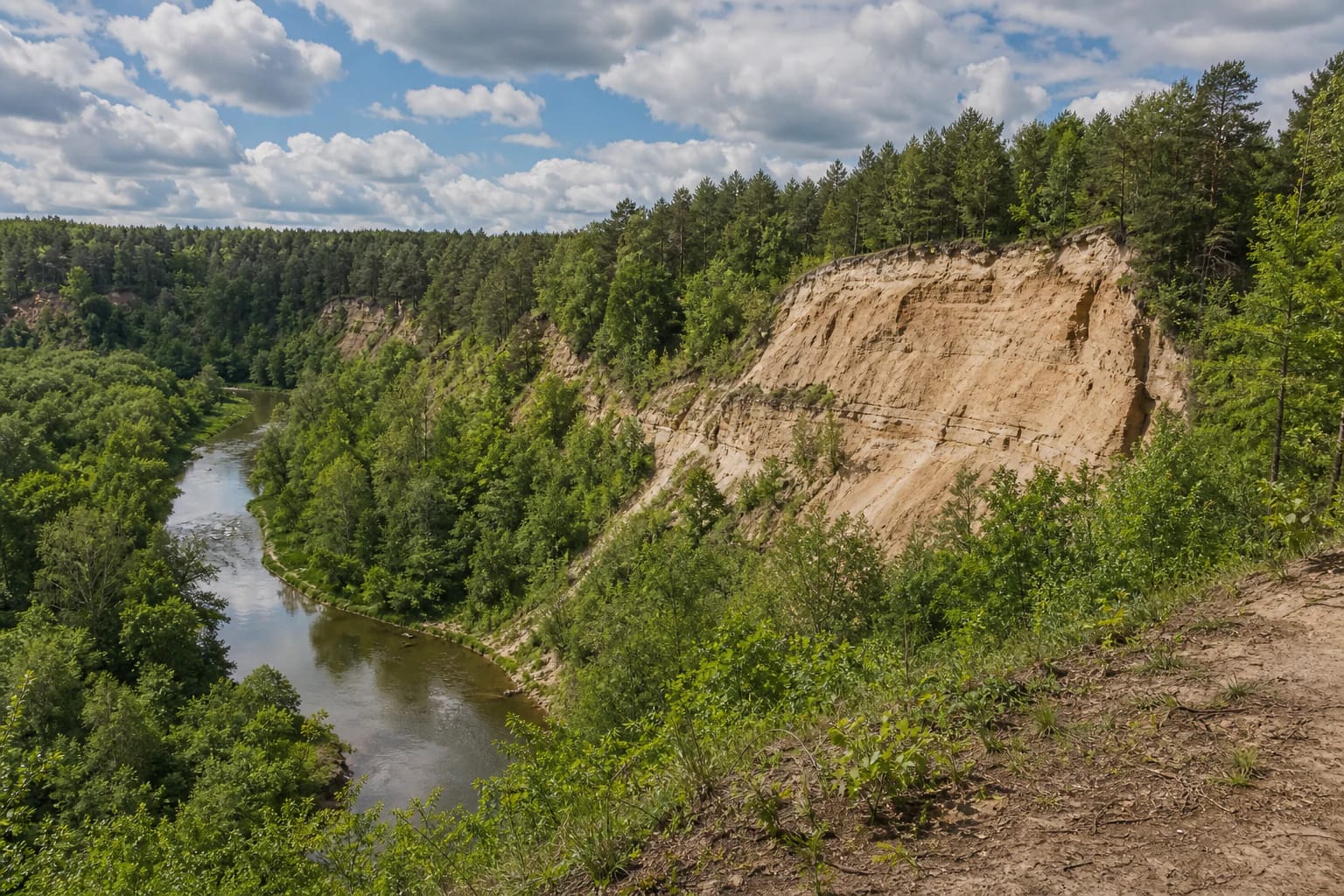
Pūčkoriai Outcrop and hillfort
The park's best-known natural object is Pūčkoriai Outcrop: a cliff over 65 m high and about 260 m wide above the Vilnia, considered the highest and one of the most impressive outcrops in Lithuania. It was formed, and is still being eroded, by the fast-flowing Vilnia River; it was declared a natural monument in 1974.
Nearby, above the Vilnia, stands Pūčkoriai Hillfort, used from the first centuries AD. These sites have separate pages, so here they are best understood as the park's key accents and as highlights on the Pūčkoriai Nature Trail.
Belmontas and heritage
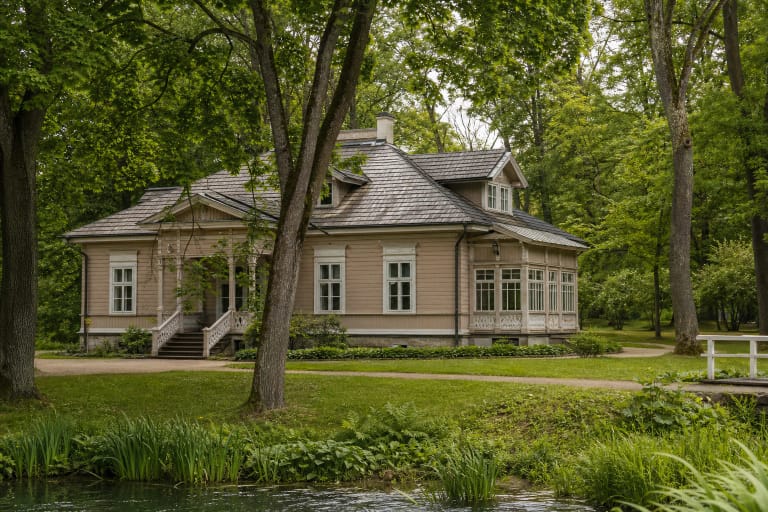
The park also has a dense cultural heritage layer, with dozens of protected objects. Among them are Markučiai Manor with its literary museum, the Rokantiškės castle site, remains of the old Pūčkoriai cannon foundry, and the Antakalnis ammunition bunkers built by the Polish army during the interwar period.
Belmontas, with small waterfalls on the Vilnia, is a popular recreation area. One practical detail matters: the bunkers have become one of the region's largest bat wintering sites, so they are closed to visitors from September through April.
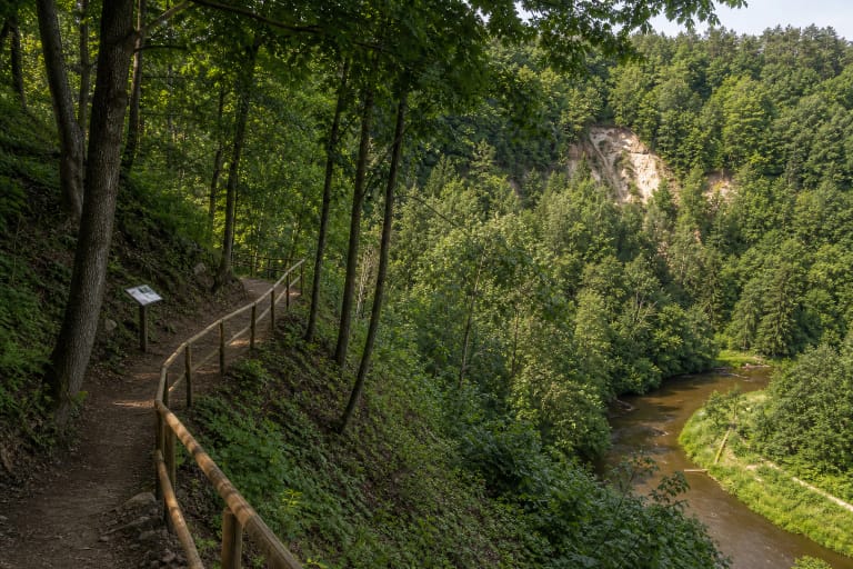
Trails and how to visit
Several educational trails cross the park, including Pūčkoriai, Sapieginė, the Rokantiškės Hillfort route, and others, with viewpoints and information boards. The popular Pūčkoriai loop usually takes 2-4 hours; if you want to walk several trails, set aside a full day.
The park and its trails are freely accessible and free of charge. Before travelling, check the official park directorate website for current route details, visitor centre information, and guided tours.