- Place
- Rūgaliai village, Šilutė District Municipality
- Region
- Nemunas Delta Regional Park
- Type
- a linear 1.2-1.8 km natural grass trail along a polder dyke, beginning at a rooftop observation platform
- Address
- Rūgaliai village 9, Kintai eldership, Šilutė District
- Coordinates
- 55.35652, 21.35376
- Visit duration
- about 1-2 hours for the 2.4-3.6 km return walk; longer for birdwatching
- Best time
- a dry day from late spring to autumn; the grassy dyke can be wet after rain or spring flooding
Tulkiaragė Trail, Tulkiaragė Interpretive Trail, Tulkiaragė Pumping Station Trail
The trail starts at the former pumping station, not at the catalogue's mid-route pin
The clearest trailhead landmark is the former pumping station at Rūgaliai village 9. Saugoma.lt gives the platform's more precise arrival point as 55.356286, 21.353737, while this guide uses the mapped trailhead at 55.3565152, 21.3537621. The separate Saugoma.lt trail entry places a pin at 55.359, 21.350 farther along the route, so navigating only to that point could make you miss the pumping station and rooftop platform.
Three similar names describe connected but distinct things. Tulkiaragė pumping station is the building and a turning point on the official water-tourism route; Tulkiaragė observation platform occupies its roof; and Tulkiaragė Nature Trail begins here before heading northwest along the dyke. This also prevents confusion between the rooftop platform and the smaller timber lookout farther along the walk.
Why published distances range from 1.2 to 1.8 km
The trail creator's original diagram and the current aquatic-warbler conservation page both state 1.2 km one way. The hiking relation in open map data is tagged as 1.7 km, while Šilutė's tourism description gives 1.8 km. The current Saugoma.lt entry publishes no distance, so there is no newer official figure that resolves the discrepancy.
The route is linear, not a loop. A practical plan is at least 2.4 km there and back using the creator's mapped route, or approximately 3.4-3.6 km if you continue to the end shown by the longer descriptions. The finish can be indistinct in the grass, so save the diagram, watch for the interpretation points and lookouts, and do not try to invent a loop along farm or access roads. Allow 1-2 hours at an unhurried pace and more if you are watching birds.
Water levels and mowing shape this natural grass trail
Tulkiaragė has no continuous boardwalk or compacted visitor-path surface. You walk a trodden and partly mown strip of grass along the top of the dyke. The terrain is almost level but can still be uneven, rutted, and slippery, with drainage ditches, channels, wet meadows, and reeds close beside it. Waterproof footwear is sensible after rain, thaw, or spring flooding.
Tall summer grass does not necessarily mean that the site has been abandoned. Mowing in these meadows is timed around the needs of protected grassland birds, so the route can become less obvious before the later cut. Long trousers, tick and mosquito protection, drinking water, and a sun hat are more useful here than city-walk clothing. Stay on the dyke, do not enter the meadows, never touch electric livestock fencing, and give farming operations room to work.
The polder story depends on both water and human work
The trail's interpretation traces the making of the Tulkiaragė landscape over roughly four centuries, as people built dykes and a polder, mowed the fertile meadows, and managed a lowland repeatedly shaped by water. The State Service for Protected Areas describes polders as low-lying meadows protected from permanent or periodic flooding by dykes: a human-made but maintenance-dependent part of the Nemunas Delta.
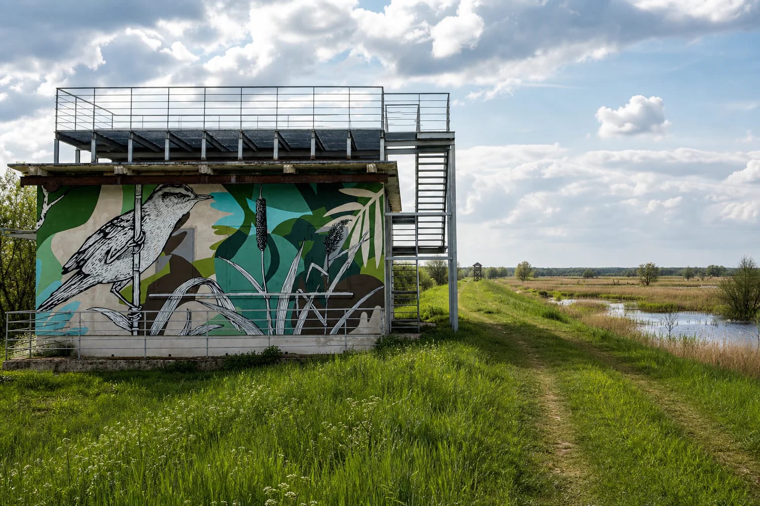
That is why the trail is more than a checklist of birds. It thanks farmers who work in ways compatible with nature and explains how correctly timed mowing keeps open meadow habitat from disappearing. The aquatic warbler painted across the pumping station expresses this idea. Saugoma.lt presents it as a globally threatened bird that still breeds in the Nemunas Delta and could return to suitably managed Tulkiaragė meadows, although no wildlife sighting can ever be guaranteed.
The pumping-station roof has been the trail's defining viewpoint since 2015
In July 2015, the Environmental Projects Management Agency reported the public launch of the trail created on the initiative of the Baltic Environmental Forum. A pumping station disused for several decades was revived with street-art murals, an open rooftop birdwatching platform, and a living nature school. One facade carries the enormous aquatic warbler; a farmer appears on the river side; and the warm south wall has nesting boxes and shelters intended for birds, bats, and insects.
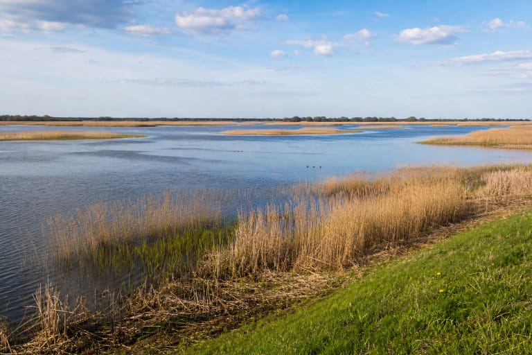
Rotating panels and exhibits with moving parts line the dyke. Visitors can blow across a bottle to imitate a great bittern, examine wood gnawed by a beaver, learn about the planks used by wetland workers and broad bog shoes made for horses, and climb onto the unusually high-legged Dreamers' Bench. A modest timber lookout farther along faces Krokų Lanka, although reeds, season, and visibility determine how much open water you see.
On 20 July 2026, Saugoma.lt still listed both the rooftop platform and the trail as visitor sites, and the checked official pages carried no closure notice. That is not a same-day structural inspection. The metal steps and smaller timber features can be wet, damaged, or temporarily fenced off, so do not climb if you see a barrier, a missing tread, loose rails, or any other warning sign.
Arrival, parking, and accessibility all require advance planning
Tulkiaragė lies approximately 8 km from Šilutė. The final stretch of regional road 4243, Atmata Riverbank - Tulkiaragė, is unpaved, so save the map before leaving and consider road conditions after prolonged rain. The official object pages do not identify a marked asphalt car park. Leave your vehicle only on firm ground where local signs permit it, and never block farm, polder-maintenance, or emergency access near the pumping station.
Tulkiaragė can also be approached from Krokų Lanka by water, but that is a separately regulated route rather than an extension of the walking trail. The Environmental Protection Department permits navigation throughout the season on the Atmata - Duobelė - Krokų Lanka - Tulkiaragė pumping station return route, with powered craft restricted to the lowest speed at which they remain controllable; recreational fishing in Krokų Lanka is prohibited. Check the current rules and water conditions before setting out.
The official trail and platform listings publish no ticket office, compulsory admission charge, or fixed opening hours. This is a remote outdoor site, so visit in daylight and check the Directorate of Protected Areas of Lithuania Minor for temporary notices. The listings also do not confirm a toilet, drinking-water point, or operating café. Uneven grass, seasonal mud, and stairs at both viewpoints mean the complete route should not be treated as wheelchair or pushchair accessible.