
- Place
- Šilutė District Municipality
- Region
- Nemunas Delta Regional Park
- Type
- linear raised-bog boardwalk with a wooden observation tower
- Address
- near Rūgaliai village, Kintai eldership, Šilutė District
- Coordinates
- 55.39100, 21.35600
- Visit duration
- 1-1.5 hours for the approximately 2.4 km return walk
- Best time
- a bright morning or evening from late spring to autumn
Aukštumala Raised Bog Nature Trail, Aukštumala Bog Trail
A 2.4 km walk there and back
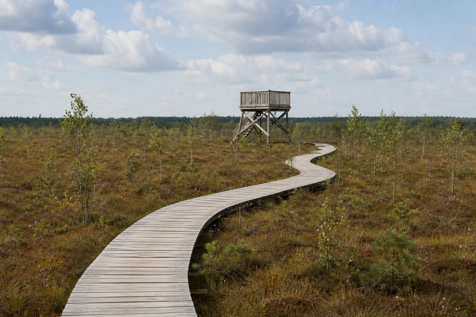
Aukštumala Nature Trail lies in Aukštumala Telmological Reserve within Nemunas Delta Regional Park. Its officially stated length is 1.2 km one way. The route is linear, so walking to the end and returning along the same trail covers about 2.4 km.
The trail gained almost 350 m when it was renewed in 2016. Its wooden boardwalk winds across the open raised bog, with information panels and rest points along the way, while the final section has a timber observation tower and viewing platform.
An eighteenth-century kūlgrinda and vanished wetland settlements
The modern boardwalk follows the site of a former kūlgrinda. The directorate describes it as different from the stone causeways usually associated with kūlgrindos elsewhere in Lithuania: in the eighteenth century, a route across the bog linked the now-vanished wetland-settler villages of Rūgaliai and Vabalai. It is a historic line through the landscape, not an exposed old stone pavement on today's trail.
According to the directorate, almost 2,000 wetland settlers lived in these villages at the time. Some grew potatoes and other vegetables for export to East Prussia, while others worked in the peatland. The trail therefore tells not only the bog's natural history but also the story of people trying to live and farm within it.
What to see in Aukštumala Raised Bog
From the boardwalk you see the low, level landscape of a Pamarys raised bog: sphagnum cover, russet and green peatland vegetation, young birches, low pines, and dark bog pools. Aukštumala has more than 380 pools across the entire bog massif, so only part of this system is visible from the trail.
The reserve protects active and recovering raised bog, natural dystrophic lakes, Rhynchosporion depressions, and bog woodland. Species found here include cross-leaved heath, rare sphagnum mosses, and protected birds, although wildlife sightings are never guaranteed. The most rewarding details are the small plant forms, water reflections, and subtle changes across the bog surface.
From Carl Albert Weber's research to bog restoration
The German botanist Carl Albert Weber studied Aukštumala in detail from 1898 to 1900. In 1902 he published a monograph about the bog that VLE and the protected-areas directorate describe as the world's first book of peatland science. Trail panels connect that scientific history with the raised-bog landscape in front of you.
Around Aukštumala, preserved bog survives beside areas affected by drainage and peat extraction. Work to restore water levels and habitats has continued in different parts of the bog since 2013, while the renewed trail has allowed visitors to experience it without trampling the peat surface since 2016.
Getting there and visiting safely
The trail is near Rūgaliai village in Kintai eldership. The coordinates 55.391, 21.356 on this page mark the trail site, and the navigation link is tied to the exact Google Maps place listing. Follow local signs on arrival and check the directorate's news before travelling, as maintenance, wildfire danger, or other conditions can occasionally lead to temporary restrictions.
The official trail pages do not publish fixed opening hours or a mandatory admission price. The directorate offers a voluntary symbolic visitor ticket, advertised at €1.35 in June 2026, but current terms should be checked before visiting. Go in daylight, stay on the boardwalk, keep children close, and expect wet or frosty planks to be slippery. Water, sun protection, and insect repellent are useful in summer.


