- Place
- Klaipėda District Municipality
- Region
- Samogitia
- Type
- hillfort of national significance with a foot settlement in Klaipėda District
- Address
- Vyskupiškiai, Veiviržėnai Eldership, Klaipėda District
- Coordinates
- 55.55906, 21.51744
- Visit duration
- 45-90 minutes, for the earthworks, monument, and Veiviržas valley view
- Best time
- in dry daylight; check access before travelling and take care on wet, steep slopes
Ragokalnis, Papilys, Skomantų Hillfort and Cemetery
Ragokalnis is a registered hillfort and settlement complex
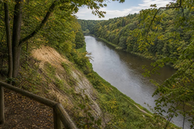
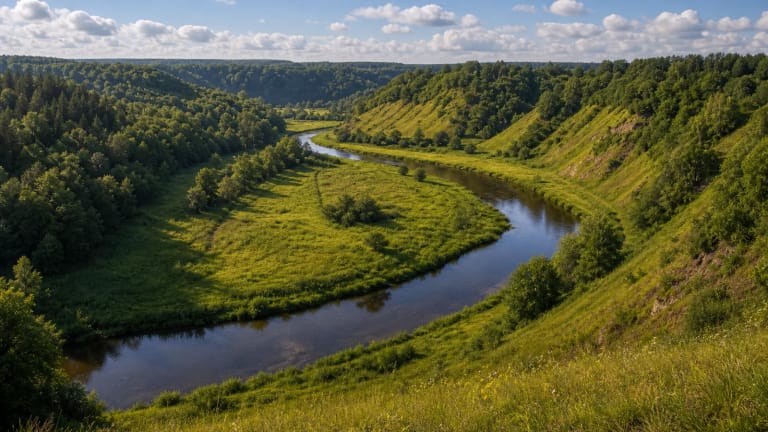
Skomantų Hillfort is west of Skomantai village, in Veiviržėnai Eldership, Klaipėda District Municipality. The Cultural Heritage Register gives Vyskupiškiai village as the official location. The hillfort occupies a highland promontory on the right bank of the Veiviržas, so the site's character comes from both earthworks and river-valley relief.
The register lists the Skomantų Hillfort and Settlement complex, unique code 23775, as a monument of national significance. Its components are the hillfort, also called Ragokalnis, Raguvos kalnas, and Raguva, code 5192, and the foot settlement, code 23776.
Sources use several names: Ragokalnis and Papilys. VLE's title joins the hillfort with a separately described cemetery. This page's visitor point is the hillfort and foot settlement, not the cemetery about 0.5 kilometres to the north.
The coordinate 55.5590621, 21.5174428 marks the hillfort location recorded by the Cultural Heritage Register. It does not promise a car park, steps, or one single entrance directly beside that point.
Steep slopes are reinforced by several ramparts and ditches
VLE gives the hillfort's slopes as 20-22 metres high. The summit is trapezoidal, about 80 metres long, and approximately 57 metres wide at the western end and 40 metres at the eastern end. These dimensions show that this is more than a small hill with one bank.
Several ramparts and ditches were formed on the western side, while another rampart and ditch remain at the eastern edge of the summit. The best way to read the relief is slowly: notice how the high ground meets the valley instead of trying to climb every slope directly.
Grass can conceal holes, roots, and uneven ground. After rain, steep places become slippery, so do not look for the shortest line upward and do not cut across the earthworks.
The hillfort and foot settlement date from the first millennium to the 13th century
VLE dates the hillfort and foot settlement from the middle of the first millennium to the 13th century. The foot settlement west of the hillfort covers about one hectare, so the archaeological site is broader than the summit and banks alone.
A. A. A. Plater excavated the hillfort in the late 19th century. In 1903, L. Krzywicki's expedition found clay daub and charcoal in a cultural layer up to 60 centimetres thick; in 2010, A. Bliujienė's expedition found a layer up to 65 centimetres thick with pottery on the hillfort. The foot-settlement layer reached 1.8 metres in places.
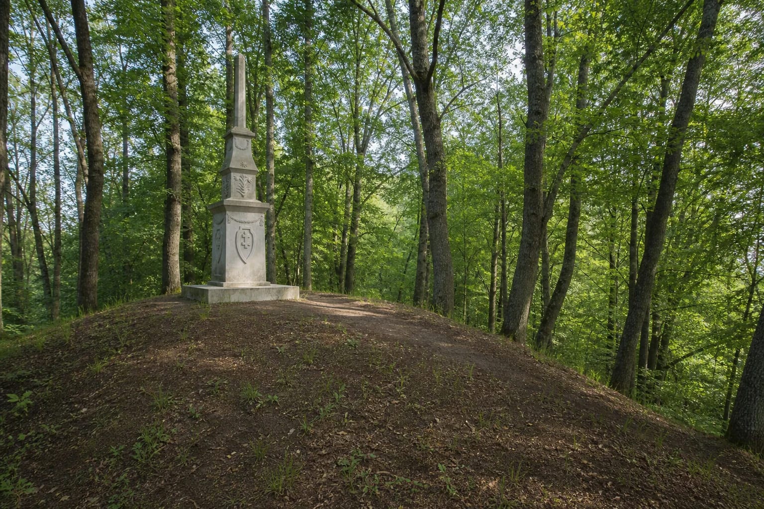
The concrete monument designed by Kostas Rameika was erected on the highest rampart in 1928. It commemorates the tenth anniversary of Lithuanian independence and the fifth anniversary of the Klaipėda Region joining Lithuania. Klaipėda District Municipality also records that Vytautas Majoras's wooden sculpture Žemaitis was installed at the foot in 1965. These are 20th-century memorials on a much older archaeological landscape.
Legends belong to local memory, not to archaeological conclusions
Stories tell of Swedish treasure hidden in the hillfort and still supposedly running around, as well as of Skomantas as a Samogitian ruler or prince. These tales add an imaginative layer to the visit.
Stories about treasure, pagan rites, or named rulers are not the same as an archaeological conclusion. At the hillfort, keep local folklore, the later memorial, and evidence from cultural layers and written sources as distinct parts of the story.
The cemetery north of the hillfort is a separate heritage object. Do not search for finds in unmarked areas, dig into the soil, or take anything from the banks or foot settlement.
The terrain and heritage matter more than infrastructure assumptions
The sources checked do not provide a dependable current description of steps, a permanent path, a parking layout, opening hours, or a ticket. Arrive in daylight, assess the final approach on site, and leave a car only where permitted.
The hillfort slopes are steep, so wear shoes with good grip, keep children away from edges, and choose weather when the ground is not saturated. In winter, freezing rain, or after heavy rain, viewing the earthwork from the foot may be the safer choice.
This is a protected archaeological landscape: do not light fires, drive across slopes, leave rubbish, or ignore seasonal and conservation notices.