- Place
- Plateliai, Plungė District Municipality
- Region
- Žemaitija National Park
- Type
- 4.1 km circular walking nature trail
- Address
- 35A Ežero Street, Plateliai, Plungė District Municipality
- Coordinates
- 56.04841, 21.82736
- Visit duration
- 1.5-2.5 hours for the 4.1 km loop
- Best time
- May to October in daylight, when forest and wetland surfaces are not icy
Šeirė Trail
Where the 4.1 km Šeirė loop begins
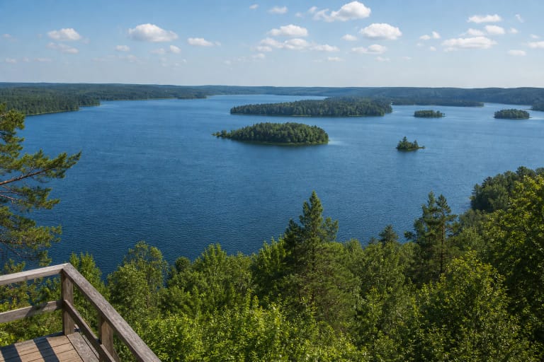
Šeirė Nature Trail starts and finishes at the Lake Plateliai viewpoint and car park at 35A Ežero Street. The official trailhead coordinates are 56.048411, 21.827357, approximately 1.3 km from the Žemaitija National Park visitor centre in Plateliai. An information board stands at the start, and arrows mark the route.
This is a 4.1 km circular walking trail in Plateliai Landscape Reserve, not the entire cycling network around Lake Plateliai. About 1.8 km overlaps the Lake Plateliai cycling route, so walkers should look out for cyclists and leave room to pass on the shared section.
The official guided walk takes approximately two hours. Allow 1.5-2.5 hours independently, depending on stops beside the lake and at interpretation points, the group's pace, and forest surfaces after rain.
From Lake Plateliai through Šeirė Forest to Piktežeris
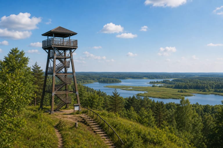
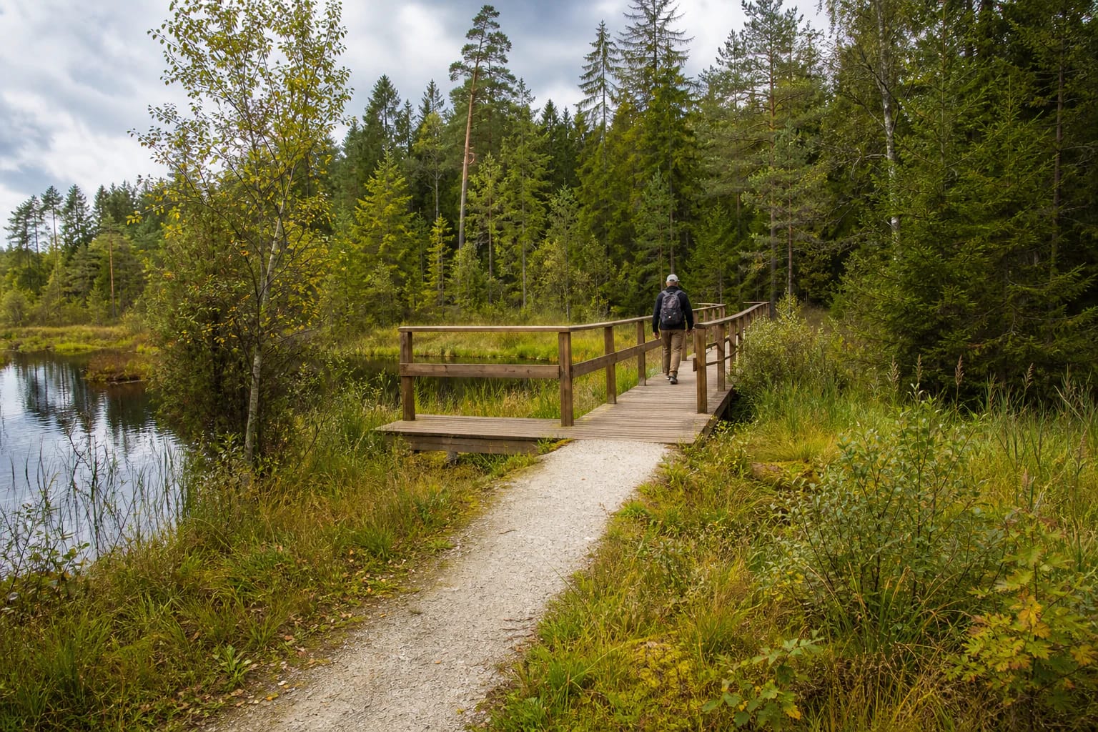
Several Žemaitija National Park landscapes unfold over a short circuit. From the Lake Plateliai shore, the path rises and falls through hilly Šeirė Forest, crosses fern-filled gullies, reaches small Piktežeris, and enters the wet Gaudupis environment. Spruce, pine, birch, and alder grow along the forest route, while reeds, sedges, mosses, and peat define the wetland.
Most of the route uses compacted or natural forest surfaces. Only one relatively short, low timber bridge with handrails and a widened stopping platform crosses Gaudupis bog. The bridge was renewed in November 2024. Šeirė should therefore not be imagined as a 4.1 km boardwalk: the wooden structure is one part of a mixed-surface loop.
The Piktežeris and Gaudupis section is a sensitive transitional mire habitat, and the whole route lies within a protected landscape reserve. Remain on the marked trail and timber crossing, do not step onto peat vegetation, and leave plants and natural objects where they are.
Play areas, audio stories, and interpretation points
The official trail description identifies four play areas and several rest stops, giving children nature-related activities as well as a walk. The condition and availability of individual elements can change, so plan this as a self-guided forest hike rather than travelling solely for one play installation.
Two hand-cranked audio devices were added in 2024. Turning a handle supplies the energy, and the devices play stories in Samogitian and English about the bog ecosystem and legends of Lake Plateliai. They work without a visitor's phone or headphones, although maintenance can affect availability on a particular day.
Two information boards with Braille were installed in the same year. They broaden access to selected subjects along the route, but a small number of tactile displays does not make the entire hilly, mixed-surface trail barrier-free.
Why official sources say both 1.4 km and about 700 metres
The main Žemaitija National Park trail page and an official 2014 description state that 1.4 km is adapted for visitors with mobility impairments. A newer park update dated 2 December 2024 instead says that approximately 700 metres is adapted and also mentions two Braille information boards. These are inconsistent official statements from different dates and should not be combined into a single invented figure.
Neither source presents the entire 4.1 km loop as fully accessible. Hilly terrain, forest surfacing, the wetland bridge, and seasonal damage also mean that suitability depends on the exact section. Before travelling, ask the Plateliai visitor centre where the adapted section currently starts and turns back and whether the bridge is in suitable condition.
Families with pushchairs should use the same caution. Claims of either 700 metres or 1.4 km of adaptation are not a promise that a pushchair can complete the whole loop. Larger wheels help on compacted ground, but rain, roots, and slopes may make turning back necessary.
Visitor ticket, guided walks, and responsible seasonal access
The official trail description lists no entrance-gate charge, mandatory registration, or fixed opening hours for an independent walk. The state park visitor ticket is voluntary for individual visitors. On 27 April 2026, the State Service for Protected Areas listed €1 for one day in one park, €5 for 30 days in one park, and €25 for an annual ticket covering all parks. Prices may change, so check the official page.
The official guided walk of approximately two hours must be booked in advance and is offered on weekdays and Saturdays. On 21 July 2026, the published Lithuanian or Samogitian rate was €3 per person per hour, or €30 per hour for a group of up to ten; in a foreign language, the corresponding rates were €4 and €40. Confirm current availability, language, and final group price with the park before booking.
The trail is not lit like an urban promenade, so walk in daylight. Natural surfaces can soften after rain, wet timber becomes slippery, and snow or ice can hide path edges in winter. Tick and mosquito protection is useful in warmer months. Keep dogs on a lead, do not enter the wetland away from the trail, and carry out all waste.