Plungė District Municipality
Samogitia
forest and lake-relief educational trail in Žemaitija National Park
Paplatelė village, Plungė District
56.04684, 21.88582
1-1.5 hours; longer with stops by water and wooden sculptures
May-October; autumn for forest colours, spring for clearer relief
Paplatelė Trail
Paplatelė Trail: a quiet forest route near Plateliai
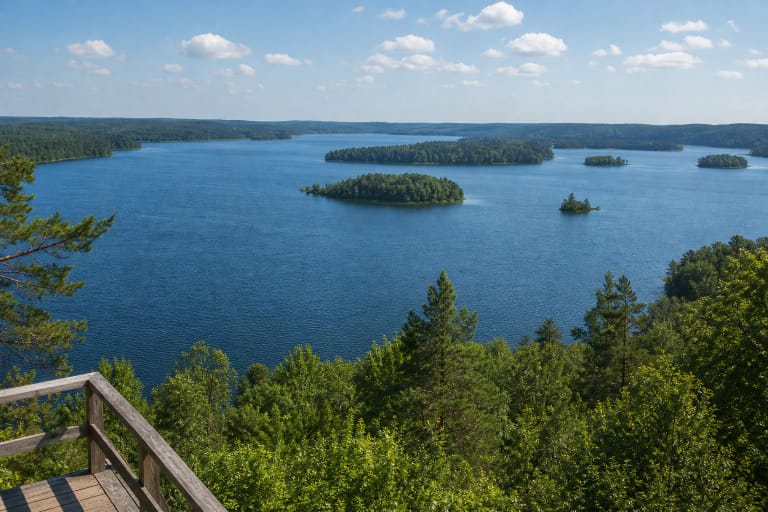
Paplatelė Educational Trail is a good choice when you want more than the main Lake Plateliai views in Žemaitija National Park and prefer a quieter forest route. The trail runs around Paplatelė village, on the eastern side of Plateliai, the largest lake in Samogitia.
Žemaitija National Park, where the trail lies, was established in 1991 and covers 21,754 ha in Plungė and Skuodas districts; it is the largest lake-filled and forested natural complex in Samogitia, with 21 natural lakes. The trail is about 2.3 km long, short enough for a family or afternoon walk yet varied enough not to feel like an ordinary forest path. It includes a viewing platform and educational stops.
Glacial Paplatelė relief underfoot
The value of Paplatelė Trail lies in its hilly relief. The Žemaitija National Park description connects it with the landscape formed by the last Ice Age, about 13,000-13,500 years ago. The whole park protects moraine and kame landscapes, so the Paplatelė hills are part of a much larger glacial-relief mosaic.
As you walk, notice slopes, depressions, water bodies, and turns in the route. The hills are not mountain-high, but they explain the lake-rich, rolling character of Žemaitija National Park, shaped by meltwater from a retreating glacier.
Sultekis and water stops
The trail passes the Sultekis Pond area, so the forest route also has a water accent. Water here matters not only for the view; it extends the relief story and gives the route more calm.
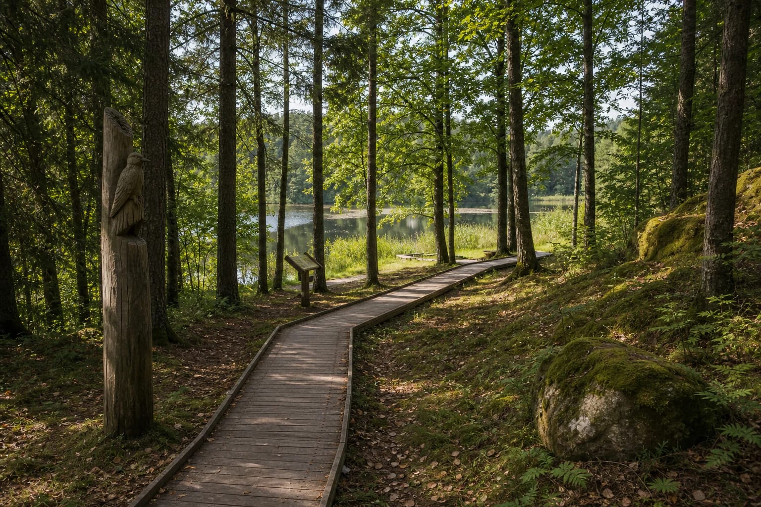
It is worth stopping by the water, especially with children. On trails like this the experience often consists of small pauses: the viewing platform, a wooden sculpture, a bird sound, light through trees, and water reflection.
Wooden sculptures and trail signs
Paplatelė Trail includes wooden sculptures that help the route become interpretive rather than purely natural. They give children clear markers and remind visitors that Žemaitija National Park trails often combine nature learning with local creativity.
They should not be overvalued as the main object. The sculptures are an added layer; the main subject remains the forest, relief, and water.
How to visit Paplatelė Trail
The trail begins in Paplatelė village. Žemaitija National Park information gives the starting coordinates as 56.046841, 21.885817. Allow 1-1.5 hours, longer if you plan to stop by the water or take photographs.
After rain the trail can be wetter, so choose comfortable footwear. In summer, insect protection is useful, and in autumn bring a warmer layer because forest and water areas can feel cooler.
What to combine nearby
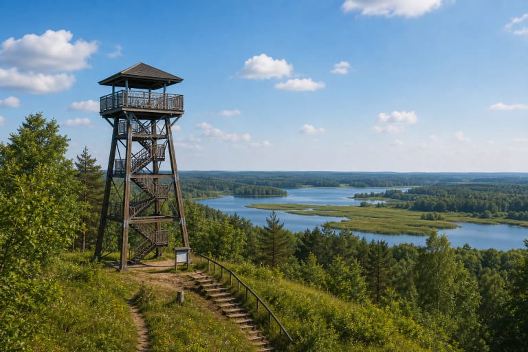
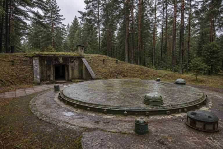
Paplatelė Trail is easy to combine with Lake Plateliai, Siberijos Observation Tower, Beržoras, and the Cold War Museum in Plokštinė. If you want a quieter nature route, start with the trail and then drive to the lake panoramas.
The trail is especially suitable for travellers looking for an easy but not empty walk in Žemaitija National Park. It gives nature, relief, and small interpretive markers.