- Place
- Prienai District Municipality
- Region
- Nemunas Loops Regional Park
- Type
- urban riverside viewpoint beside Greimai Bridge
- Address
- Dariaus ir Girėno g. 2, Prienai
- Coordinates
- 54.63110, 23.94922
- Visit duration
- 20-45 minutes; longer with the riverside walk
- Best time
- a calm morning or evening when side light defines the river and bridge
Nemunas Riverside Viewpoint, Viewpoint by Greimai Bridge
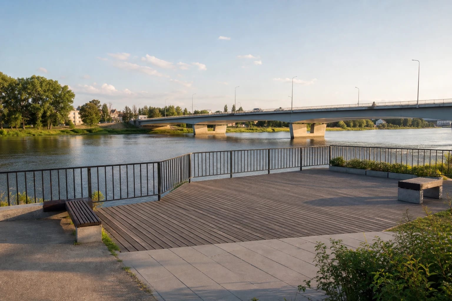
A small viewpoint right beside Greimai Bridge
The platform sits low on the urban riverfront, so its strength is proximity rather than height. You see the width of the Nemunas, the direction of its flow, the bridge supports, and the relationship between the two banks of Prienai. It is an intimate river view, not a distant panorama from a cliff.
The bridge is named for Jonas Greimas and Algirdas Julius Greimas. The Universal Lithuanian Encyclopedia notes that the name was given in 2010, linking the former mayor of Prienai with his son, the internationally influential semiotician.
Prienai on both banks and at the meeting of two regions
Most of Prienai forms a narrow strip on the left bank, while Paprienė stands on the right. The bridge joins them physically, and the riverfront also marks a symbolic boundary between Suvalkija and Dzūkija. That makes this location meaningful even without a tall tower.
At Prienai the Nemunas forms a loop about 17 kilometres long, part of the Great Nemunas Loops system. Saugoma.lt identifies this hydrographic phenomenon, together with valleys, exposures, and old forests, as one of the regional park's defining values.
Part of a riverfront route rather than a single-photo stop
The platform itself may take only a few minutes, so combine it with the riverside path. Municipality information describes a paved route connecting the viewpoint with the pier near the bridge and Revuona Park, while other central public spaces are also close.
The viewpoint and approach were delivered with lighting, street furniture, parking, and accessibility work. Lower riverfront sections can nevertheless become temporarily awkward after floods, frost, or repairs.
The existing viewpoint and future works are not the same
The viewpoint beside Greimai Bridge already exists. In 2026, however, the municipality launched a much broader programme running to 2029 to improve the Nemunas riverfront, the area around the Kęstutis monument, paths, rest areas, and visitor infrastructure.
The 2026 design proposals mention additional observation areas, an elevated timber path, and new connections. Do not attribute those future elements to the present platform. During construction, follow signs and current municipality notices.
Photography and safe access
Morning and evening side light brings out the bridge structure and reflections. After heavy rain the Nemunas may be higher and turbid, while an open riverfront can be icy in winter. Stay behind railings and never enter a flooded path.
This is a free public space with no ticket office or museum-style opening hours, though daylight is the safest time to visit. Park only in marked places, keep access routes clear, and share the combined path predictably with cyclists.