- Place
- Žarijos village, Prienai Eldership, Prienai District Municipality
- Region
- Suvalkija
- Type
- the hillfort component of a nationally significant archaeological monument complex, with a stream-eroded summit and a separately protected ancient settlement
- Address
- Žarijos village, Prienai Eldership, Prienai District Municipality
- Coordinates
- 54.64494, 24.01255
- Visit duration
- 30-60 minutes to read the wooded banks, ditches, and slopes; allow extra time to find a lawful approach from the public road
- Best time
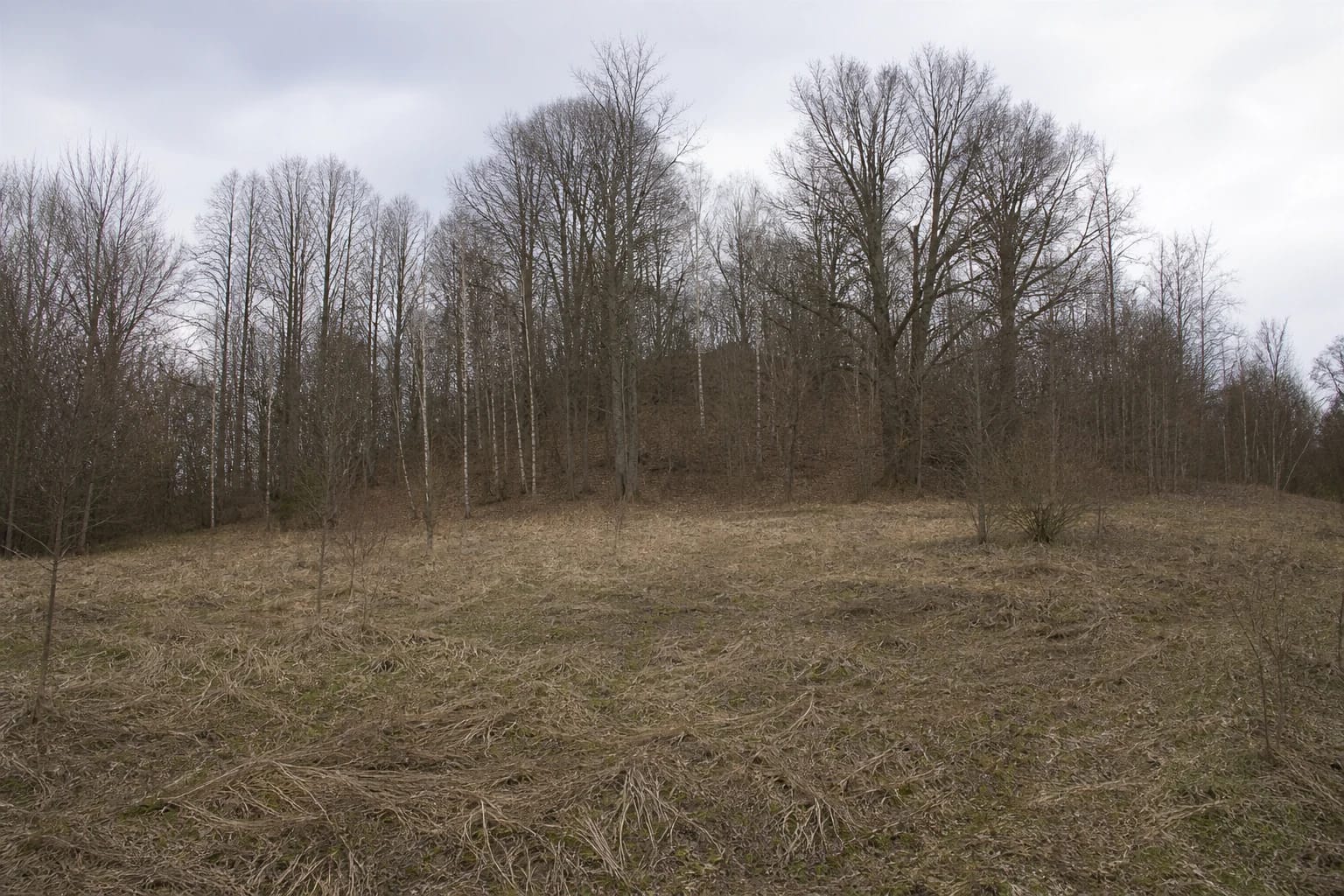
- a dry day in early spring or late autumn, when bare branches expose the banks; dense foliage and undergrowth obscure almost the whole landform in summer
Žarijos II Hillfort and Settlement, Žarijų piliakalnis II su gyvenviete, Žarijų II piliakalnis
Žarijos II is a separate woodland mound about 350 m east of Žarijos I
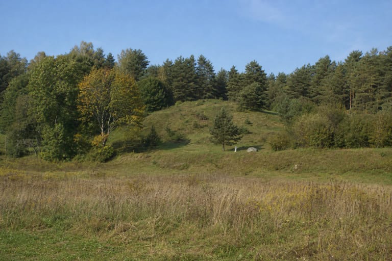
Žarijos II Hillfort occupies a spur of the upper terrace above the left side of the Nemunas valley. Deep, broad gullies containing a small unnamed stream wrap around its north-eastern, northern, north-western, and western sides; another gully closes the south, while the upland continues only to the east. Dense deciduous trees and shrubs now blur these boundaries, so the first feature seen from the meadow is a rounded wooded slope rather than a clearly defined summit.
Žarijos I is a separate hillfort roughly 350 m to the west. Žarijos II is identified by KVR complex 22965 and its hillfort component 5508. Searching only by the village name can bring visitors to the wrong mound, so check the Roman numeral, coordinates, and register number together.
The exact Google Maps listing for Žarijų II piliakalnis marks 54.6449379, 24.0125481. Its place ID is ChIJzY18TOM350YRjuvZjSaQR2s and its CID is 7730305780667771790. On 15 July 2026, it showed a perfect 5.0 out of 5 from one review. That cleared the 4.5 selection threshold, but a single vote is an exceptionally fragile sample: the very next rating can change the average immediately.
A stream removed most of the summit, but the 33 m arc of the main bank can still be traced
The KVR description recording conditions in 2021 calls the summit oval, aligned south-west to north-east, and only about 7 m long by up to 2 m wide. This is merely the surviving fragment: the stream washed away most of the crown. Trees and shrubs cover what remains, so the narrow platform feels less like a level viewpoint than a short strip of ground beside steep drops.
The main bank curves around the eastern, southern, and western sides of the summit. It is about 33 m long, 6.5-13 m wide, and rises as much as 2 m above the inner side. The stream removed not only the northern part of the summit but part of this enclosing bank. Pits and animal burrows damage what survives, although the register recorded no active new disturbance in 2021.
The proportions matter: the 33 m bank is several times longer than the 7 m summit fragment. Žarijos II is not a symmetrical green cone or a reconstructed castle mound. It is a spur reshaped by water, erosion, human-made earthworks, and woodland, with the defensive arc now accounting for more visible terrain than the crown it once protected.
A low second bank survives on the western slope, while two ditches occupy different levels
About 7 m below the summit, the western slope carries a ditch roughly 22 m long, 2.5 m wide, and no more than 0.5 m deep. Beyond it lies a much lower second bank, approximately 25 m long, 5 m wide, and up to 0.5 m high. Under trees, this sequence can resemble ordinary undulations, so it is easier to read by following the changes in level than by looking for a crisp ditch profile.
A second ditch lies at the eastern foot. It is substantially broader and deeper, about 13 m wide and up to 3 m deep. Both ditches have partly slumped or filled and are covered by trees and shrubs. Their different measurements belong to different sides of the mound; the depth of 3 m must not be transferred to the 22 m western ditch.
The natural slopes are steep and rise 10-20 m. The northern slope has been partly washed away, while minor erosion and animal burrows affect other sides. Undergrowth, leaf litter, and shallow holes complicate footing even without rain. Observe the earthworks from stable ground rather than descending into gullies merely to reach every recorded feature.
The hillfort is unexcavated; the finds from 1963-1964 belong to its separate settlement
The Cultural Heritage Register treats Žarijos II Hillfort and Settlement as complex 22965. It consists of hillfort 5508 and ancient settlement 22966. The complex has monument status and national significance, while the e-TAR list of cultural monuments preserves its former identifier A216KP. The present KVR territory covers 34,562 square metres, far more than the slender surviving summit.
KVR explicitly calls the hillfort's cultural deposit unexcavated. No published excavation section therefore supports a plan of buildings, a destruction date, or a named castle. Reconnaissance expeditions appear in the bibliography for 1971 and 1988, but field survey is not the same as a systematic excavation across the summit.
The recorded finds belong to the settlement component. During survey in 1963-1964, sherds of rough-surfaced handmade pottery were found at the south-western foot, while flint artefacts and more rough pottery were recovered east of the hillfort. They document activity in the settlement area but do not form a sealed assemblage excavated from the summit. The fallow and cultivated ground at the foot remains protected, so do not collect or dig there.
The current register says first millennium; the church and weapons depot remain stories
The current KVR dates the complex, hillfort, and settlement to the first millennium. Prienai Regional Museum and the municipality still publish an older range extending into the beginning of the second millennium. Because the register data were subsequently refined, this guide follows its narrower present chronology. Even that does not identify the century in which each bank was constructed.
The older official summaries also measure the summit differently. The museum gives 2 by 5 m, the municipality roughly 15 by 6-7 m, and the 2021 register about 7 by 2 m for the surviving platform. The municipal page also calls the whole irregular hill 150 by 280 m without explaining that boundary. These figures cannot be combined into one plan; the latest KVR landform description is the most useful guide to what survives.
KVR and the municipality record two competing traditions. Some people said that a church stood on the hill; others spoke of weapons stores. Neither church foundations nor the remains of a depot are presented as archaeological finds. The documented mention of nearby Bagrėnas and Rūdupis from 1609 belongs to the later history of the surrounding villages, not evidence for either tale.
An old field-road description confirms neither present vehicle access nor a right of way
An older public description from Prienai Eldership approaches Žarijos II from the Strielčiai-Pociūnai road, turning onto a field track beyond the woodland and walking the final section to the forest edge. That text confirms neither the track's present surface and ownership boundaries nor permission to drive it. The exact Google coordinate marks the hillfort itself, not an entrance or car park.
The official sources checked for this guide identify no marked parking area, steps, handrails, information panel, toilet, or reliable step-free path. Leave a vehicle only where it is legal and safe beside a public road, do not block a farm or field entrance, and never drive over crops. If the approach is unclear or agricultural work is under way, turn back and verify the route with the eldership or municipality.
Official sources publish no admission charge, ticket office, or gated opening hours. This is an unlit, unattended, densely overgrown archaeological site, so visit in daylight, in dry weather, and preferably before leaf-out or after leaf-fall. Steep 10-20 m slopes, pits, animal burrows, and the unverified path mean the site should not be presented as wheelchair-accessible or suitable for small children without close adult supervision.