- Place
- Paverkniai I, Birštonas Municipality
- Region
- Nemunas Loops Regional Park
- Type
- hillfort with a foot settlement
- Address
- Paverkniai I, Birštonas Municipality, by the Verknė valley
- Coordinates
- 54.60688, 24.08530
- Visit duration
- 45 minutes-1 hour; longer if you study the approach, stairs, and Verknė valley setting
- Best time
- a dry day from late spring to autumn; steps, grass, and the earth path can be slippery after rain
Ginkaus Hill, Žydeikoniai Hillfort, Kisieliškė Hillfort, Paverkniai Hillfort
Paverkniai Hillfort: a surviving corner above the Verknė valley
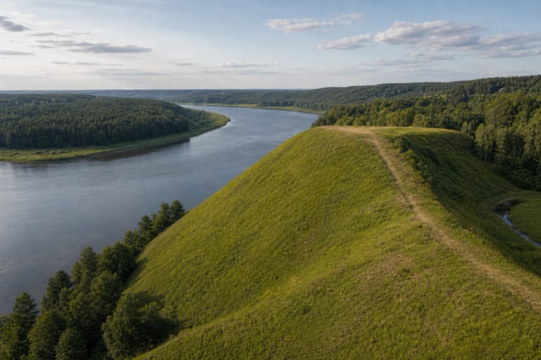
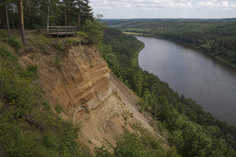
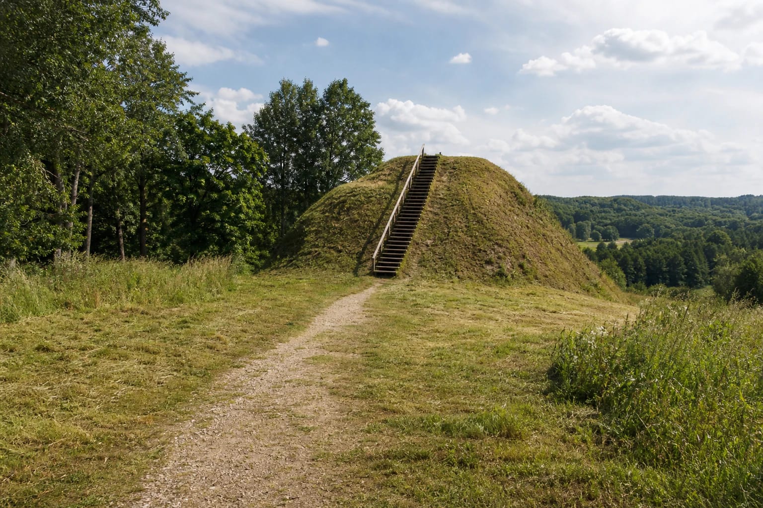
Paverkniai Hillfort was built on a separate hill in the valley on the left bank of the Verknė. By the nineteenth century the river had washed away almost the entire hillfort, so visitors now see its south-western corner rather than a complete defensive mound. The surviving slope is about 14 metres high, with a platform fragment roughly 6 by 8 metres at the top.
This is the site's defining detail. The stairs lead to a small surviving piece of relief, not to a broad level summit with a reconstructed castle. From the path, visitors see a grass-covered earthwork, a line of trees, and the green Verknė valley. River erosion is not just a historical footnote here: it explains why the monument is so fragmentary.
Ginkaus Hill, Žydeikoniai, and Kisieliškė names
Official and encyclopaedic descriptions use Ginkaus Hillfort or Ginkaus Hill alongside the name Paverkniai. Žydeikoniai and Kisieliškė Hillfort are also found in sources. These are not several different hillforts, but names that help identify the same Paverkniai I archaeological complex.
The hillfort and foot settlement are a cultural-heritage object in Birštonas Municipality. It was declared a cultural monument in 1998, and heritage and research documents use the A217K code alongside other register codes. Use the specific map point when navigating because the Paverkniai village and nearby manor-site features may appear separately.
Eleventh- and twelfth-century fires survive in the cultural layer
In 1994, archaeologist Gintautas Zabiela excavated a 10 sq. m section of the surviving platform and found a cultural layer up to 1.3 metres thick. The lower layer contained remains of a timber defensive wall, burnt bronze ornaments, smooth and rough-surfaced pottery, grain, and an iron arrowhead.
The research points to two destructions of the castle. The first attack dates to the eleventh century. Afterwards, the burnt layer was covered with sand up to 60 cm thick and the platform edge was reinforced with stones. In the twelfth century the castle was attacked and burnt again; barbed arrowheads and parts of broad-bladed axes are associated with the assault. The hillfort dates from the second half of the first millennium AD to the twelfth century.
This account is based on archaeology rather than a later legend. On site, imagine a timber defensive settlement whose fortifications and daily life left several layers beneath today's grass, not a reconstructed stone castle.
The foot settlement is a separate part of the complex
An ancient settlement of about 1 hectare lies at the western and southern foot of the hillfort, once enclosed by an old channel of the Verknė. Smooth and rough-surfaced pottery was found there. People therefore lived not only on the defended hill but also in the wider valley space around it.
In 2010, researchers examined eroding slopes and areas where visitor infrastructure was planned. A total of 368 sq. m was investigated at the hillfort and foot settlement, producing 284 pottery sherds and 10 individual finds. The settlement layer varied by location from a few centimetres to 40 cm, with finds dating from the middle of the first millennium to the twelfth century.
The settlement boundaries are not marked by a fence or a separate museum. It is part of the archaeological landscape, so do not dig, collect pottery, or drive across the meadow in search of an exact edge.
Reaching the hillfort and judging the stairs
The official approach runs from the Prienai-Trakai A16 road. At Būdos, turn north, drive about 3.5 km, descend into the Verknė valley, then turn east and look for the site on the left after roughly 450 metres. The hillfort point 54.606879, 24.0853032 is not a guaranteed car park.
Timber stairs and an earth path lead to the surviving corner. The stairs are steep, and their steps and the grass can be slippery after rain, in autumn, or in winter. The 2010 research description mentions visitor paths, a car park, and a rest area, but it does not guarantee that today's surfaces or parking arrangement remain unchanged. Park only where lawful and never drive onto the slope or foot-settlement meadow.
The full visit is not step-free. The final approach may be uneven and natural, and the top is reached by stairs. Visitors with mobility needs should assess whether viewing from below is sufficient and should not infer full accessibility from the presence of a maintained approach.
A short visit that must respect erosion
Allow about 45 minutes to an hour: walk from the approach to the stairs, read the local information, climb only on the marked route, and return by the same path. Allow longer if you want to study the foot-settlement landscape or combine the site with other Nemunas Loops Regional Park places.
The checked official pages publish no separate ticket or fixed opening hours. A daylight visit is safest: check current signs and stay away from erosion-damaged slopes above the Verknė when the ground is wet or fresh slips are visible.
Stay within the stairs and marked path, do not disturb the eroding slope, collect archaeological objects, or light a fire unless a clearly designated and permitted place exists. The protected value is not only the view but also a fragile archaeological layer that the river and visitor pressure can remove faster than it appears.