- Place
- Marijampolė, Marijampolė Municipality
- Region
- Suvalkija
- Type
- a nationally protected urban park of dendrological value on the right bank of the Šešupė
- Address
- between R. Juknevičiaus and Parko streets, Marijampolė
- Coordinates
- 54.57049, 23.34732
- Visit duration
- 1-3 hours for the dendrological trail, Šešupė riverbank, and selected leisure areas; longer with children, a picnic, or swimming
- Best time
- a dry spring day during the cherry blossom, a summer morning, or the autumn colour season; check the newest water-quality result before swimming
Pašešupio Park, Pašešupis Dendrological Park
Where Pašešupis Park is and where its territory ends
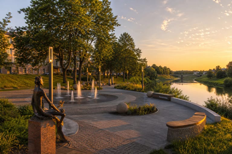
Pašešupis Park lies in the Degučiai area of northern Marijampolė, on the right bank of the Šešupė. In the official 2016 landscape programme, the Šešupė banks and the city boundary formed the west and north edges of the study area, Parko Street the east edge, and R. Juknevičiaus Street with adjacent buildings the south edge. Coordinates 54.5704923, 23.3473178 come from the municipality's embedded map and mark a representative point inside the park, not its only entrance or a car park.
The municipality's current park page gives an area of 27.39 ha and calls it the largest park in the city. The 2016 landscape programme studied a 25.9916 ha project area, while earlier municipal green-space lists used other close figures. They reflect boundaries and project areas from different years, so this visitor guide uses the latest 27.39 ha figure.
Do not confuse Pašešupis with the 4.36 ha Poetry Park in central Marijampolė, historic Vytautas the Great Park, or Marių Park beside the Marijampolė II reservoir in the south. On 21 July 2026, the latest publicly indexed summary for the exact Pašešupis Park Google Maps listing showed 4.6 out of 5 from 344 reviews. That cleared the 4.5 selection threshold, but both the average and review count will change.
Interwar planting, the 1977-1987 expansion, and national protection
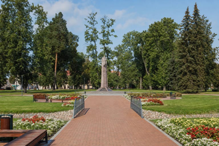
The park was created in the 20th century to designs by architect T. Šešelgienė and engineer T. Jūras. The official landscape programme distinguishes two planting periods, the interwar years and 1977-1987, and identifies an older avenue of small-leaved limes that predates the park's systematic development. Open ground makes up roughly half of the naturalistic composition, and an orchard survives in the western part.
On 21 June 2007, Environment Minister Order D1-352 declared Pašešupis Park, valued for its dendrology, a nationally protected botanical natural-heritage object. The 2016 programme counted roughly 10,000 trees and ornamental shrubs, mostly native species but also introduced taxa. Together with the Šešupė valley, the park lies in a regional migration corridor, which means continuity of the vegetation and river landscape matters alongside recreation.
In 2014, 25 young pines planted beside the eastern pond formed the Temperance Avenue. In 2022, another 60 flowering cherries were added: most on the island in the large pond, now called Sakura Island, and others near the picnic area. It is a young feature, so the blossom display depends on tree condition and the particular spring; the municipality was still using the Sakura Island name in its 2026 event information.
Planning a walk between the river, ponds, and mature trees
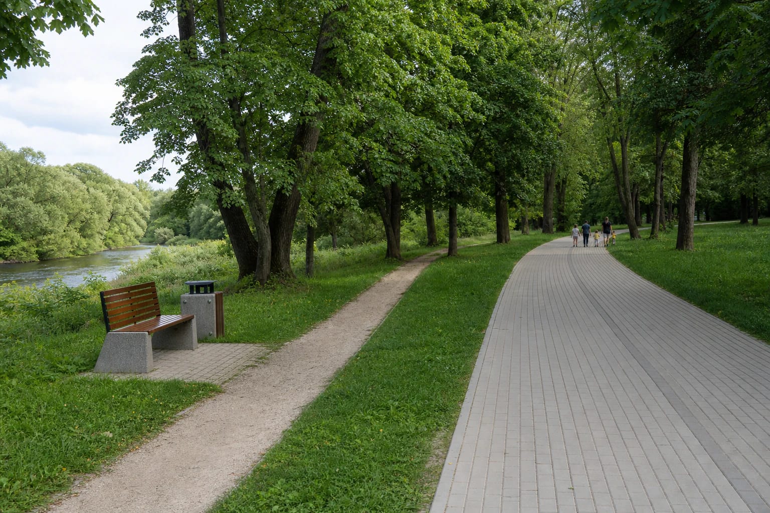
The main orientation line from the 2020 renewal is an approximately 1.5 km paved pedestrian and cycle path, 2.5 m wide, beside the Šešupė. Its principal section is illuminated. Alongside it is a 3 km dendrological trail with compacted aggregate surfacing, interpretation boards for notable plants, and a viewpoint furnished with stylised cube seats. The more natural side sections are not everywhere as smooth or as well lit as the main path.
The 2020 opening description mentions almost 4 km of side paths, while in 2022 the illuminated riverside connection was extended by another kilometre to the sports arena, with 30 LED columns and 16 benches. Do not simply add those lengths into one circuit: they describe different project phases and some segments connect with or follow the same corridor. For a first visit, follow the main path, add a loop of the dendrological trail around the ponds, and return by the same or another marked path.
Both park ponds were cleaned in 2020, their slopes and margins were repaired, and a flowering meadow was sown beside the larger pond. Look for Sakura Island and orchard blossom in spring, shade beneath the mature avenues in summer, and foliage colour in autumn. The ponds are not designated bathing places; the bathing area is in the Šešupė river.
Sports, children's areas, picnics, and everyday facilities
The sports and leisure project completed in 2020 installed badminton, beach-volleyball, and outdoor-tennis courts, disc-golf and football-golf areas, an outdoor chess table, and a recreational bike track with low rollers. The last is not a professional racing track or a venue for large jumps. Inspect surfaces, nets, and equipment before use, because a completed-project list does not confirm the daily technical condition of every item.
Children have several types of play area, including a space for younger visitors, rope-climbing equipment, and a swing designed for a wheelchair user. The park also has a renewed fenced dog-exercise area, barbecue and picnic space, benches, changing cabins, and a drinking-water tap. The public outdoor toilet still appeared on the municipality's 2026 toilet list, but check the same-day operation of the tap, toilet, and seasonal equipment on site.
This is an open municipal park, so there is no entry ticket or gate timetable. Individual events and organised activities can have their own hours and rules. The illuminated main route is more practical after dusk, but the entire 27.39 ha landscape is not uniformly lit, so use side paths in daylight.
Šešupė bathing place, water tests, and high-water risk
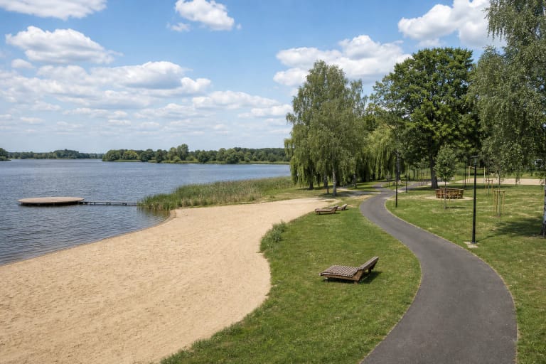
The park's sandy bathing place is in the Šešupė, not either pond. Changing cabins and an access platform, described as suitable for a visitor with limited mobility, were installed in 2020. No dependable permanent lifeguard timetable was found, so supervise children and less confident swimmers as though no lifeguard were present.
In the newest 2026 municipal table published by the review date, the sample taken from the Šešupė at Pašešupis Park on 7 July met the microbiological parameters of Lithuanian hygiene standard HN 92:2018; the page was updated on 9 July. That is one sample date, not a season-long guarantee. Excess E. coli was recorded here in July 2024, and after a temporary failure in 2025 only a repeat test confirmed acceptable water again. Check the latest municipal table and signs before every swim.
The National Public Health Centre advises avoiding swimming after heavy rain and when water changes colour or smell, becomes unusually cloudy, contains litter, or shows an algal bloom. Pašešupis Park occupies the low Šešupė valley, and the river experiences spring and rain-fed high water. After prolonged rain, lower paths, the beach, and natural surfaces can be wet, muddy, or flooded; never cross an inundated section or step onto unverified river ice.
Parking, accessibility, and completed work versus proposals
The clearest documented car park is beside Marijampolė Sūduva Gymnasium on R. Juknevičiaus Street. Completed in 2022, the illuminated lot holds more than 80 cars; a paved approach leads into the park, with bollards that stop motor vehicles while allowing a bicycle, scooter, or pushchair through. Other approaches come from the R. Juknevičiaus bridge, Parko Street, and surrounding residential districts.
In 2024, old steps beside Kokolos Street were replaced by a sloping path intended for pushchairs, older visitors, cyclists, and people with limited mobility. Handrails were still described at publication as an upcoming addition, so their presence is not guaranteed here. The level main path and inclusive swing improve access, but aggregate side paths, wet valley ground, the beach, and some sports surfaces mean the whole park is not universally step-free.
The three principal renewal projects officially opened in 2020, the car park and additional river route were completed in 2022, and the Kokolos Street slope in 2024. A municipal procurement entry dated 9 April 2026 covered a new children's play area with design work on the plot at 32 R. Juknevičiaus Street, but a procurement record alone does not prove that it is finished and open. Nor was confirmation found that the proposed 2022 change to shared-path signs had taken effect, so follow the signs on site and share the route carefully.