- Place
- Leliūnai Eldership, Utena District Municipality
- Region
- Aukštaitija
- Type
- a hillfort with a foot settlement and state-protected cultural heritage
- Address
- Pakalniai, Leliūnai Eldership, Utena District
- Coordinates
- 55.43898, 25.45841
- Visit duration
- 45-90 minutes; longer if you walk along Vidinkstas Lake
- Best time
- a dry, bright season; early spring and late autumn reveal the rampart relief more clearly
Švedų Baterija, Pakalniai hillfort with foot settlement
A hillfort beside Vidinkstas Lake
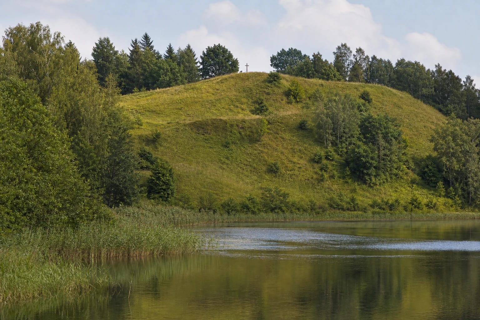
Pakalniai Hillfort lies in Utena District's Leliūnai Eldership, near Pakalniai village and Vidinkstas Lake. It occupies a separate hill on the lake's south-western shore, so a visit is best understood through both the summit and its relationship with the water and woodland edge.
The public KPD Cultural Heritage Register dataset identifies the hillfort component with unique code 3593 and point 55.438980, 25.458411. This coordinate marks the protected hill rather than a guaranteed parking place or the only path to the top.
Švedų Baterija is an important local name, but the hillfort is not a Swedish military structure. It is an archaeological site whose form, ramparts, and foot-settlement layer belong in the context of Lithuania's prehistory and early medieval history.
The summit, ramparts, and ditches
The summit is elongated, about 48 by 41 metres, with an approximately 0.5-metre-high and 7-metre-wide rampart along its edges. The Leliūnai Eldership description gives the hillfort's overall height as about 25 metres and separately says that the slopes were steepened 3 metres below the summit. These are different measurements: 3 metres locates the steepened section rather than describing the hill's total height.
A system of defensive ditches and ramparts survives below the summit. Descriptions mention a ditch about 8 metres wide and 0.8 metres deep, followed by a rampart about 1.2 metres high, while the western side preserves traces of several additional ditches and ramparts. The relief is easiest to read when grass is low and the ground is dry.
A settlement of about one hectare once occupied the southern and eastern foot. Do not assume that only the top of the hill is archaeological ground: the foot-slope relief and soil are part of the site's story as well.
What archaeological research revealed
In 1836, Pranciškus Vilčinskis found an iron object, small coins, and bronze horse bits at the hillfort. Later research helped distinguish chance finds from the cultural layer preserving traces of everyday life.
In 1989, an expedition of the Lithuanian Institute of History examined 16 square metres on the summit and found a cultural layer up to 35 centimetres thick, with postholes, hearth remains, fragments of brushed, smooth, and rough pottery, and animal bones. Research continued in the foot settlement in 1991.
The hillfort dates from the second half of the first millennium BC to the beginning of the second millennium AD. Finds are kept at the National Museum of Lithuania, so do not dig, collect pottery fragments, or turn archaeology into a search for souvenirs.
The cross and partisan memory
A cross stands on the summit, continuing the local memory of a large oak cross erected in 1918. The present marker is an important orientation point on the hill, seen against the open sky and the lake landscape.
Four partisan graves are located on the summit. Pakalniai Hillfort is therefore more than a scenic viewpoint: it is also a sensitive memorial place where visitors should be quiet, stay away from the graves, and avoid photographing other people without reason.
Local stories also mention a round knoll called Laumės kvartukėliu. One tale says that fairies built the hillfort with their aprons and explains the nearby knoll as the place where they emptied their loads. It is a compelling legend, but should not be confused with archaeological conclusions.
Getting there and assessing the site
From Pakalniai village, follow the Pakalniai-Leliūnai road for about 800 metres; the hillfort is on the right-hand, eastern side by the south-western shore of Vidinkstas Lake. Reaching the final section may mean walking, so do not assume that a car can be driven to the summit.
The official sources checked here do not publish a ticket, ticket desk, or opening hours. This is an outdoor cultural-heritage site, but actual access depends on the road, grass, slopes, and private-property boundaries. Leave a vehicle without blocking the road or entering a yard or field without permission.
Before climbing, assess wet slopes, the safety of children and dogs, and the area around the cross and graves. Natural ground can be slippery after rain, while the memorial features on the summit require quiet and respectful behaviour.
A respectful visit by Vidinkstas
The ramparts and slopes are vulnerable, especially after rain when soil is soft and informal paths multiply. Use existing approaches, do not climb steep slopes just for a photograph, and do not try to descend directly from the hill towards the lake.
Do not dig, collect finds, disturb ramparts, light fires, or leave rubbish. If other visitors are at the cross or graves, give them space and keep the atmosphere quiet.
The best visit here is unhurried: walk around the hill from a safe distance, see Vidinkstas Lake, read the rampart relief, and remember that prehistory, local legend, and twentieth-century memory meet in the same place.