- Place
- Naujoji Rėva, Zujūnai Eldership, Vilnius District Municipality
- Region
- Neris Regional Park
- Type
- hillfort with an associated settlement at its foot in Sviliškės Landscape Reserve
- Address
- Naujoji Rėva village, Zujūnai Eldership, Vilnius district
- Coordinates
- 54.73951, 25.02267
- Visit duration
- 45-75 minutes; about 3 hours for the full Šilėnai-Naujoji Rėva trail
- Best time
- a dry spring or autumn day, when the Neris valley is more visible through the trees and the earthworks are easier to read
Russian Church, Russian Church Hillfort, Cultural Heritage Register 5674
A high promontory above the Neris
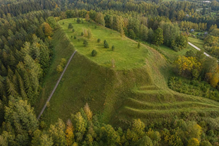
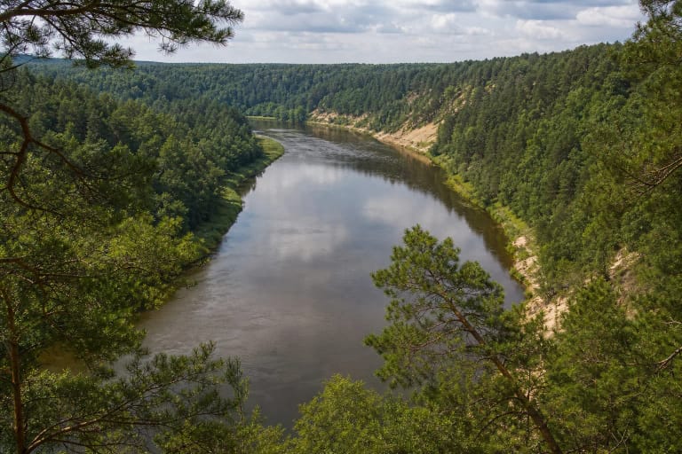
The hillfort occupies a promontory on the upper terrace of the right bank of the Neris, at the edge of Naujoji Rėva village. The river valley encloses it from the south, while spring-fed gullies cut into the land on either side. This natural protection explains why the wooded hill was chosen as a defensive site.
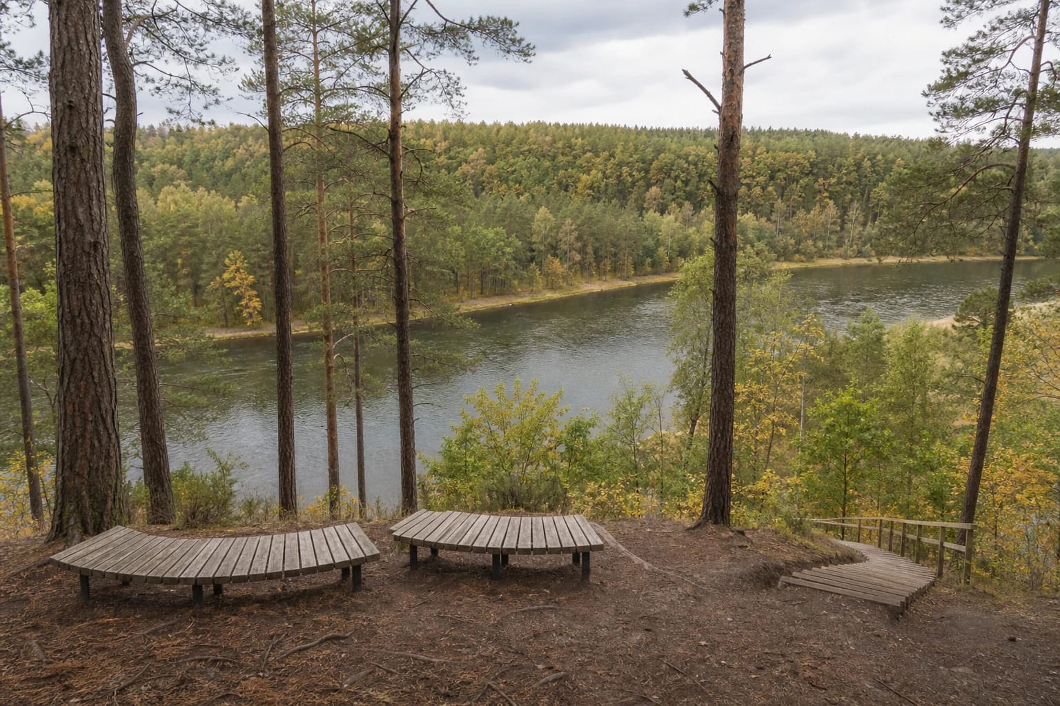
Today the hillfort forms part of Sviliškės Landscape Reserve. The reserve protects a wooded reach of the Neris valley, its loops and rapids, meadow and forest habitats, and the archaeological complex itself. A viewpoint with curved timber benches stands near the top, although summer foliage can partly screen the river panorama.
A rampart and six-metre ditch guard the 40 by 15 metre platform
The roughly rectangular platform runs from northeast to southwest and measures about 40 metres by 15 metres. At its northeastern edge is a bank about 10 metres long, 2 metres high, and 11 metres wide. Beyond it lies a ditch approximately 14 metres long, 21 metres wide, and 6 metres deep.
The natural slopes rise between 12 and 35 metres. Do not look only toward the Neris: the bank, ditch, lower southwestern end of the platform, and steep sides let you read the complete defensive layout on the ground. This is fragile archaeological relief, so visitors should remain on the stairs and established paths.
The 2018 excavation revealed an earlier layer of activity
Before visitor infrastructure was improved, archaeologists excavated one trench and five test pits in 2018, covering 30.25 sq. m across the hillfort and its foot. No cultural layer survived in the test pit on the platform, probably because of erosion, while thin layers measuring 3-24 cm were recorded in the settlement at its foot. From the terrain, the researchers estimated that the settlement may have extended over about 11,000 sq. m. This is a proposed extent, not an area that has all been excavated.
The trench produced 143 sherds of hand-built and partly wheel-turned pottery. The clearest group comprised 49 sherds of coarse-surfaced pottery dated to the third to eighth centuries; brushed, smooth, and partly wheel-turned wares, clay daub, slag, animal bones, and cattle and horse teeth were also present. Fifteen flint flakes and a possible scraper leave open the possibility of earlier Stone Age activity, but do not prove a campsite.
Older summaries commonly dated the hillfort to the beginning of the second millennium. The 2018 finds show that people were active at its foot much earlier, but they do not demonstrate continuous occupation or date the construction of the rampart precisely. Nor can the site be securely linked to a specific castle or ruler named in chronicles.
The Russian Church is a place-name and legend, not an excavated building
The Register of Cultural Property records the monument as Naujoji Rėva Hillfort with Settlement, also called the Russian Church. The hillfort component has unique code 5674 and the associated settlement code 24177; both have monument status.
A local story published by Vilnius District Municipality says that a Russian church sank into the hill and that people supposedly heard bells below ground or saw the tracks of processions. This is folklore. The municipality's account suggests that, in a Catholic setting, the image of a church of another faith may have preserved a memory of an older Baltic sacred place, but archaeology has confirmed neither a sanctuary nor a church here.
How to visit without confusing the site and the full trail
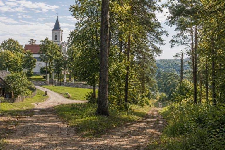
The exact site pin lies by Naujoji Rėva village. Saugoma.lt identifies parking by the hillfort as one of the two starting points for the Šilėnai-Naujoji Rėva Nature Trail. A forest path and timber stairs lead upward; steep sections can be slippery after rain or during a thaw and are unsuitable for wheelchairs or pushchairs.
Allow roughly 45-75 minutes for the hillfort alone. The complete nature trail is about 6 km and takes around 3 hours. Near Naujoji Rėva, cyclists may need to push or carry their bicycles along a steep, narrow section.
As of 29 July 2026, the official object pages published neither an admission charge nor fixed opening hours for the hillfort. At that time VSTT offered a voluntary EUR 1 state-park visitor ticket, which is not an entrance fee; check the official page for the current price and purchase arrangements. Also review park notices before travelling for information about the path, stairs, and forest conditions.