- Place
- Alovė eldership, Alytus District Municipality
- Region
- Alytus District
- Type
- stone railway culvert with cascades
- Address
- Alovė, Alytus District, Motertis stream valley
- Coordinates
- 54.38873, 24.10108
- Visit duration
- 30-60 minutes
- Best time
- a dry day, when the stream and cascades are safer to approach
Motertis Stream Culvert
Tunnel or culvert in the Motertis valley
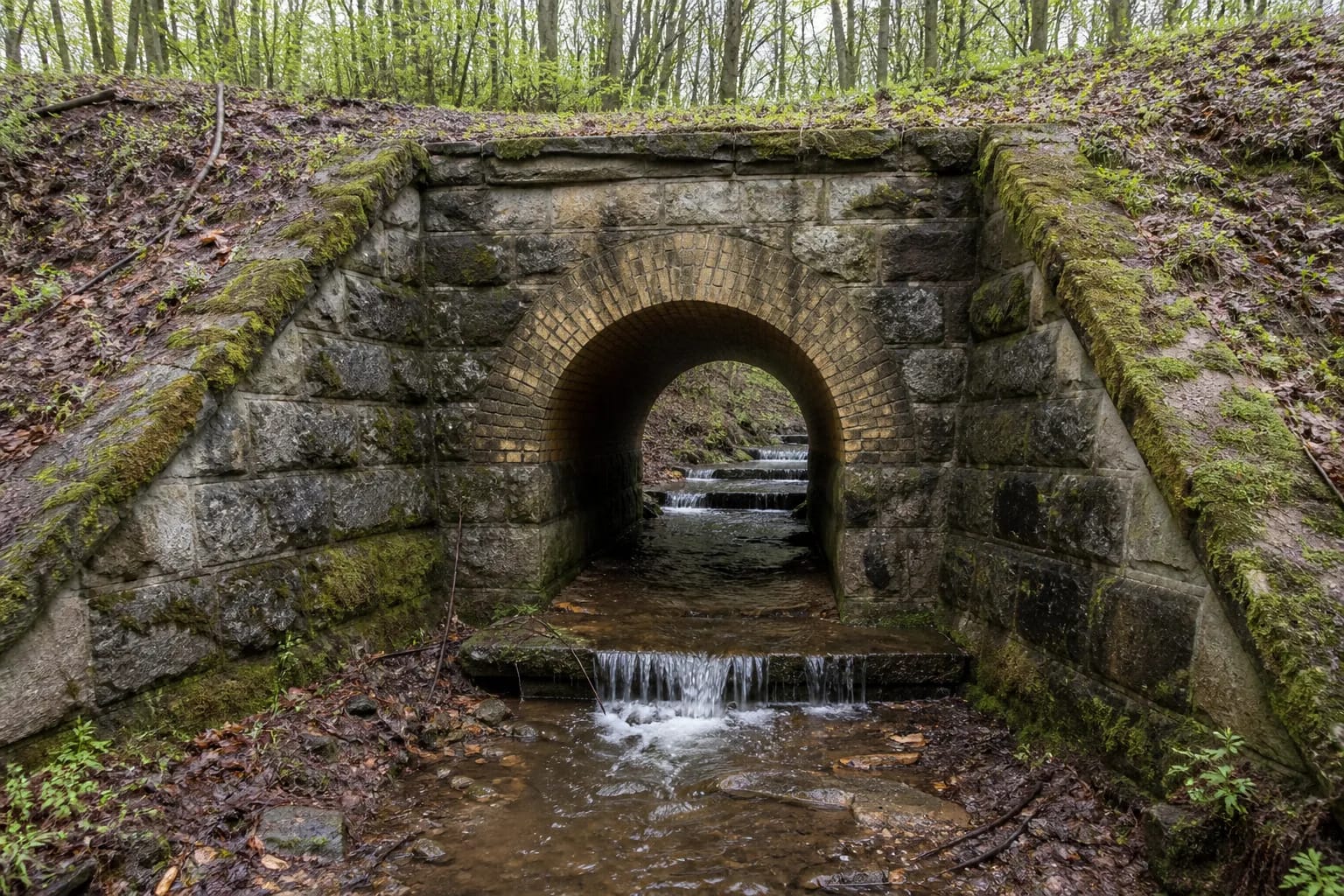
Motertis Stream Tunnel stands near Alovė beneath the tall embankment of a former railway line. From the woodland side, the first thing you see is a rectangular portal of dressed stone, topped by a semicircular arch of warm yellow clay bricks.
Travellers commonly call the structure a tunnel, but its engineering purpose is a railway culvert carrying the stream below the embankment. The two names are useful together: this is not a walk-through railway tunnel, but a water-and-stone structure worth observing from a safe approach.
An 1898 railway structure
The culvert dates to 1898, when the railway section from Poteronys station to the bridge over the Nemunas was being built. A date carved into the western portal's keystone recalls the construction; its final digit was re-cut over time and may read as either 6 or 7.
The wing-type culvert is about 75.05 m long, with 61.94 m beneath the embankment. The embankment rises more than 20 m above the valley, so the structure feels far more monumental from below than the small stream might suggest.
Stonework, arch, and cascades
Both portals are built from dressed stone, and the culvert retains a stone floor. It is 3.17 m wide, 5.03 m high on the upstream side, and 7 m high on the downstream side. The changing height shows how the structure responds to the embankment and valley relief.
About ten cascades, each roughly 0.2 m high, break the Motertis channel through the culvert. They were designed to reduce the current's speed and protect the structure from water. After rain, the water may be muddy and the stones slippery, so watch the cascades from firm ground rather than wading.
The embankment and valley landscape
The culvert is more than an isolated piece of masonry. A stone retaining wall strengthens the southeastern valley slope, a stone drainage collector sits above the railway line, and terraced slopes reveal something of the old embankment-building logic. Walking slowly around both approaches brings out these details.
The setting is shaped by woodland, running water, and the high railway bank, making it rewarding for visitors interested in small-scale engineering heritage. Do not climb the embankment slopes or masonry: they are steep and mossy in places, and the culvert surroundings are not an official visitor trail.
Reaching and viewing the Motertis valley tunnel
The Motertis Stream Tunnel can fit into a trip around Alovė and the historic places of Alytus District. The coordinates mark an approach to the structure rather than a visitor centre, so allow for a short walk at the woodland edge and bring shoes that can handle damp ground.
Before visiting, check the water level and wear sturdy, non-slip shoes. Avoid the water during high flow, do not enter dark structural spaces, and stay away from active railway infrastructure.